
Solo exploration, lots of solitude and quiet, and, occasionally, people
A Foto Essay Adventure from Sunday 2 – Tuesday 4 August 2009
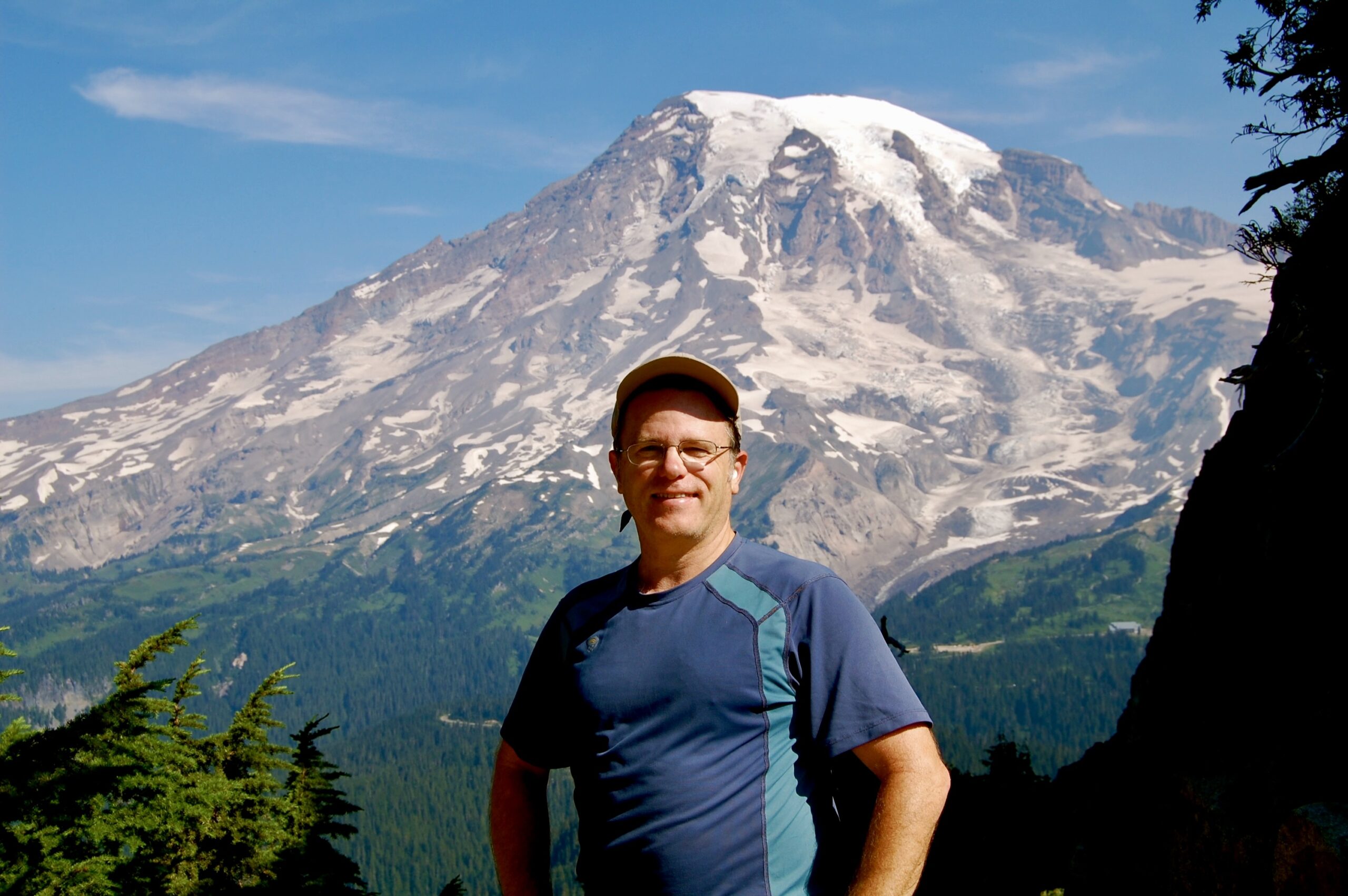
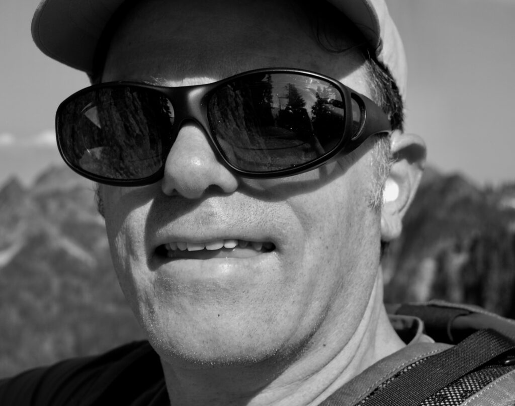
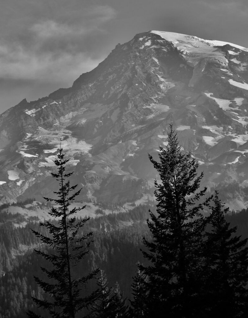
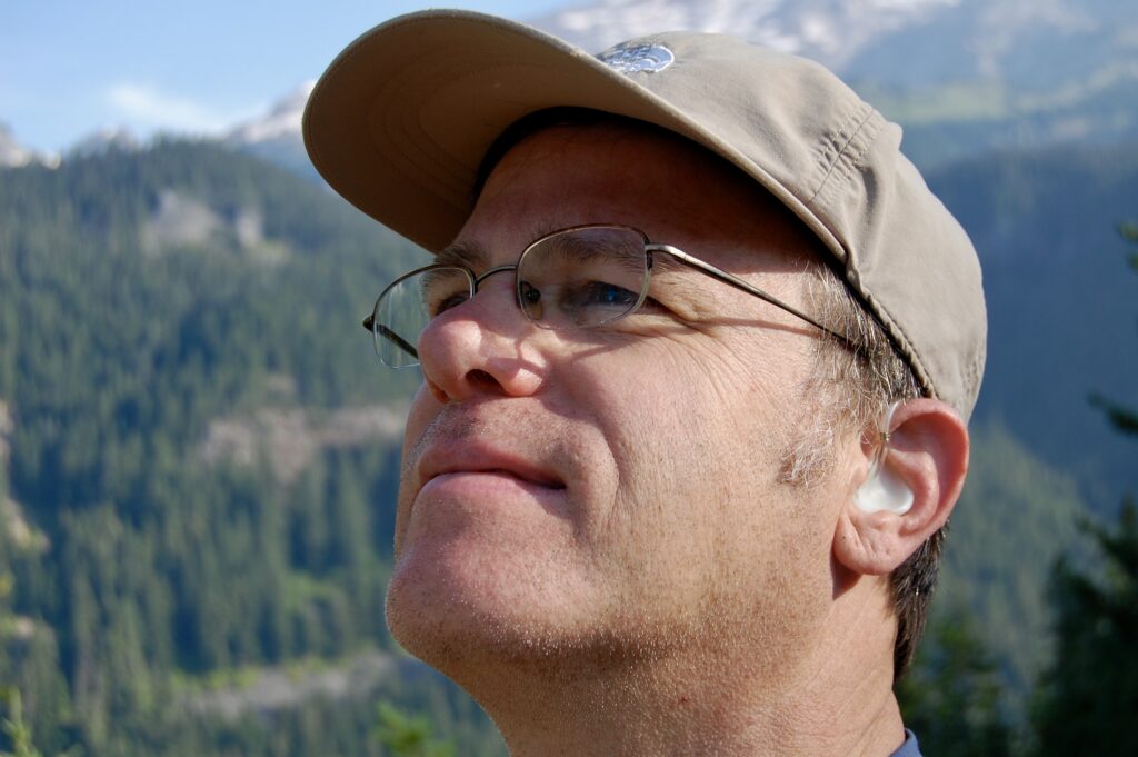
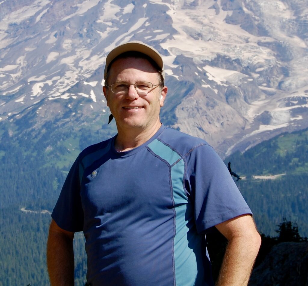
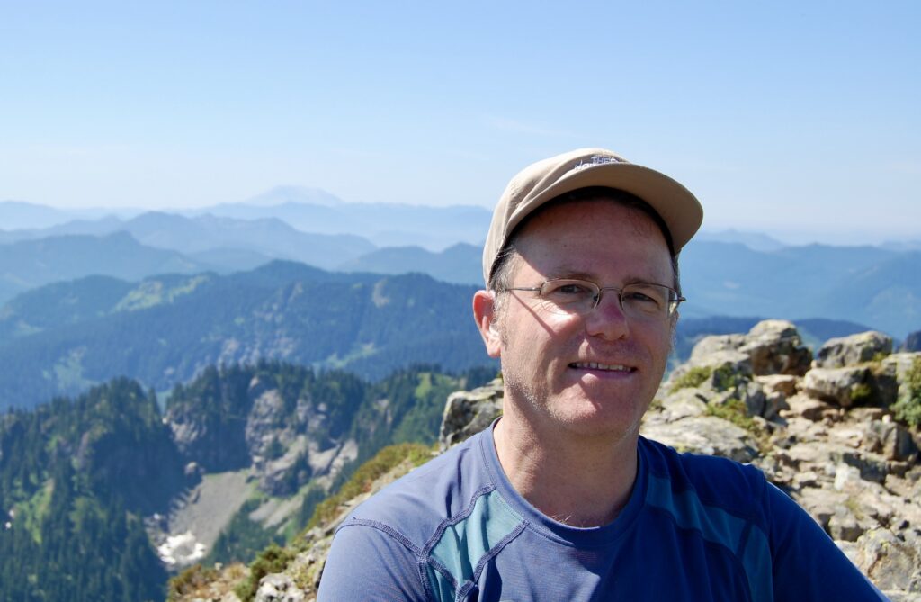
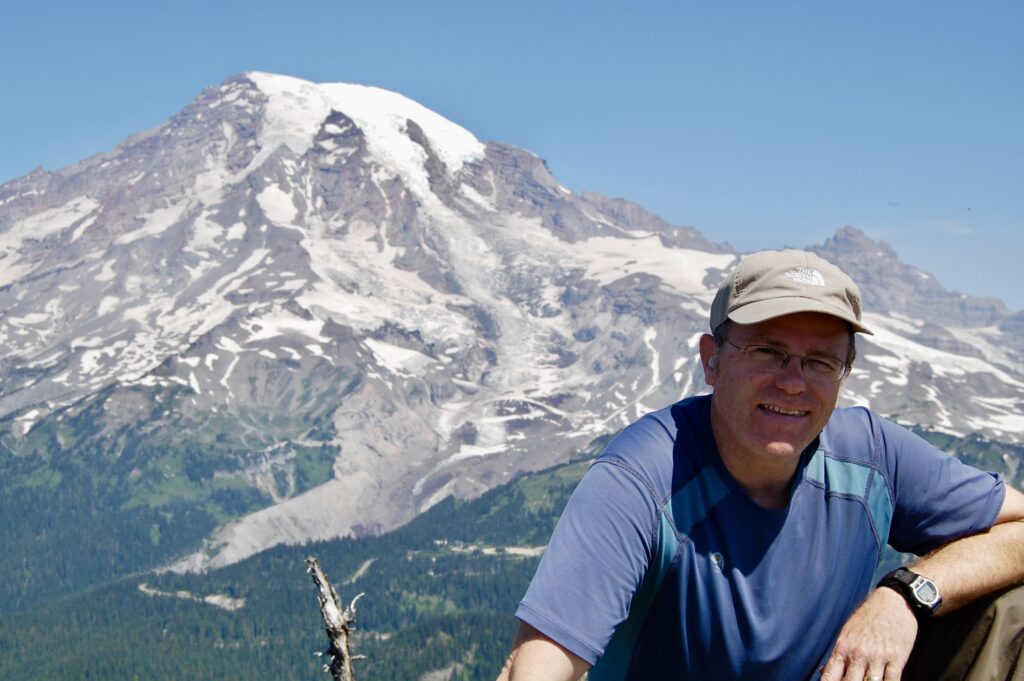
Self-portrait by the author up on Plummer Peak in the Tatoosh with Mt. Rainier (Ti’Swaq’) in the background with glimpses of Paradise, Monday the 3rd of August 2009.
This was one of the few times I traveled out solo while my wife, Kristina at the time, and the kids stayed home or engaged in other activities. Sometimes one needs to be alone. While I missed my family, I also valued these rare moments all to myself out in the vastness of Nature. Ambiverts such as myself often need time for one’s self as well as time in the midst of others. The presence of the Divine was everywhere every time I paid attention.
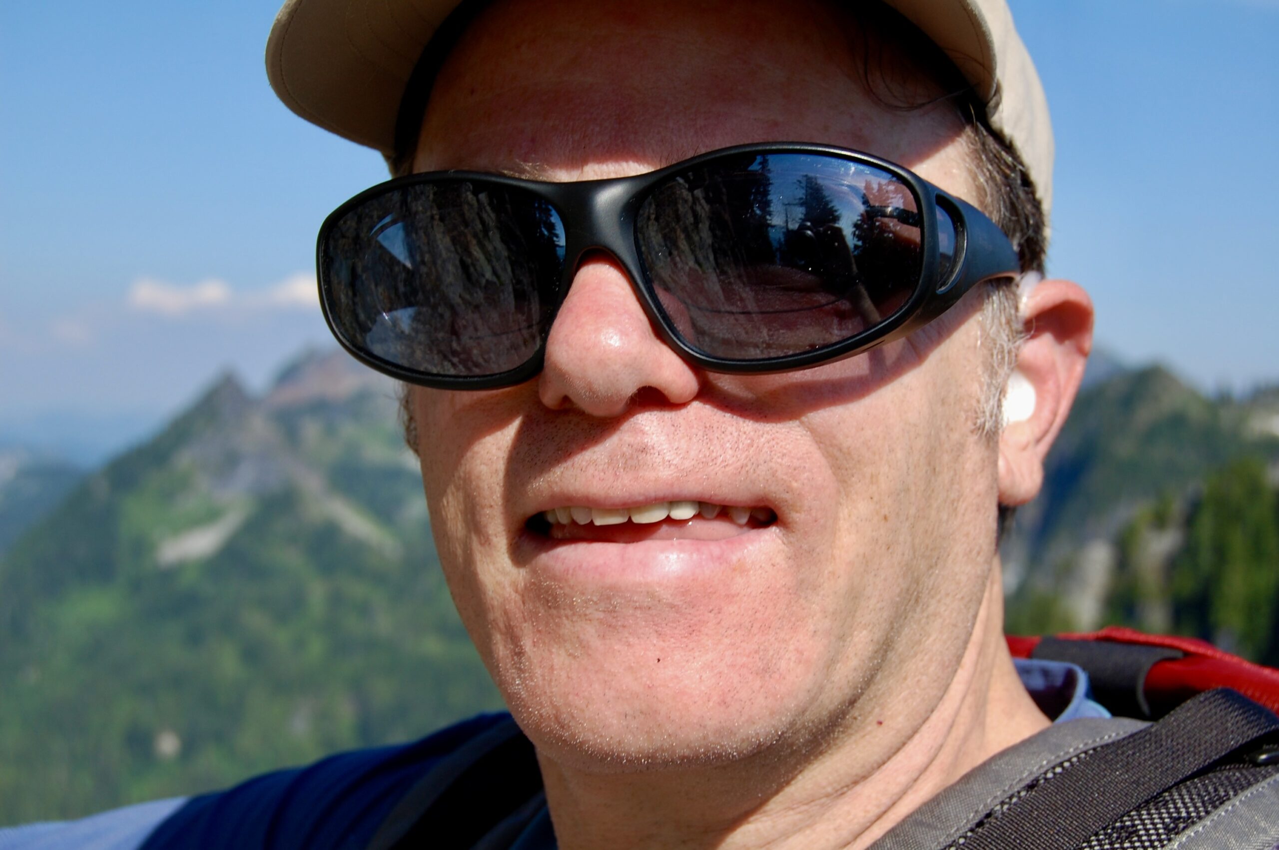
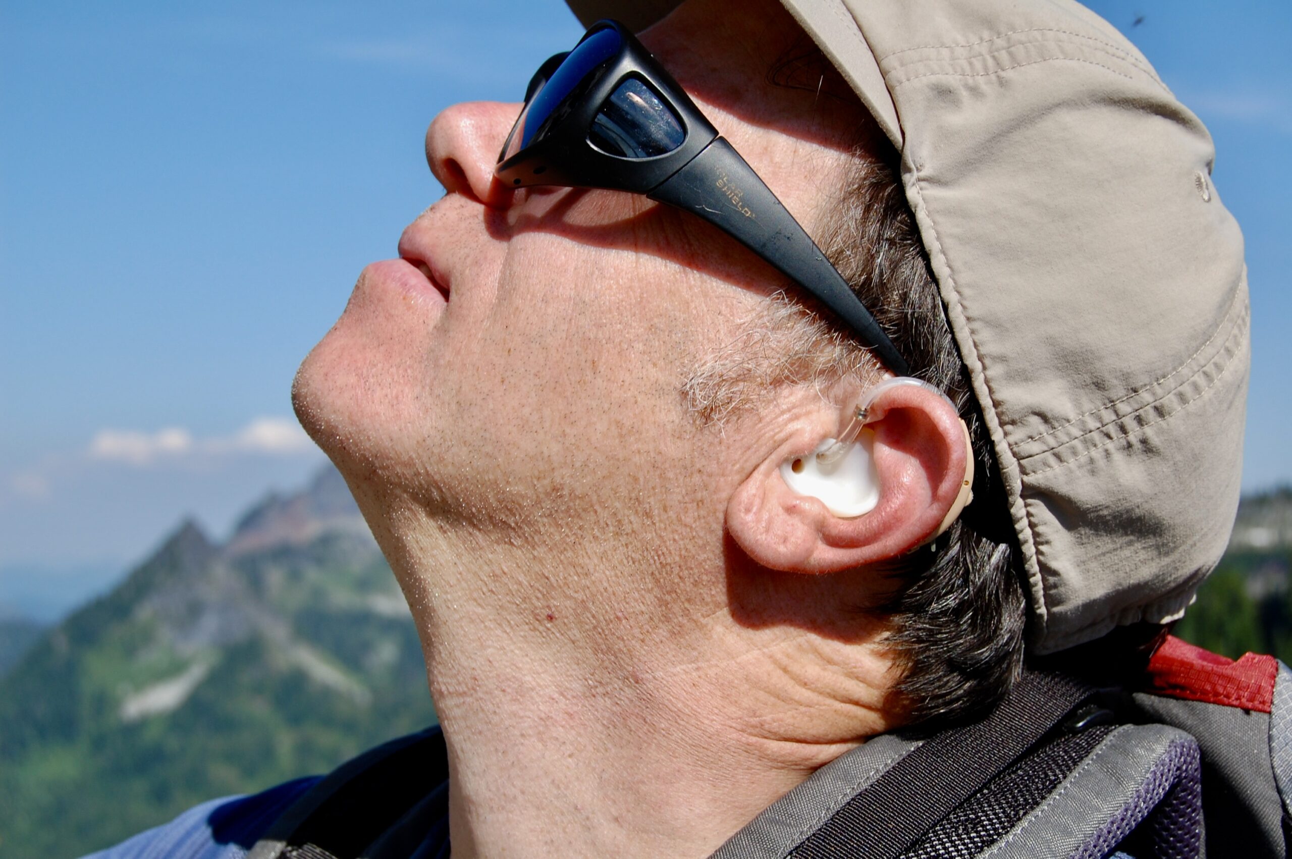
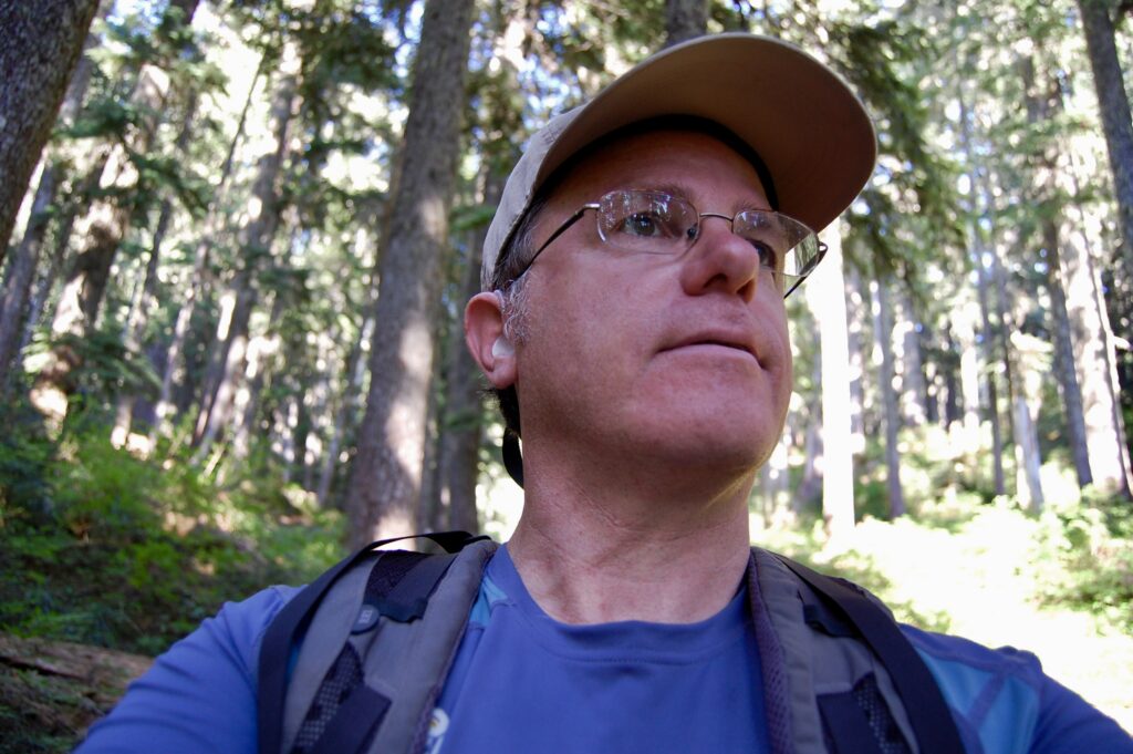
Selfy shot from just below the summit of Eagle Peak in the Tatoosh Range. Yup, that’s me, William Bass, early August 2009.
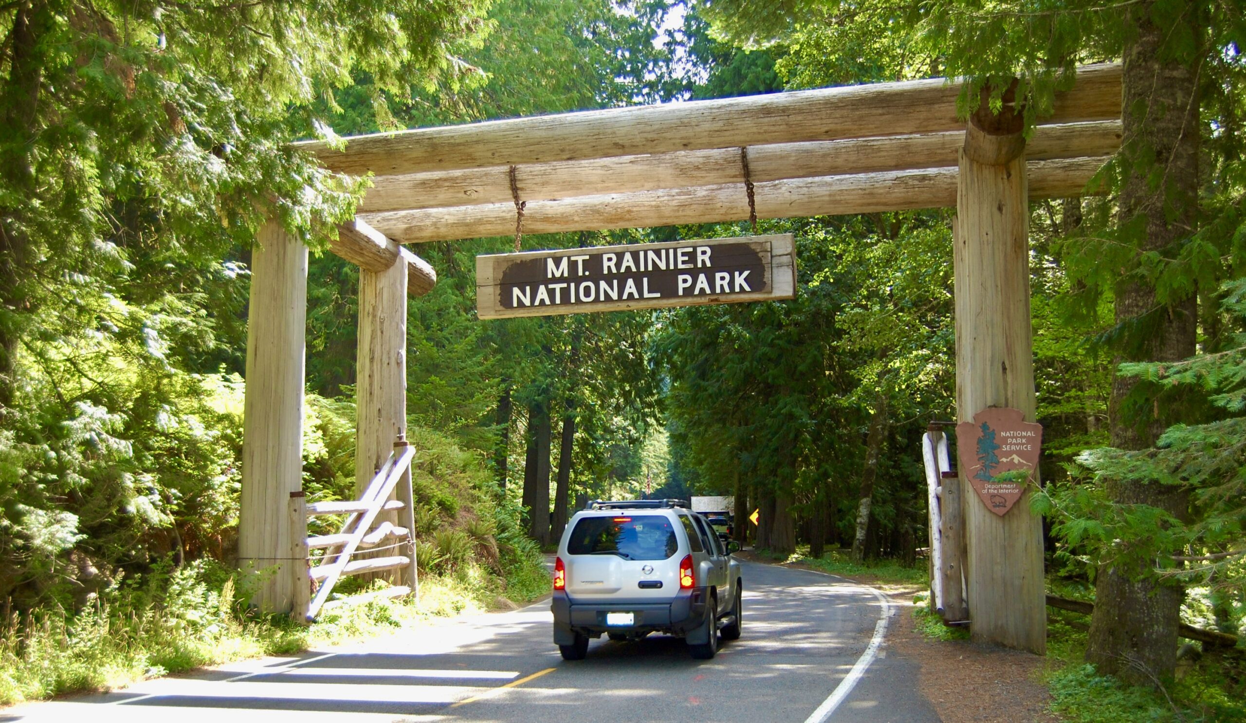
Squeezing between the early morning and noon crowd waves as I followed behind this SUV into the park at the famous Nisqually Entrance, Sunday 2 June 2009.
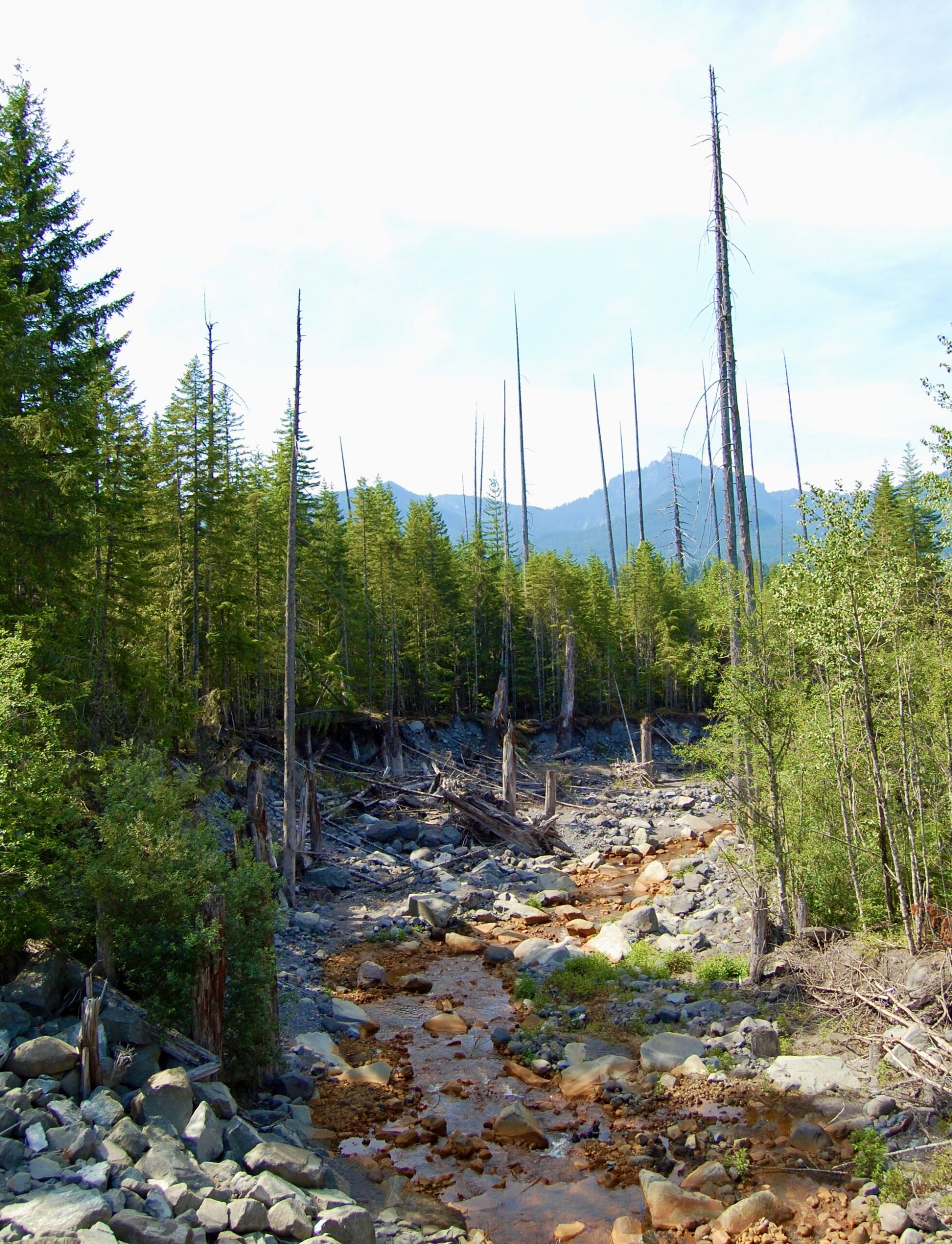
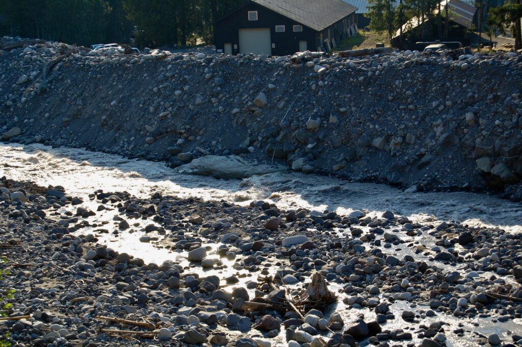
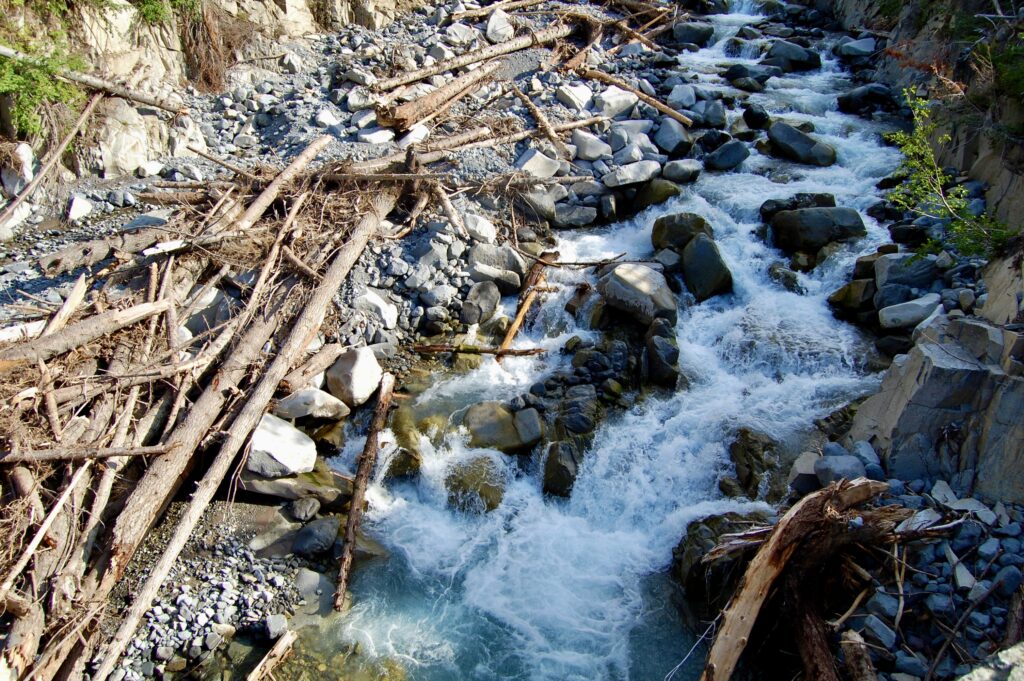
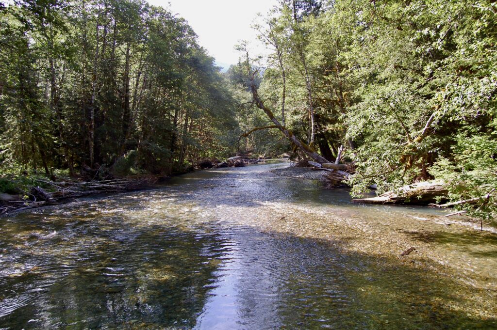
Crossing over Kautz Creek on the road from the Nisqually Entrance to Longmire and, eventually, Paradise. Evidence abounds of destructive flooding from heavy rains and snowmelt.
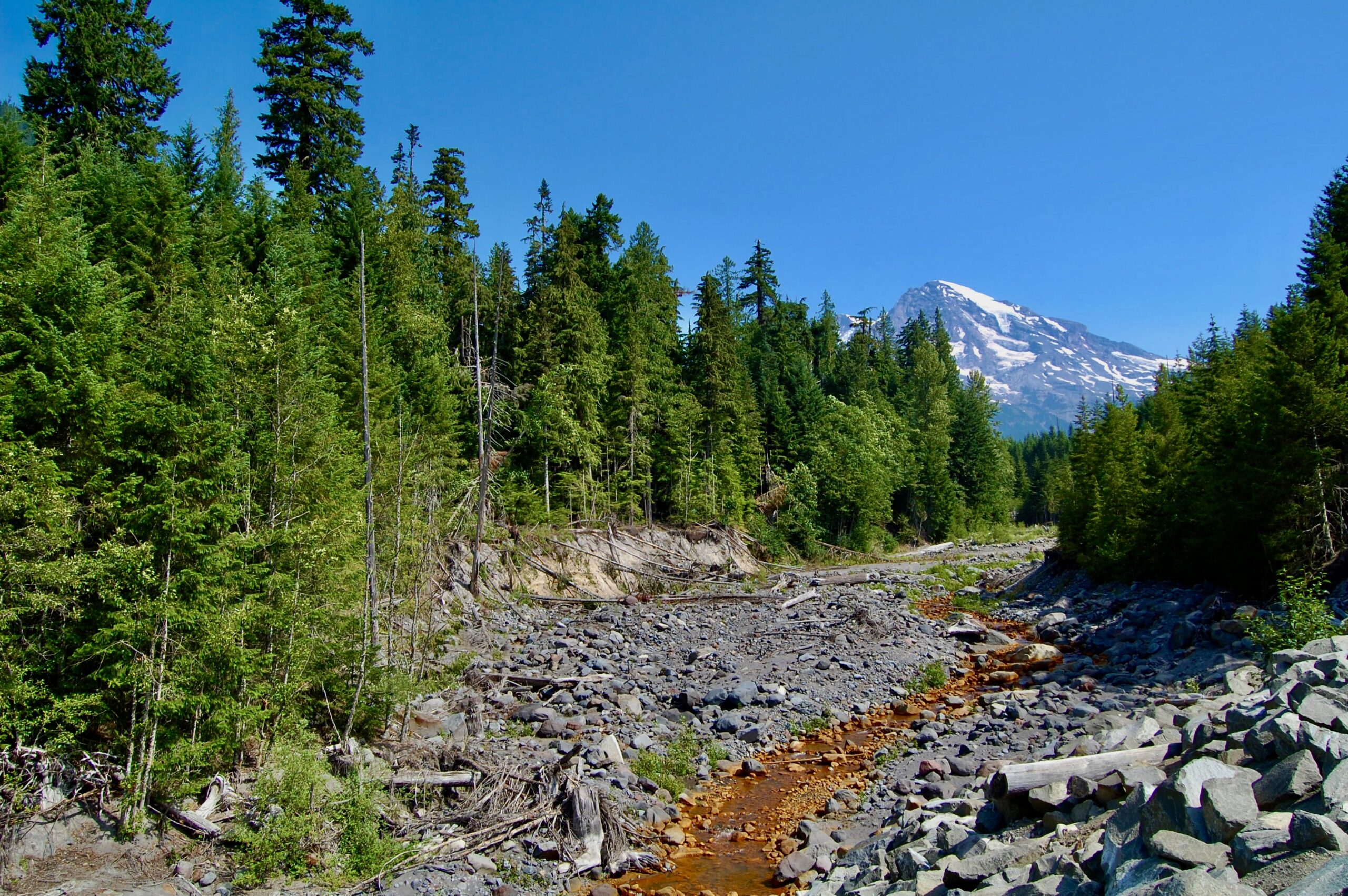
Looking up Kautz Creek. The stream turns into a seething river churning with logs and rumbling boulders during heavy floods. The otherwise little creek flows for about six miles from the terminus of The Mountain’s Kautz Glacier into the Upper Nisqually River. The orangey-brownish-red coloration in the streambed arises from deposits of iron oxide. Massive floods across 2008-2009 ripped away the banks and exposed the iron to oxidation.
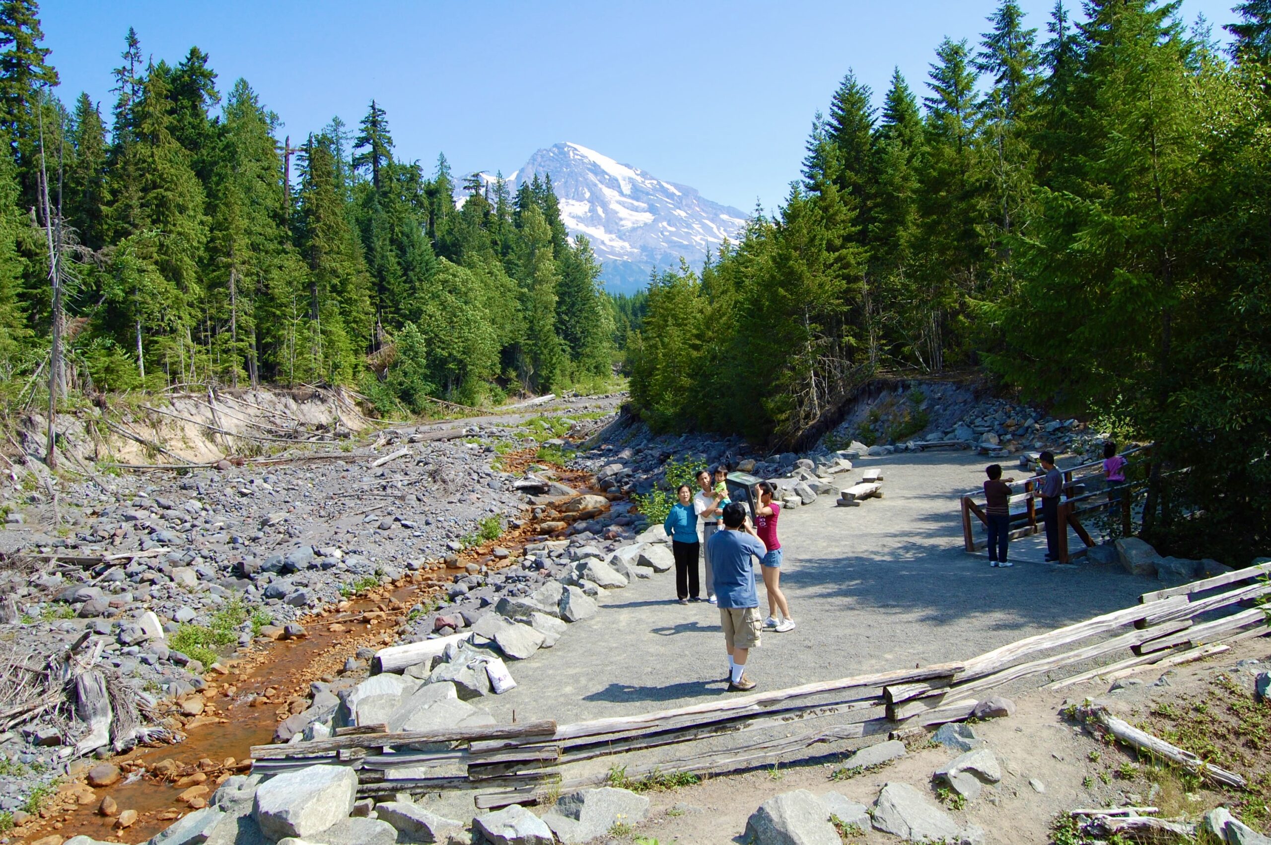
People travel to Mount Rainier National Park from all over the world. I love watching my fellow human beings interact with each other. This particular family asked me to take their picture, and I did. Wished I had taken a foto of them with my own camera afterwards, but I felt too shy. Silly, I know. All part of pace and space, ebb and flow. Amen.
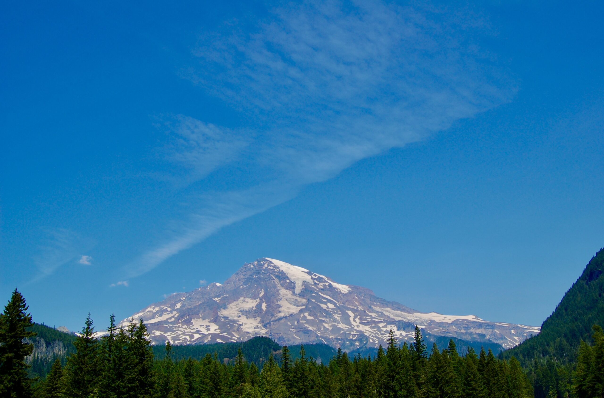
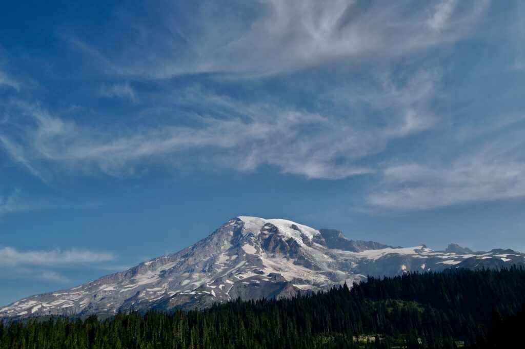
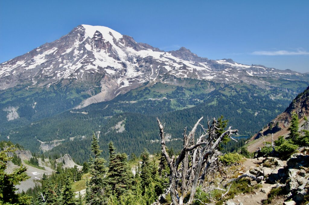
Rainier, The Mountain, Tahoma, Tacoma, Ti’Swaq’ the Sky Wiper, the Mountain that Wipes Clean the Sky, the Giant Volcano…all different names for the same geological beast. There are other names, too. We live under the Volcano in “Pugetopolis,” the Greater Puget Sound/Salish Sea Metropolitan Area. Ti’Swaq’ wipes clean our Cascading skies at 14,410 feet in height or 4,392.5 meters tall. Some sources, however, claim the Volcano is as high as 14,411 feet or as low as 14,408 feet. Changing snow and ice accumulations and rockfall may have something to do with such debates. It’s just a giant mountain, bigger in bulk than any of the Himalayan giants tho bereft of a high plateau like Everest and K2. Only the Hawaiian Volcanoes are more massive as those entire islands are individual mountains rising from the seafloor.
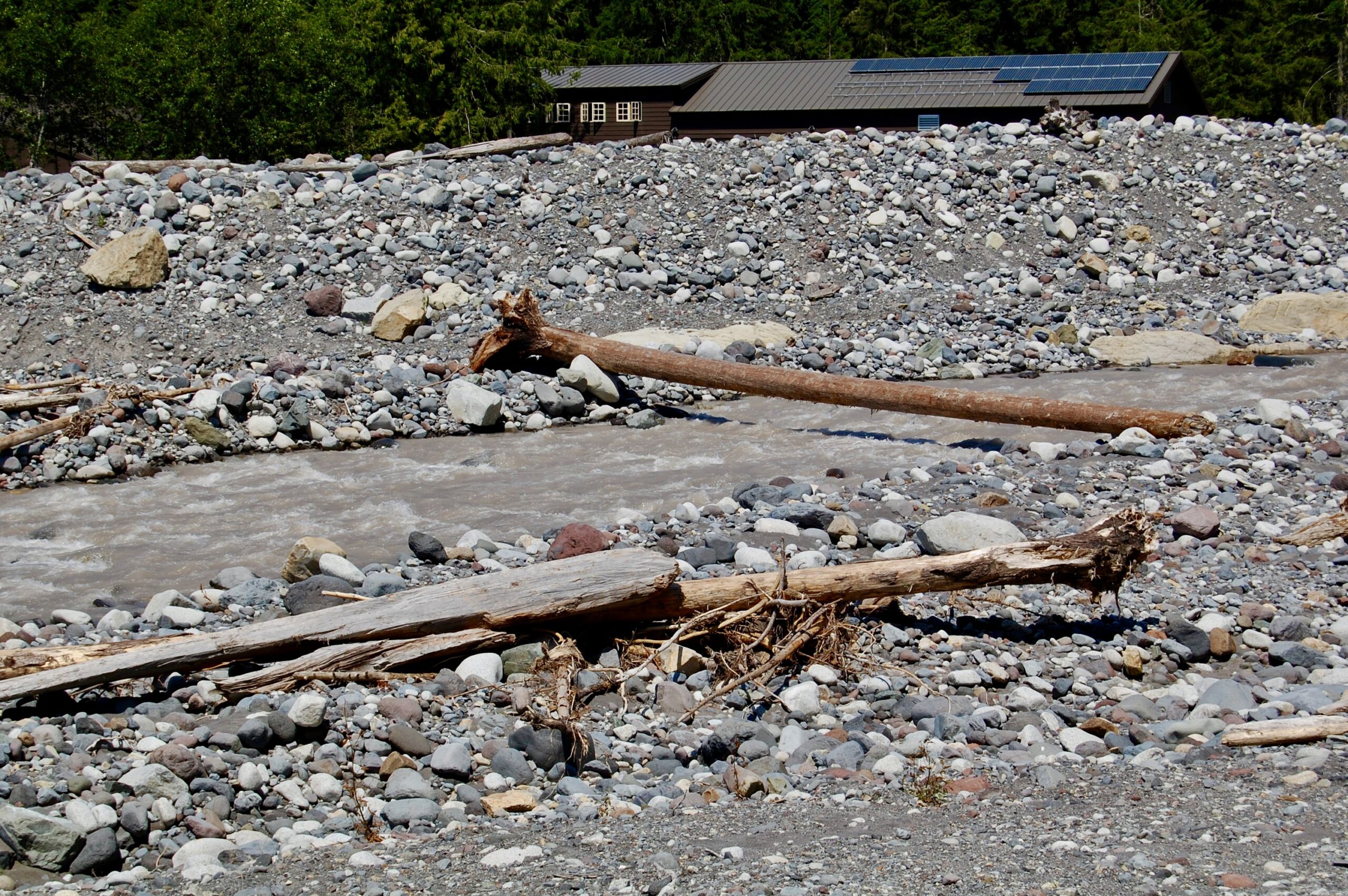
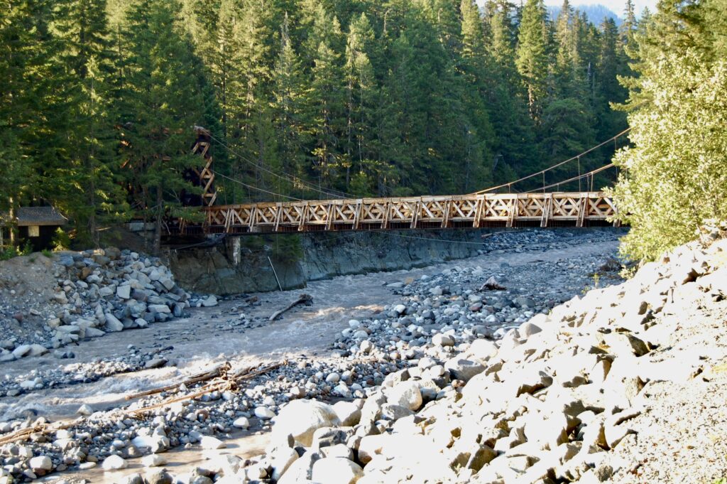
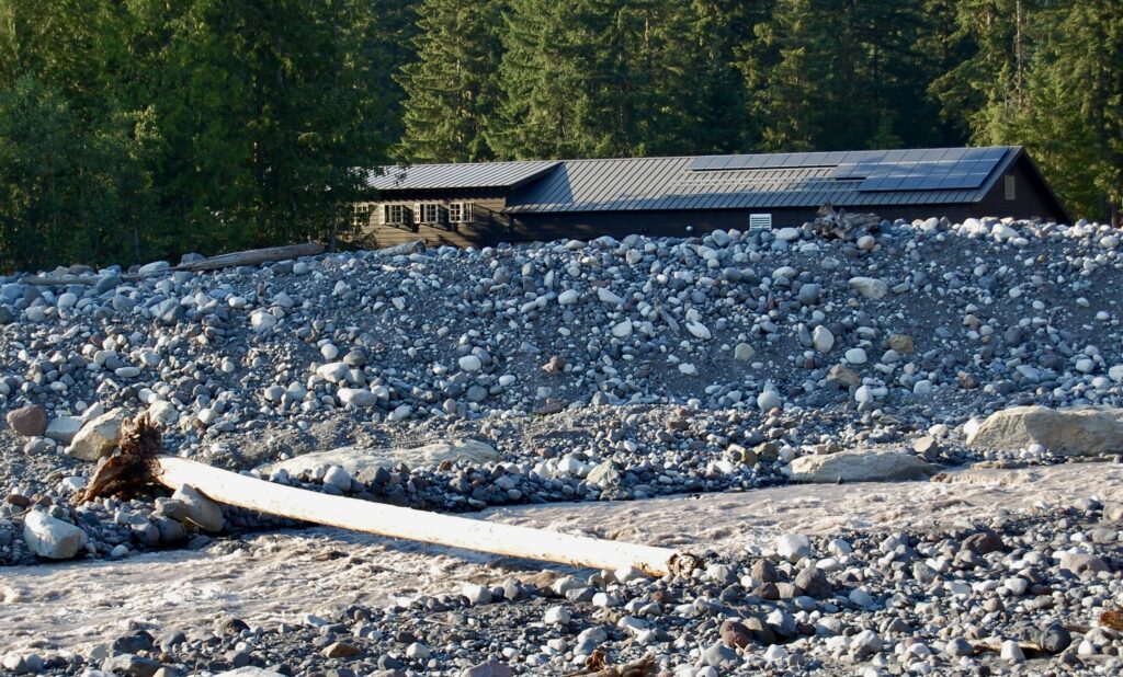
On the other side of the Upper Nisqually River by myself. Tempted to test walk the log across the stream, but altho running at low summer levels the water’s rougher and deeper than it looks. Intrigued by the rows of solar panels on the back of one of the maintenance buildings at Longmire. Longmire does have a Historic District with a Walking Tour. Few tourists see the “back side” of the village.
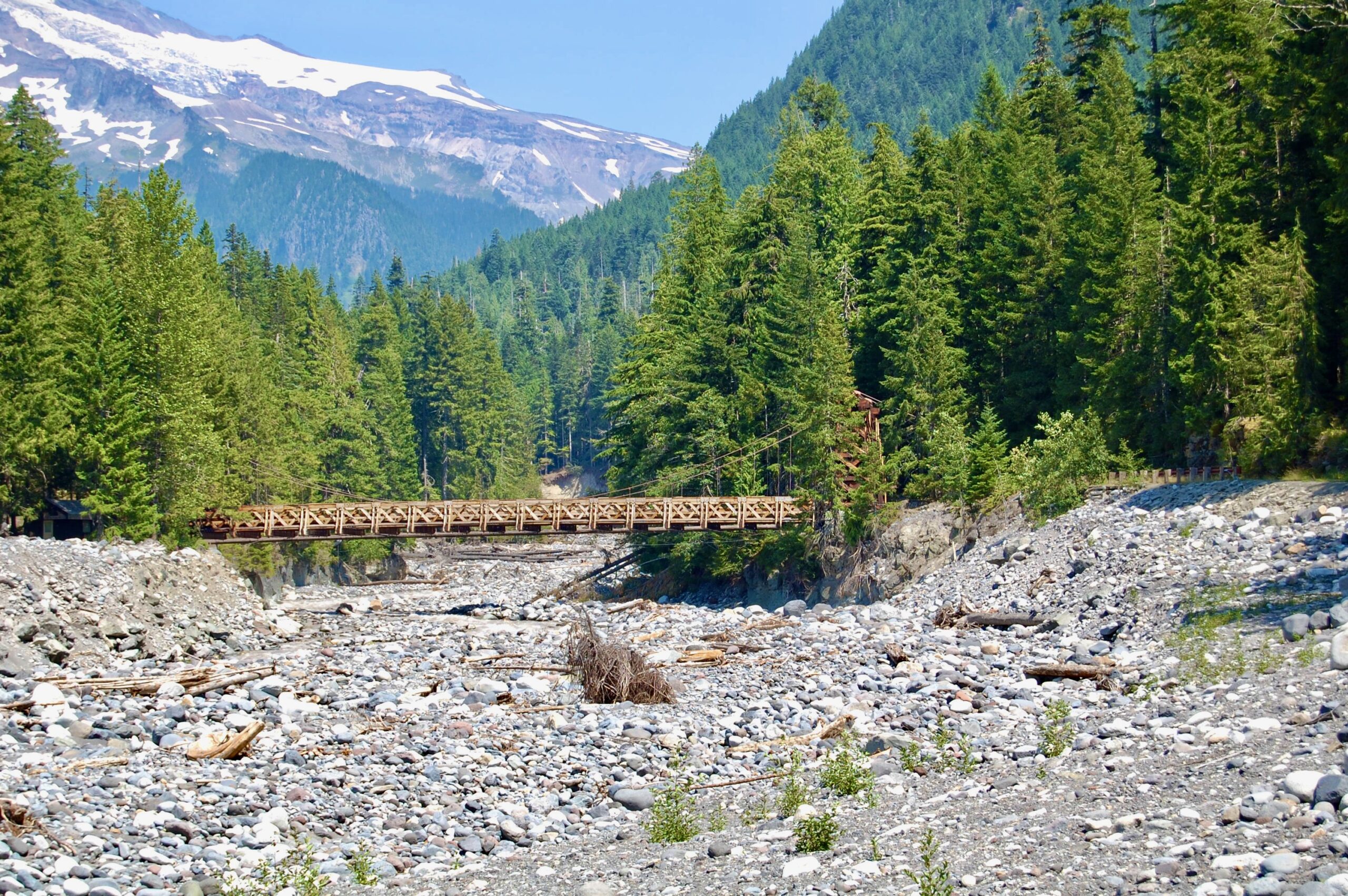
Looking back at the one-lane Nisqually Historic Suspension Bridge. It’s the oldest suspension bridge in the United States’s National Park System. The original was first built in 1911, followed by a new, stronger one in the early-mid 1920s. Later additions came again over the years. It’s a beautiful bridge reflecting what is called “NPS rustic architecture,” sturdy infrastructures made from local materials and built to blend in with the natural look of the area.
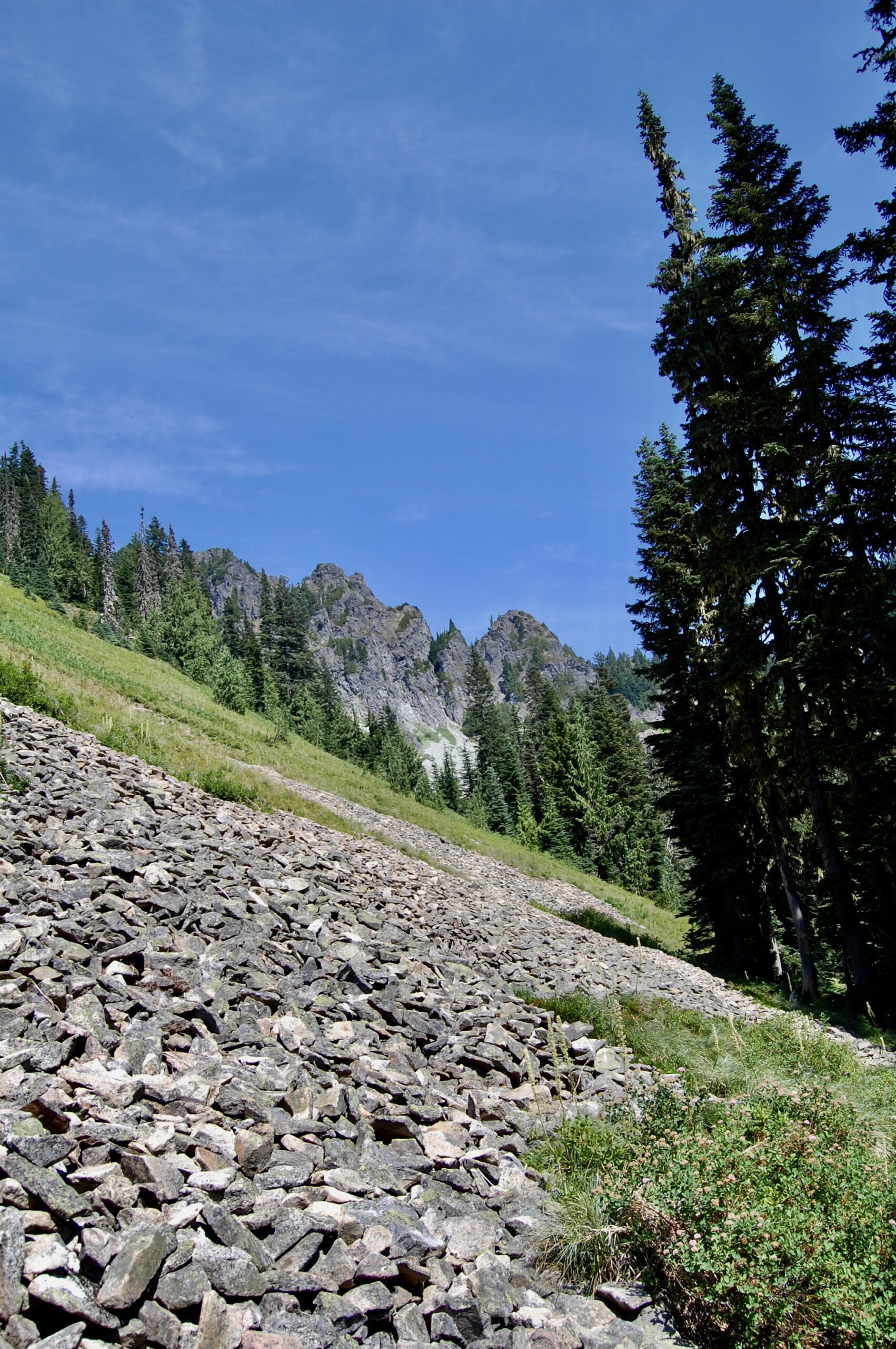
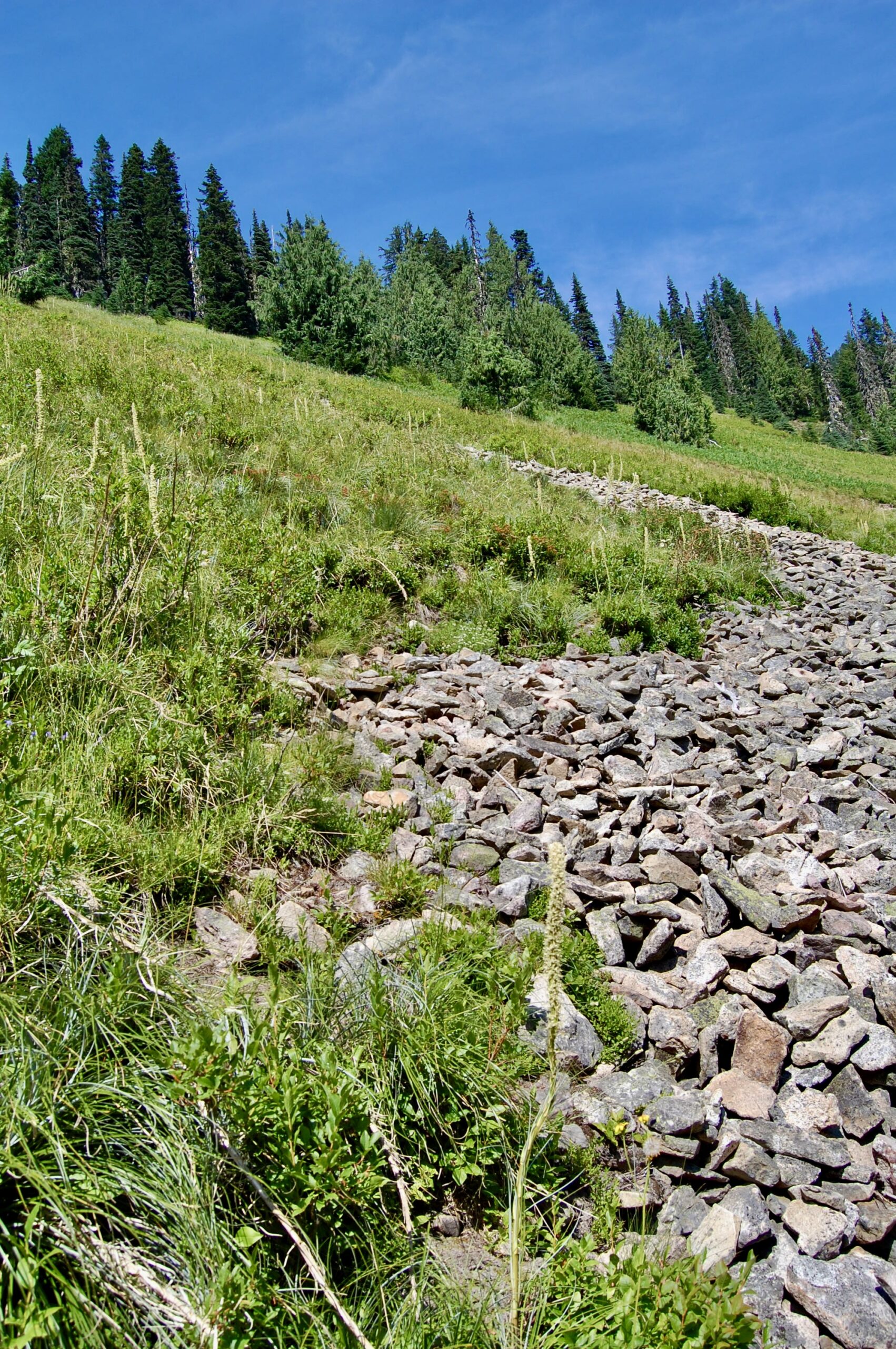
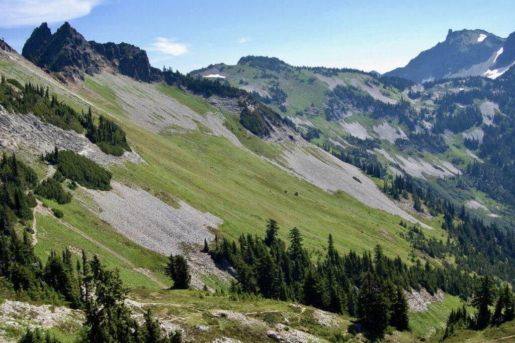
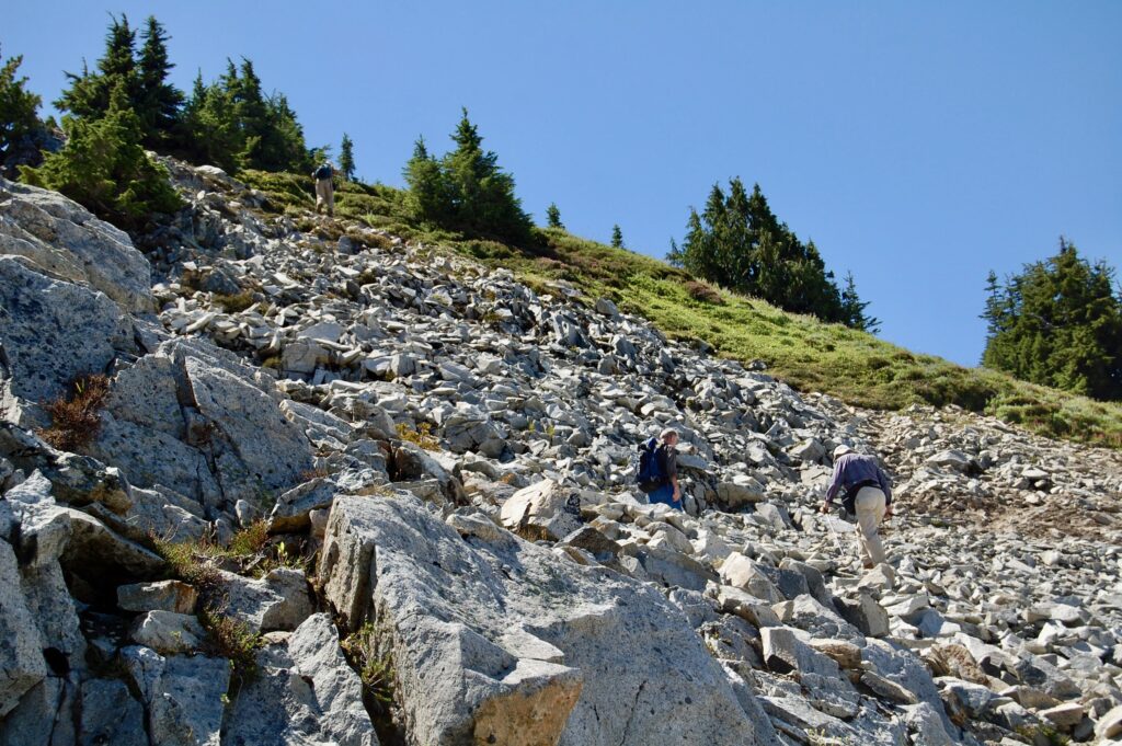
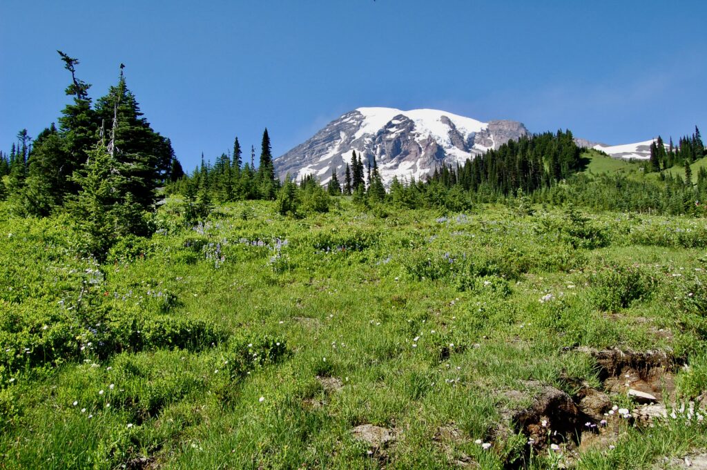
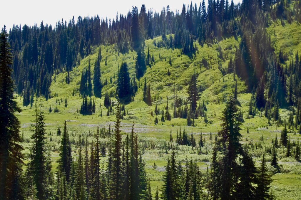
On the Eagle Peak Trail as it emerges from dense evergreen forests into alpine meadows amidst scree and talus slopes. A dayhike into the Tatoosh Range of Mt. Rainier National Park. The time’s 15:15 this Sunday afternoon on the 2nd of August 2009. Yes, it’s a late start, and, hey, at least I’m well rested from a good night’s sleep and these summer days are long at these northern latitudes.
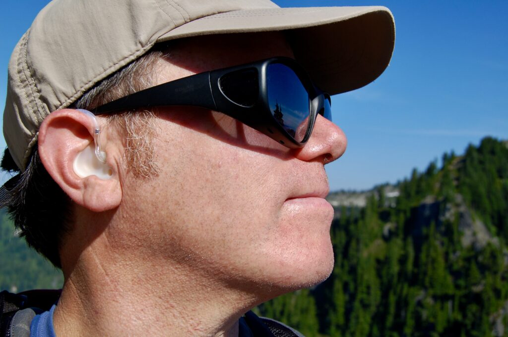
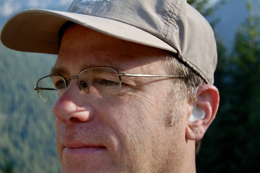
Edges and edges here, between the earth and the heavens, between the living and the nonliving, between stones and plants and air, all observed by the conscious mind of a bipedal organism wearing sunglasses, clothes, and hearing aids.
Plants rule the planet, and more animal egos would best serve to humbly recognize and acknowledge such biological domination. Or maybe viruses rule.
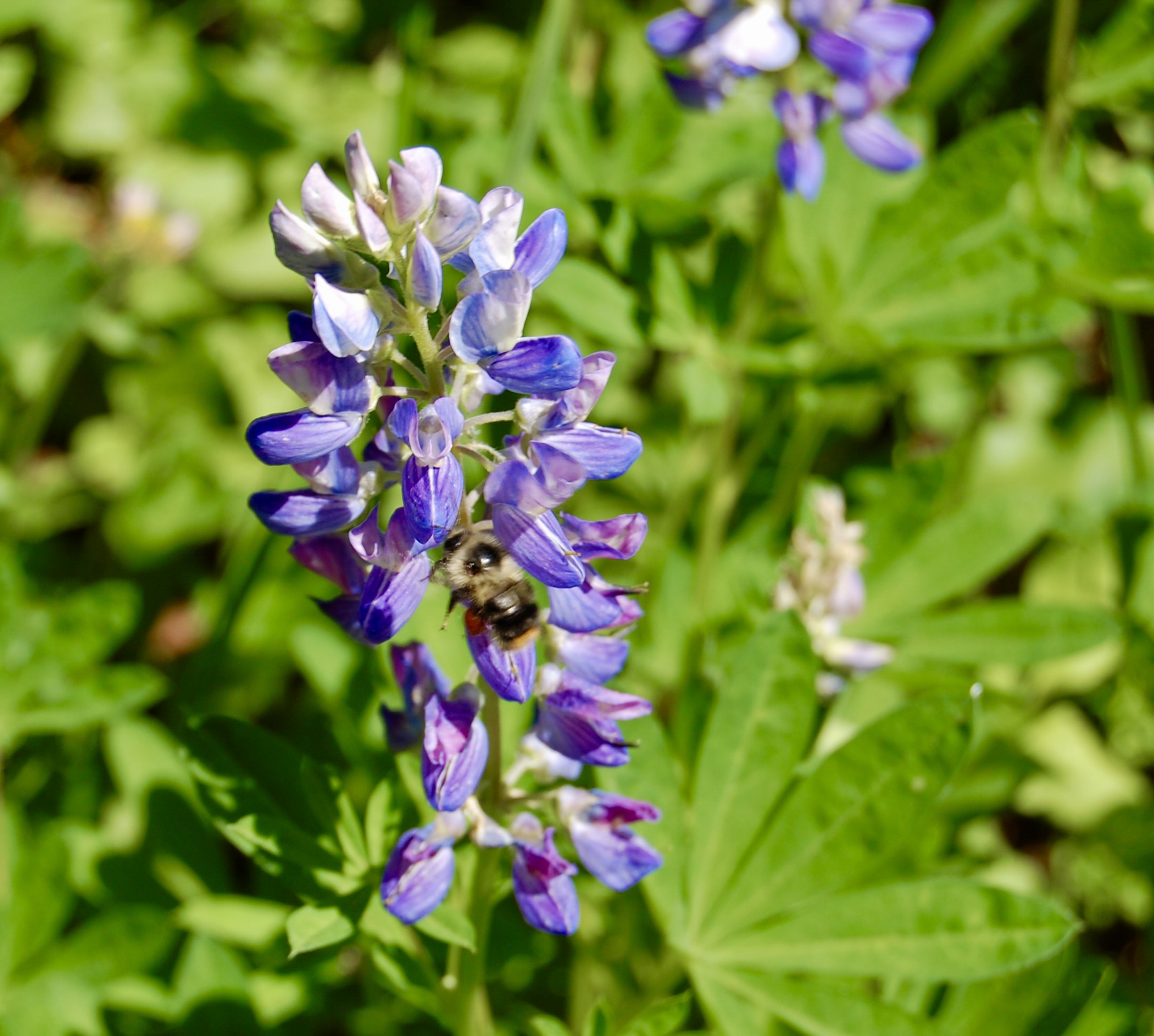
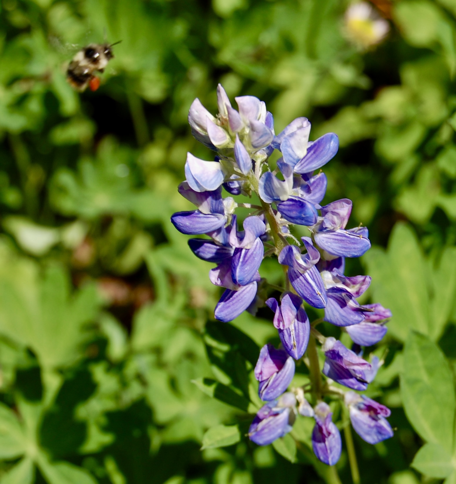
A wild honeybee working hard gathering nectar on a stalk of broadleaf lupine (Lupinus latifolius). There are many species of both wild native and wild imported honeybees in Cascadia and the Pacific Northwest in general, but I don’t know enough to identify which one this wee little, hard working bee belongs to.
This little fella captivates me, tho. Consider how hard his muscles work to make his wings flutter as they do, and how powerful this buzzing little animal’s respiration must be to help oxygenate his small but powerful body.
Look at their red bundle of nectar. Must glue it all together with its own saliva?
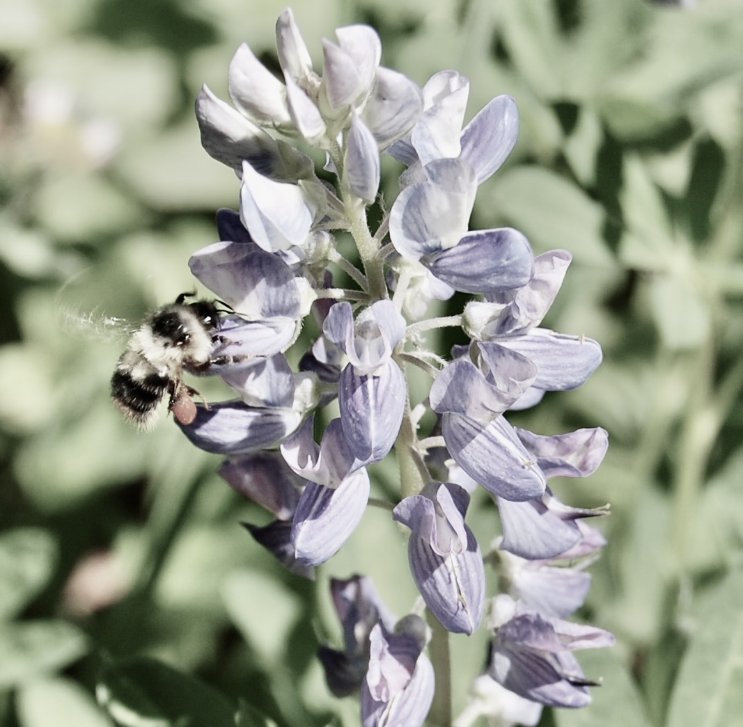
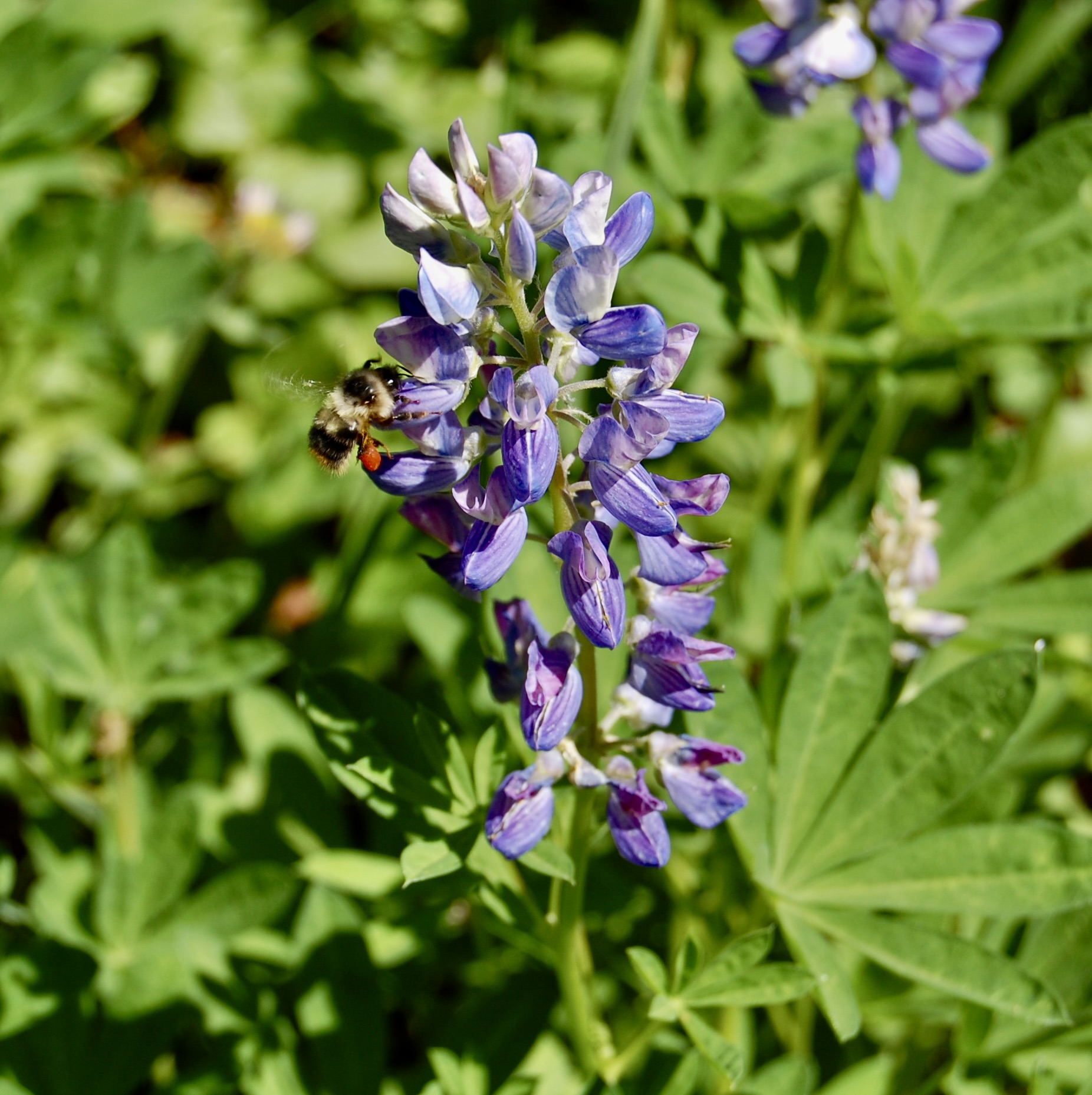
Off ‘e goes!
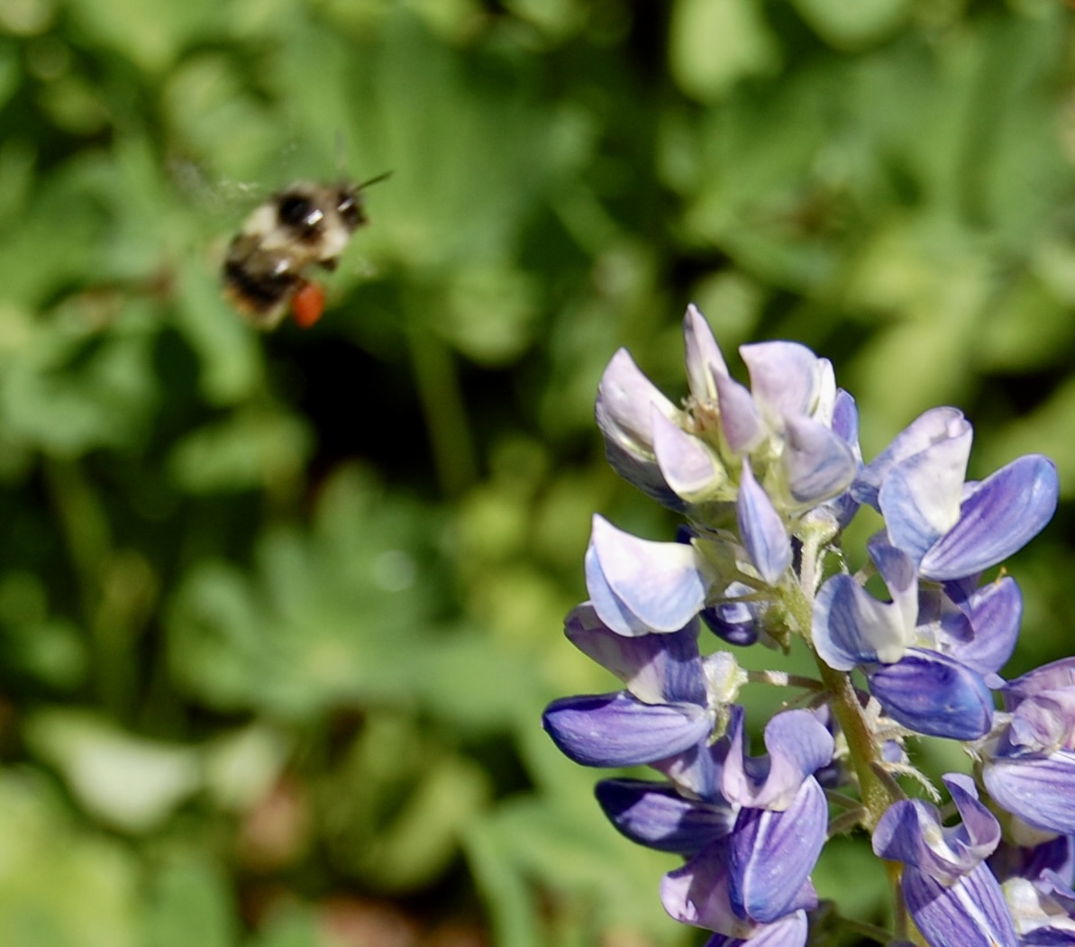
Programmed for duty, this bee is.

Bigger just gets blurrier, doesn’t it? Well, lookit that little strawberry-looking bucket of nectar the bee’s carrying.
Ok, enough with the bees, LOL! I get it. And they’re fascinating animals. Honeybees are vital to pollination of plants and the spread of life in general. Their effect on ecosystems is enormous. Rapid decline in honeybee populations borders on a crisis.
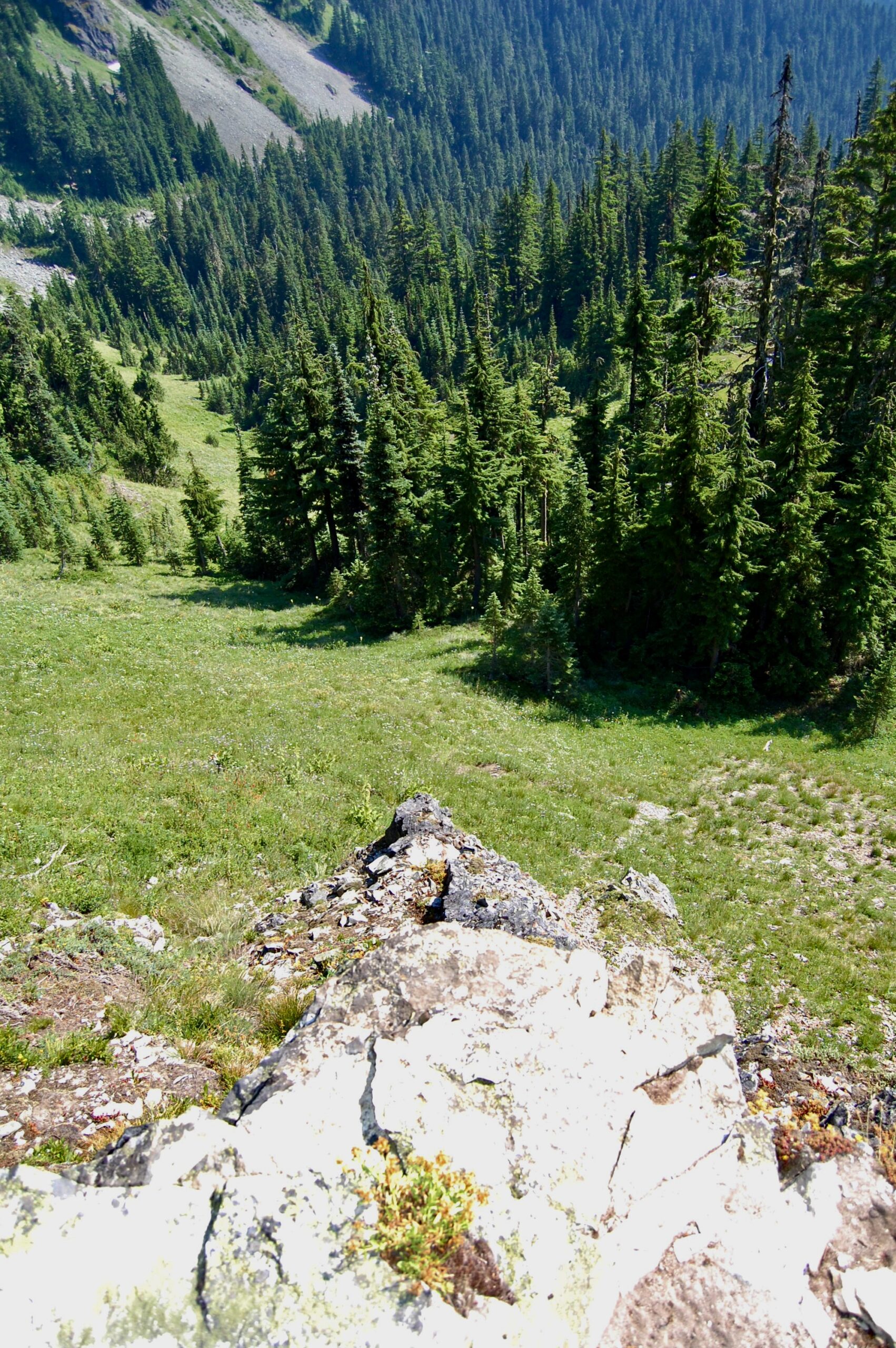
Love standing out atop rocks and looking back down across the valley.
And gazing out across the flanks of the Tatoosh along the edge of the Nisqually Valley. I love Mount Rainier National Park!
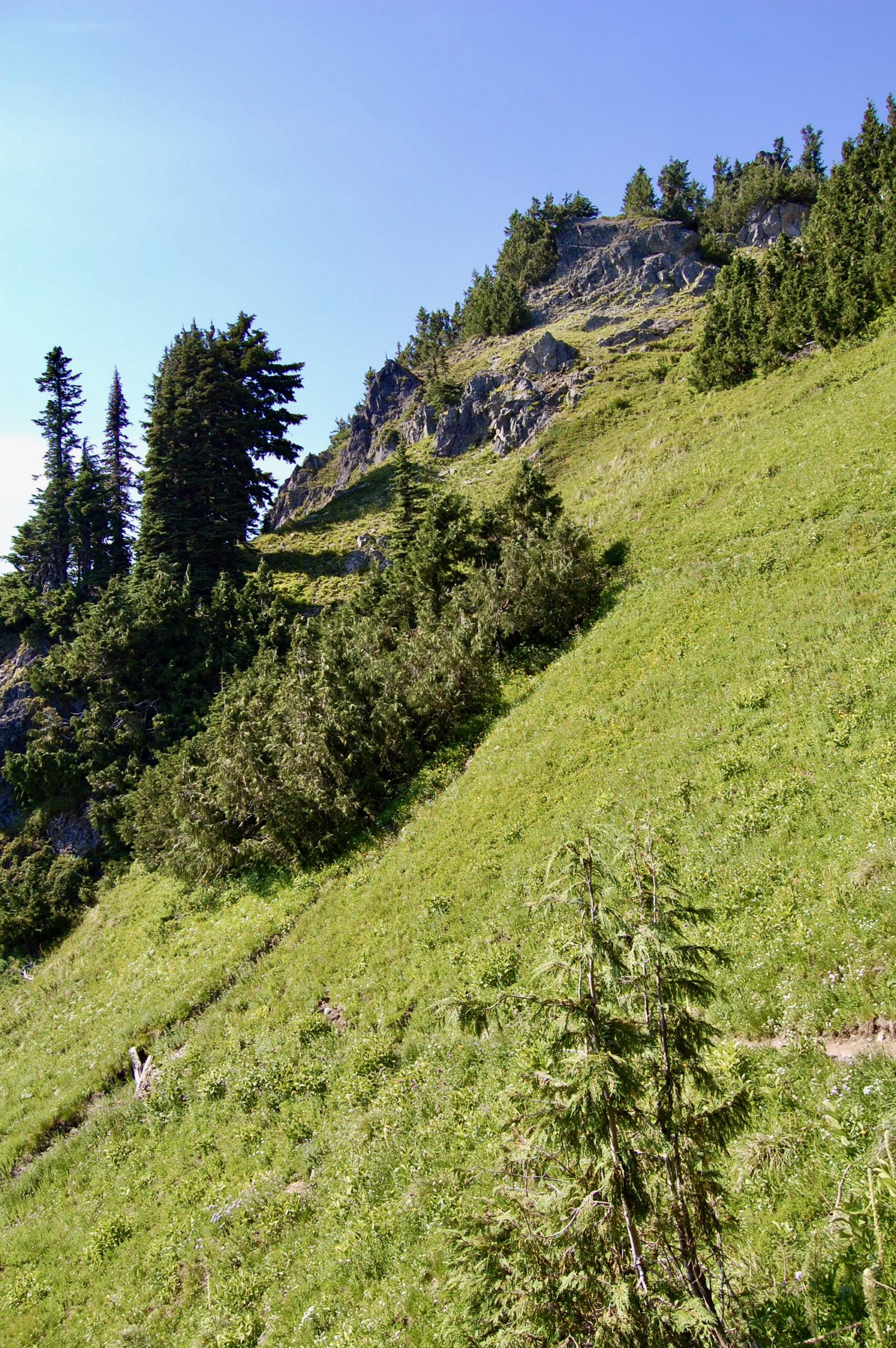
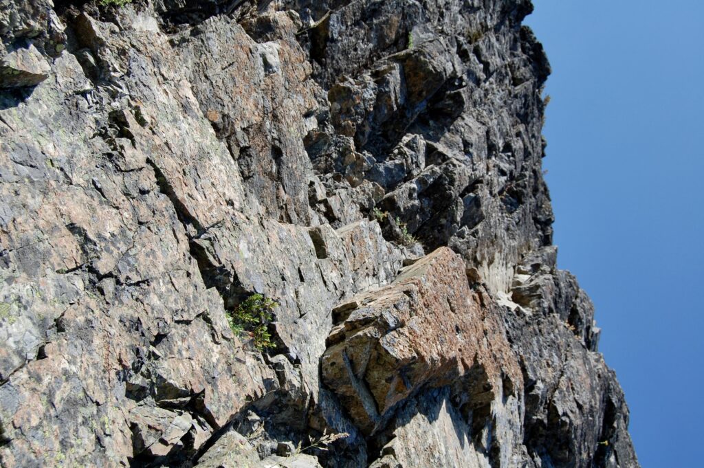
Steep, old trails cut their way back and forth up the slopes of Eagle Peak.
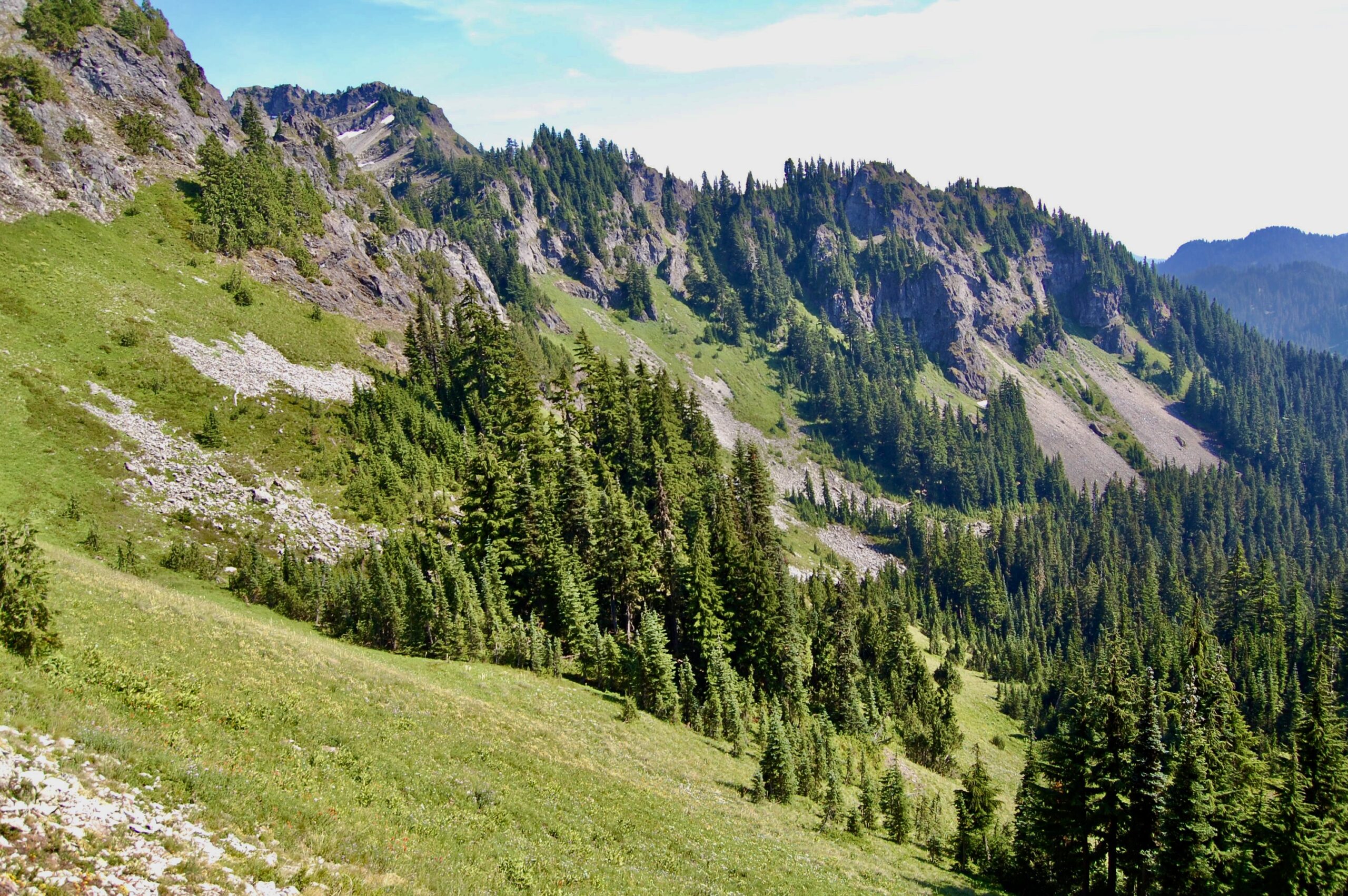
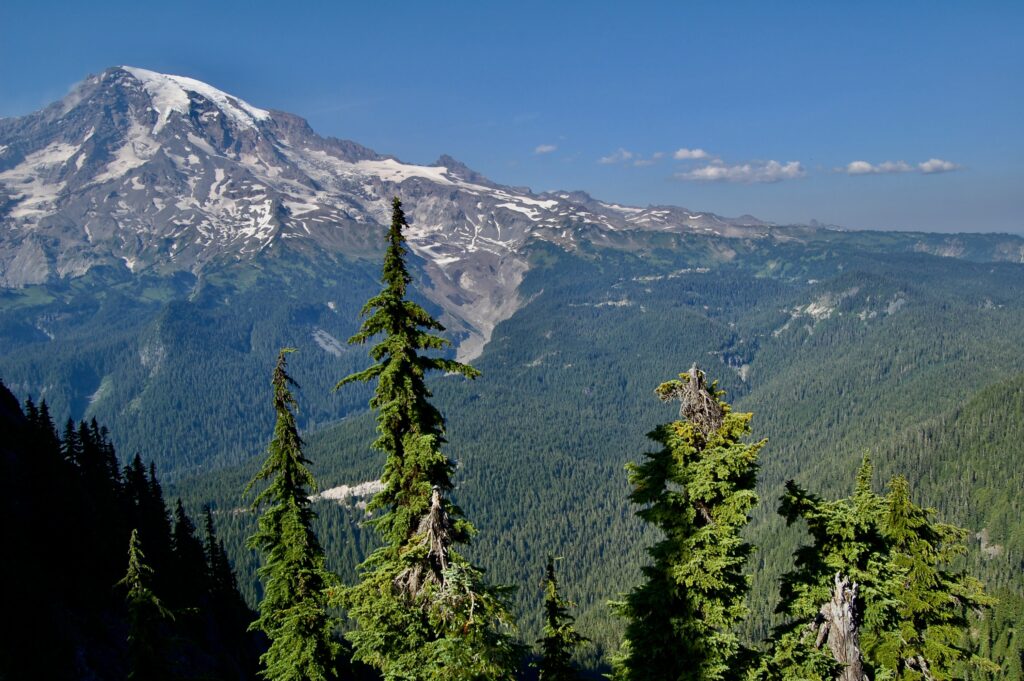
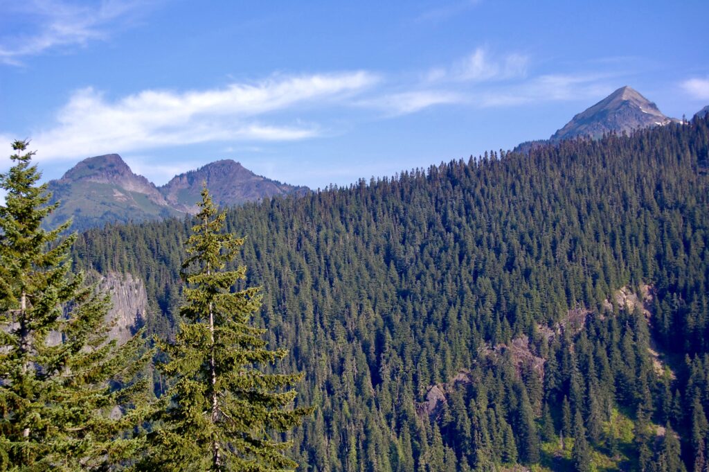
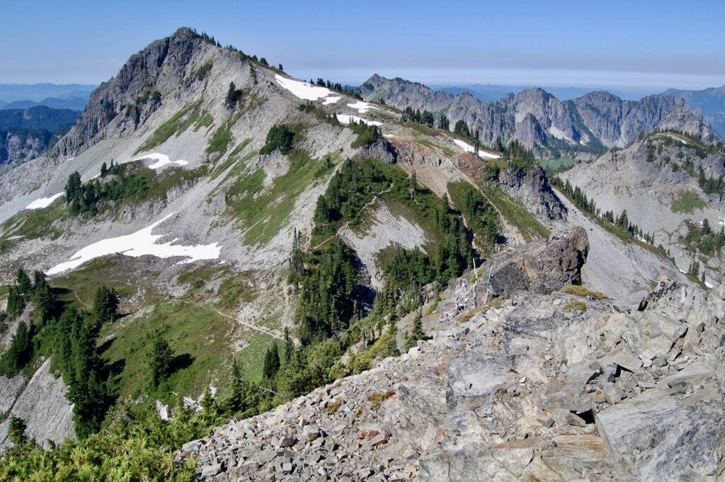
The Tatoosh Range stretches on towards the East.
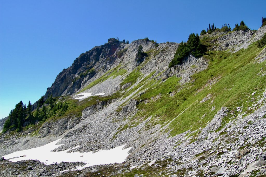
The backcountry beckons us further beyond the more dramatic peaks into a rough, beautiful land of meadows, forests, and bare rock where the bones of the earth breathe into the sky.
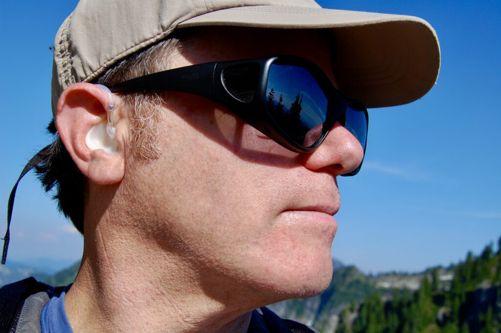
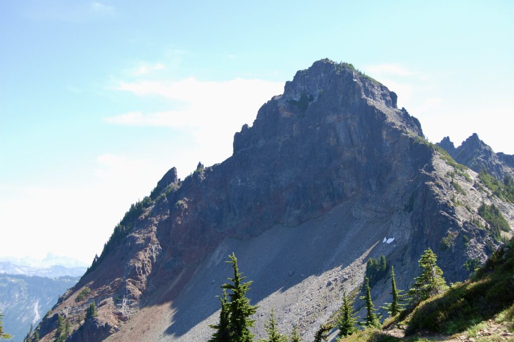
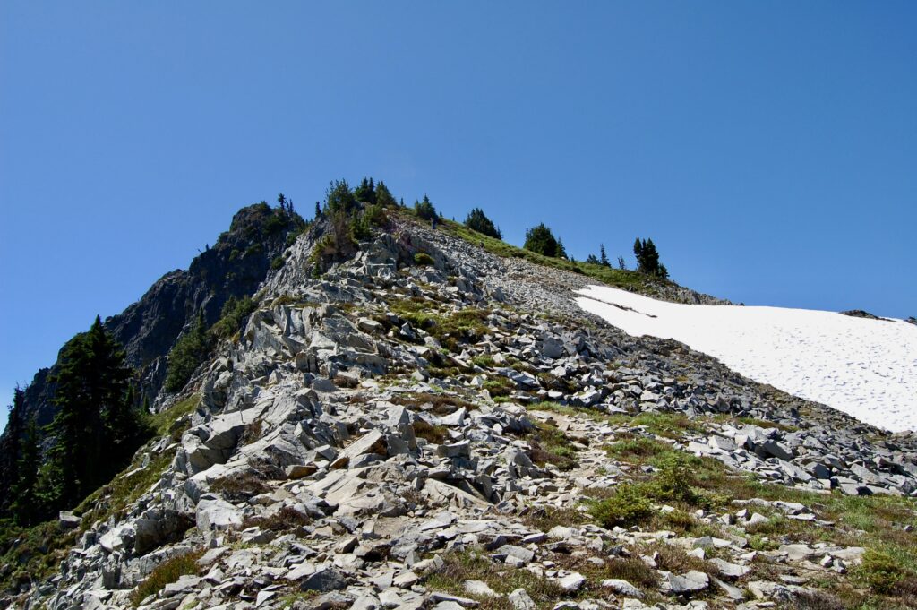
The author experiments with a sideways self shot up in Eagle Peak Pass at the base of the exposed, scramble section to the tip of the summit.
Content in the summer sun at age 50.
Looking up at the rest of the scramble from the pass to the summit at about 16:38. Considered climbing on up, but felt more concerned about getting safely back down as I was solo and without a rope. So I chose to enjoy the views from the pass before hiking back down to the car.
Yup
and yuppers, LOL
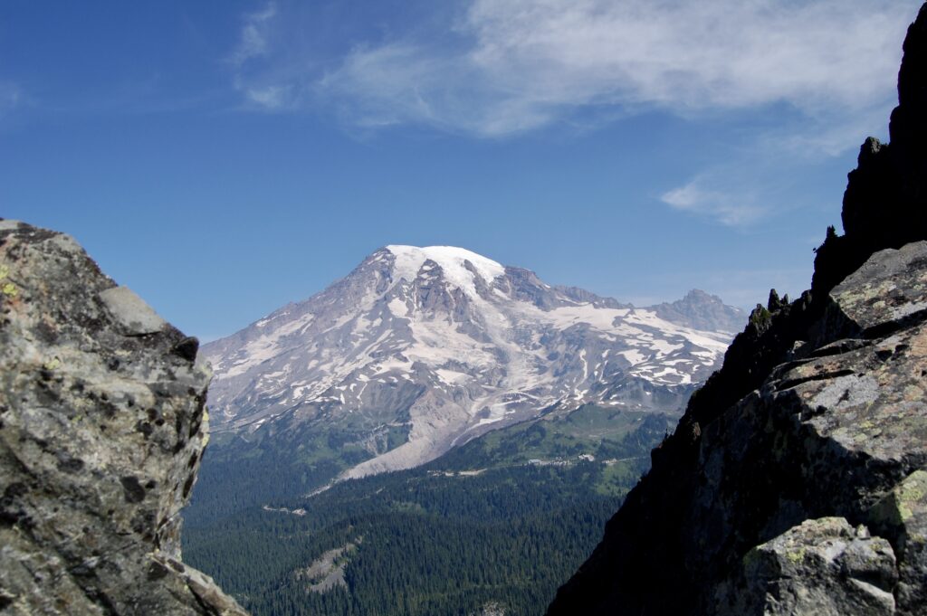
The Volcano dominates the region.
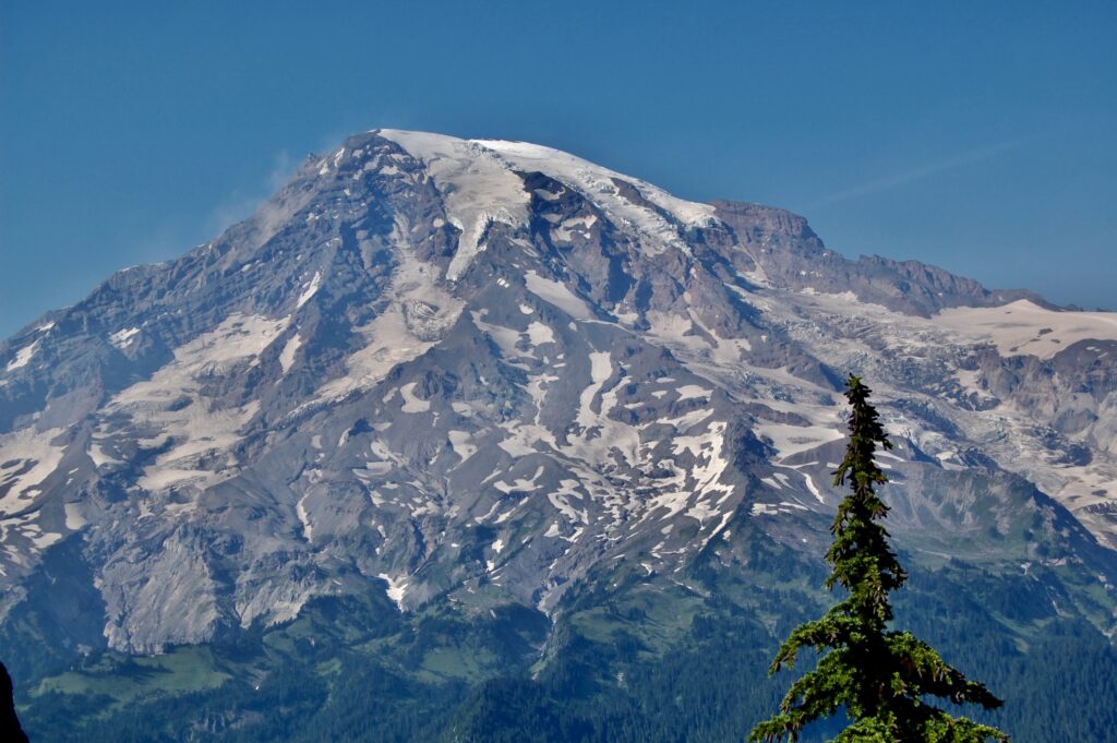
Is the misty smoke on the edge of the top of the volcano, picture left, clouds of dust from a rockslide, or merely small clouds?
Looking directly from Eagle Peak Pass across the park at the tiny village of Paradise halfway up The Mountain. The large building in the distance is Paradise Inn. Little Paradise River carves a narrow, deep gash down the flanks of the volcano where it merges with the Nisqually. The big cliffy chunk cut out of the forest slopes just left of center may be part of Narada Falls.
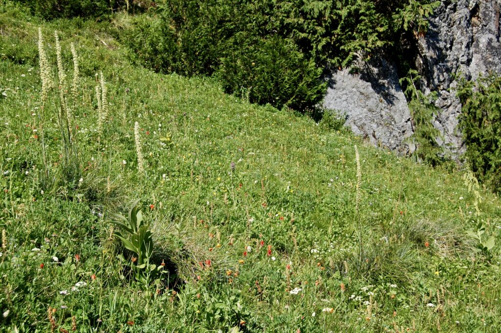
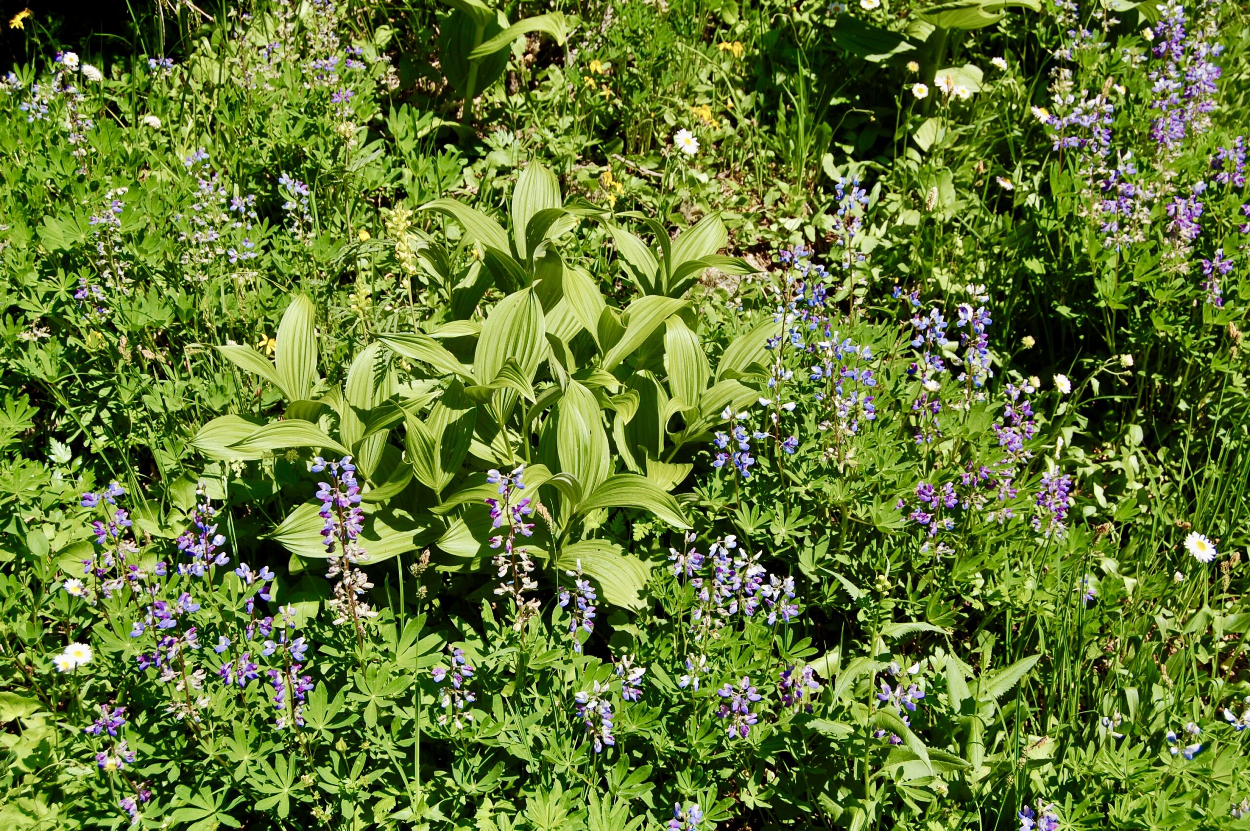
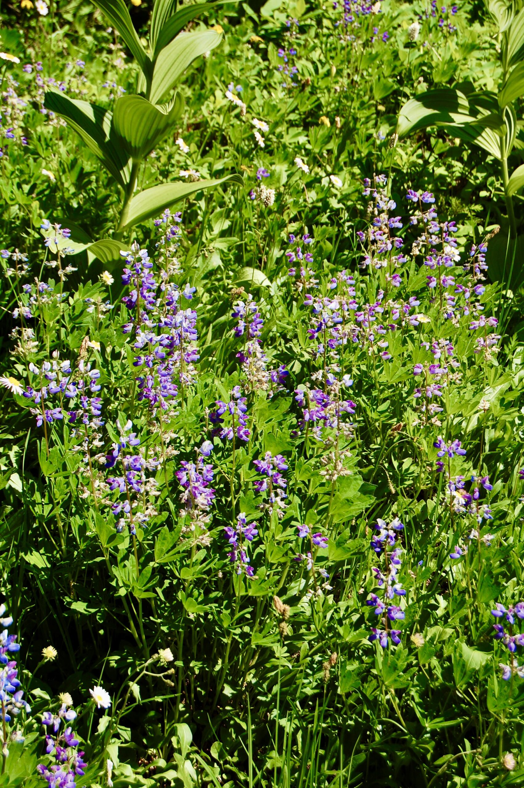
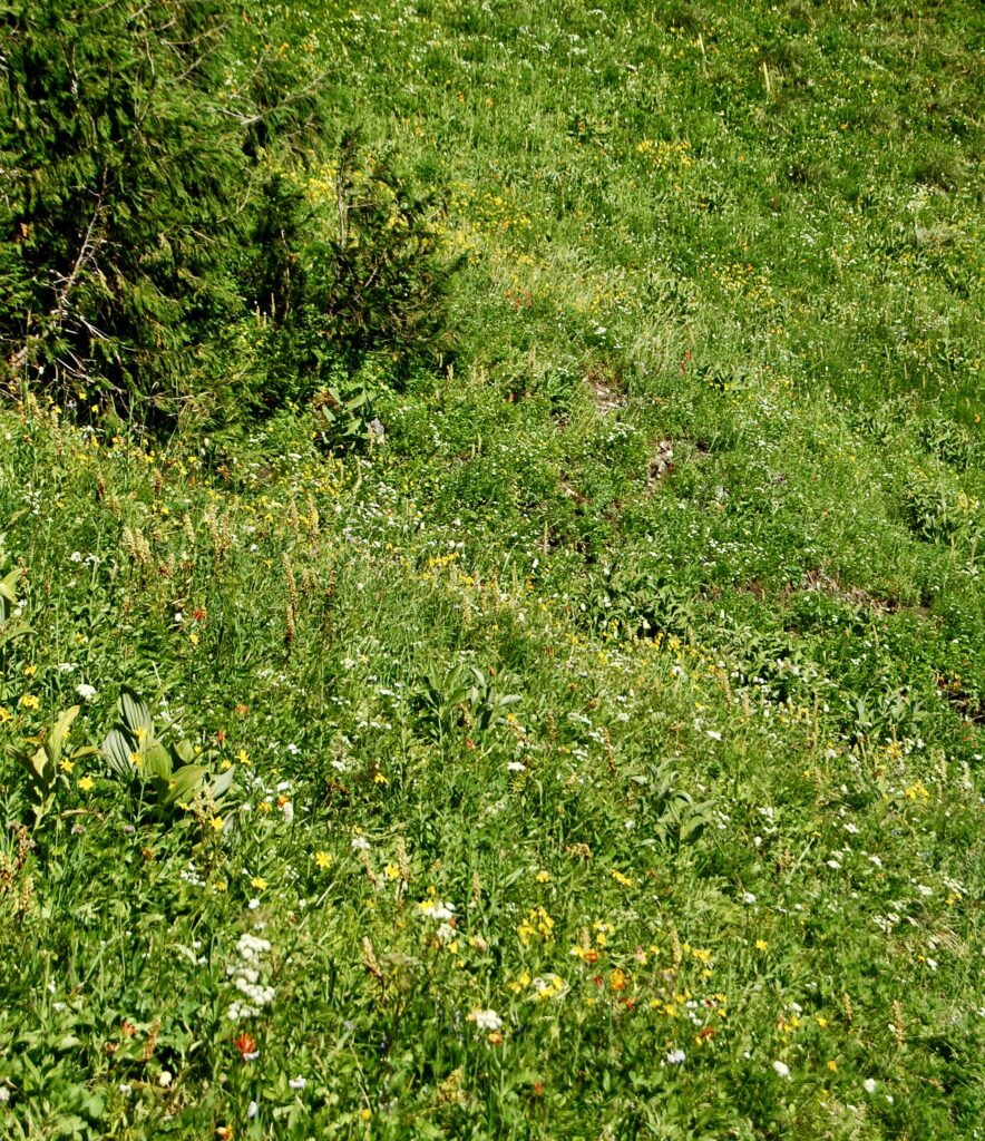
Wildflowers flourish in the mountain meadows.
The trail beckons.
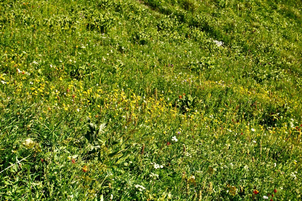
Passing the last of today’s wildflowers.
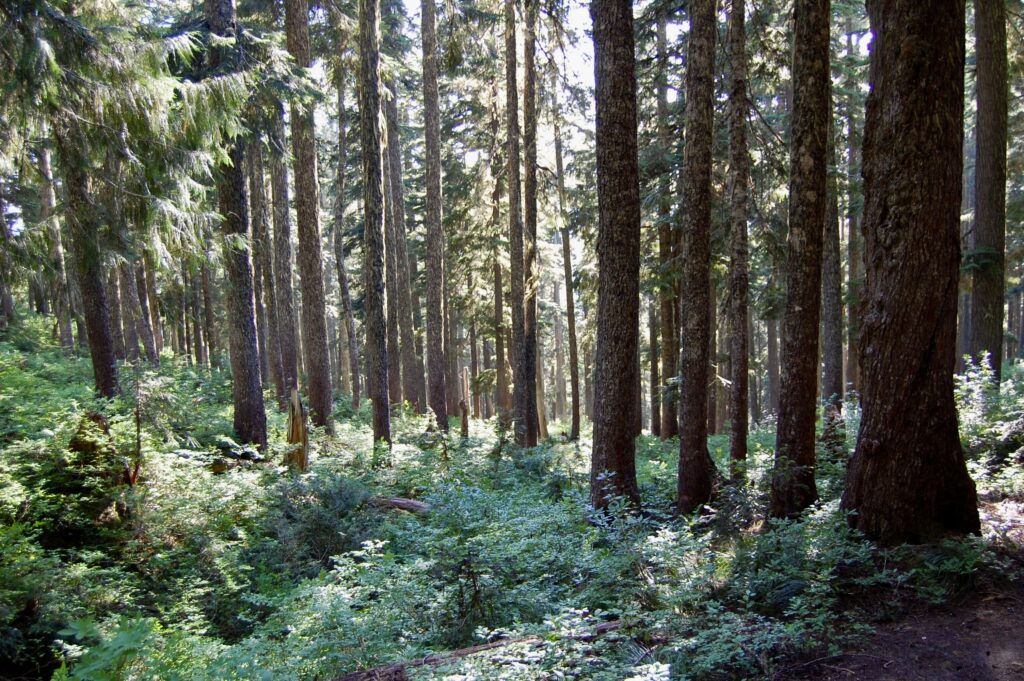
Back into the woods! And it’s almost 17:40. Plenty of daylight left.
Last break before pushing on.
Love the changing dance of light and shadows as the late afternoon summer sun shines thru the trees of the forest. 17:41 on Sunday the 2nd of August 2009.
Standing on the banks of the Nisqually outside Longmire an hour later. The water is a little bit higher than it was earlier when I first came thru here.
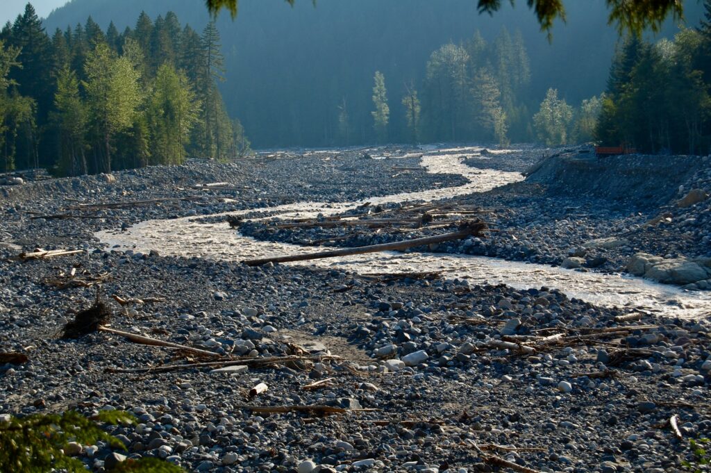
The Nisqually is a small and rambunctious river at this time of year. During autumn storms and spring snowmelt, however, the little river turns into a monster flooding over the banks.
The historic old bridge across the Upper Nisqually has stood over many a bank-gouging flood surging down the mountain from glacier and sky.
The beginnings of alpenglow in the mountains with just a couple more hours of daylight left to go here in Longmire.
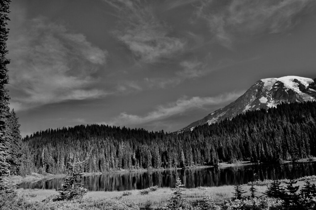
Mt. Rainier, the Volcano that Wipes clean the Sky, on Monday morning the 3 of August 2009. I’m moving to hike up the steep Plummer Peak Trail across from the Reflection Lakes. As I am crafting this foto-essay here in June of 2024, I do not remember where I camped on this particular solo trip. Perhaps it was at the nearby Cougar Rock Campground. Since I was traveling in a Dodge Caravan, however, a minivan, I probably slept in the back where I had the rear seats removed. I often did so, stealth camping, sort of, as it was a lot simpler. I do recall sleeping in my car up at Paradise on my first solo trip to Mt. Rainier, in August 1986, and also in later trips including in the Summer of 2010. Camping and sleeping in the car or a minivan, if properly and well set up, is amazing and liberating. My second wife Gwen and I explored much of North America this way. This was also back in the day before “van life” became a thing, and, no, no damn glamping either. We camped for shelter, for protection, and to sleep, not to prance around on the edge of cliffs like some half-naked addlebrained influencer on social media. Now I engaged in lots of naughty stuff with friends and lovers, sure, but not in front of cameras for socmed likes. Times changed, didn’t they?
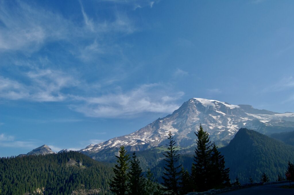
Ti’Swaq’ dominates Cascadia as no other giant mountain does.
Surrounding peaks and mountain forests with hidden canyons.
Scanning the world around me.
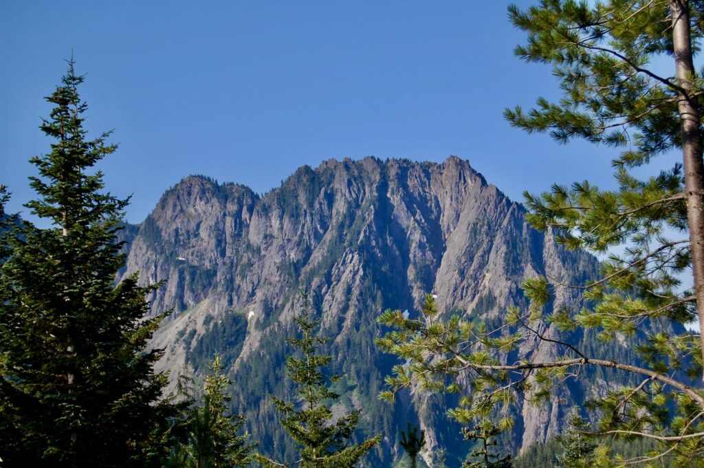
Big, jagged peaks.
This is a posed, selfie shot, sure, and I do spend a lot of time looking up at big mountains and the skies around them. Too many UFOs/UAPs to all be zooming in from faraway star systems. One of the first significant, post-World War II sightings of UFOs was of a fleet of 9 UAPs seen speeding around Mt. Rainier on 24 June 1947 by Kenneth Arnold, an experienced private pilot active on Idaho search & rescue teams.
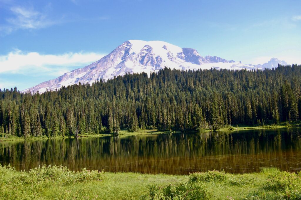
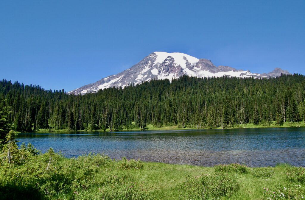
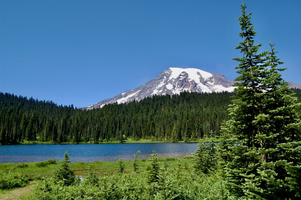
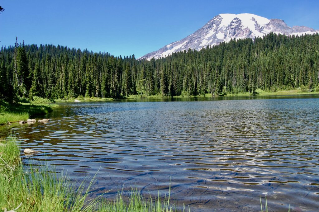
Standing on the south shores of the Reflection Lakes, which are in the south-central part of the national park just off the Longmire-Paradise-Stevens Canyon Road. Monday morning @ about 8:50 on 3 August 2009.
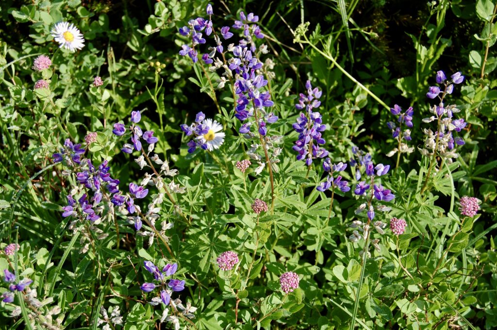
So many wildflowers even in August.
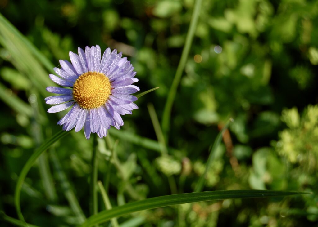
Beautiful! A common subalpine daisy, Erigeron peregrinus, bursts with life as it faces the Sun.
The lakes are edged by shallow, muddy bogs in turn ringed by forests.
There are moments in the stillness of nature I feel as if I somehow fell across a tangle of timelines to end up at The Outer Limits of The Twilight Zone with my fellow humans suddenly looking as if They Live! with the Body Snatchers. Yuppers, I’m a huge syfy fan, LOL!
Gazing into the hazy vastness of stillness…
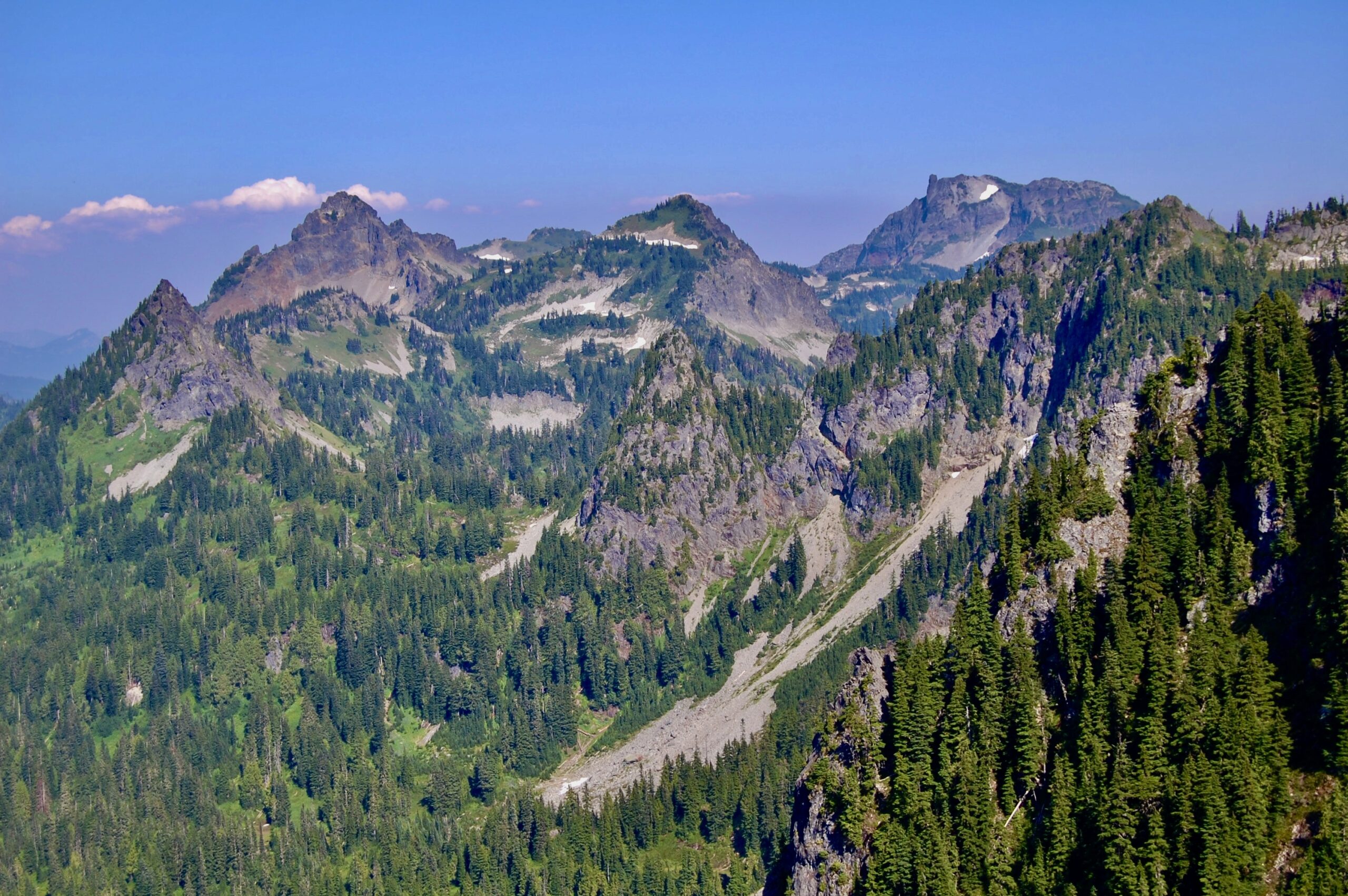
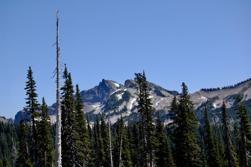
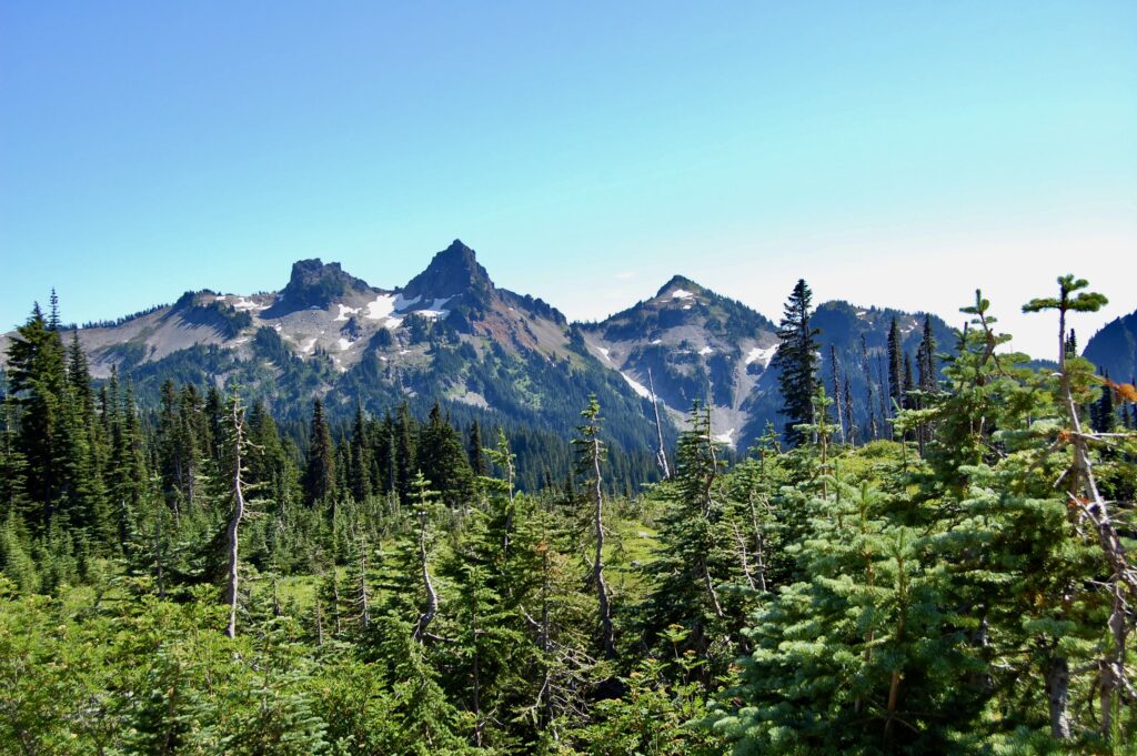
Unicorn Peak juts forth as the tallest of the Tatoosh Mountains. Unicorn stands at 6,971 feet or 2,125 meters tall. Once climbed it with The Mountaineers back in the mid-to-late 1990s. I remember it as fun, comradely adventure. We went straight up the steep, snowy couir in the center, turned back toward the summit, and climbed a mixed of 4th class and easy 5th class rock with protection. Beautiful views we had that Spring day.
It’s a steep grunt hiking up Plummer Peak! Perfect weather, too! Plummer’s 6,370 feet or 1,942 meters high (Peakbagger and SummitPost), altho I also saw the mountain listed as being 6,562 ft. in elevation (The Mountaineers), 6,359 ft. (Washington Trails Association), and 6,374 ft. / 1,943 m. high (Wikipedia, which references Peakbagger dot com, altho the latter shows a different height). So, which is it? Crazy humans pile up a stack of rocks and dirt, or pull some down, or both back and forth? Earthquakes? Geomagnetic anomalies bewitching GPS satellites? Surveyors spot on back in the day? And which source is quoting from whom? It’s often like that with many mountains. While not a big fan of Wikipedia with its biases towards UFO/UAP/NHI and paranormal issues, I took note Wikipedia used NAVD 88, the North American Vertical Datum of 1988. NAVD 88 establishes parameters and metrics, specifically orthometric heights, for vertical control surveying within the USA. NAVD 88 supersedes the NAVD of 1983 and the National Geodetic Vertical Datum of 1929. These are all supposed to be replaced in 2025 with a newer, more digitalized geometric frame and model. It’s a fascinating rabbit hole to explore for those both curious and obsessed with such matters.
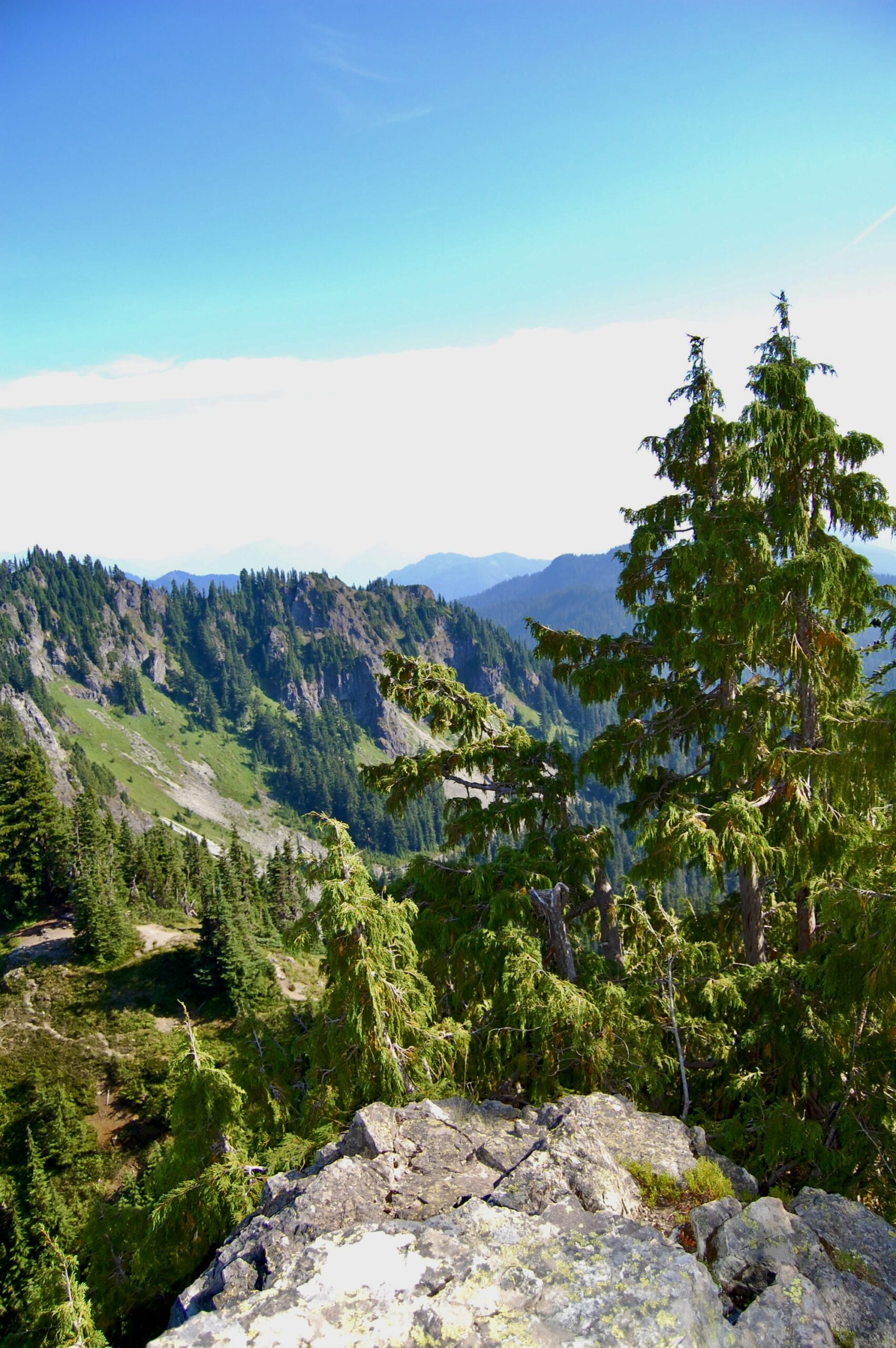
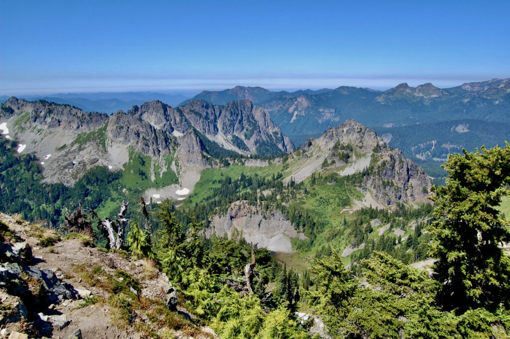
One can see the smoggy, hazy brownish gray zone of air pollution floating in the lower atmosphere over the urban corridor to the west. Otherwise I’m drawn to the network of hiking trails and scramble routes before me where they cut across the flanks and up the ridges of Plummer Peak.
Plummer Peak, 6,370 feet or 1,942 meters in height.
Unicorn.
Ti’Swaq’ wipes the sky above the Tatoosh.
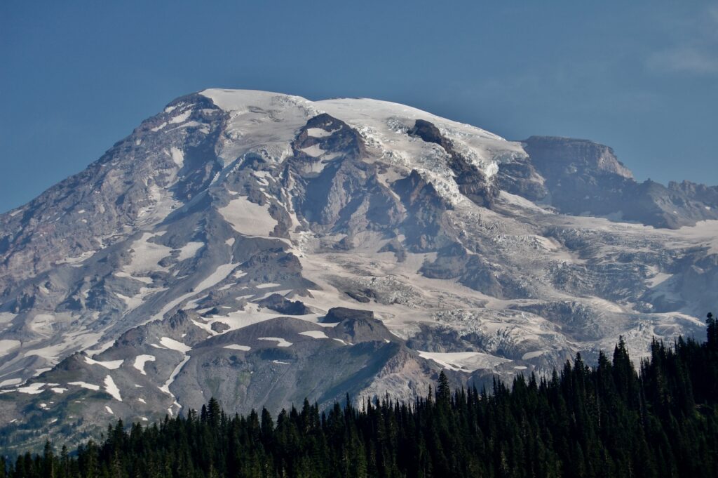
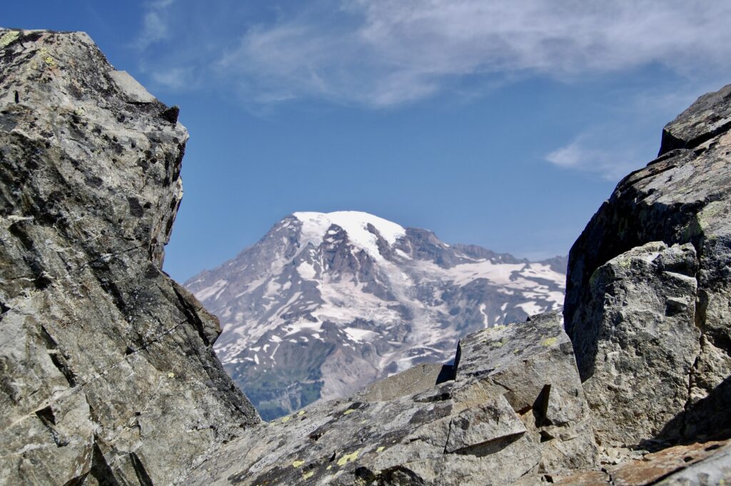
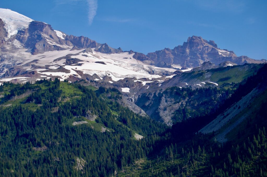
The big gash in the center of the lower slopes of Mt. Rainier is the Upper Nisqually Canyon left behind by the retreating Nisqually Glacier.
Unicorn again, born from fire, ice, time, and gravity.
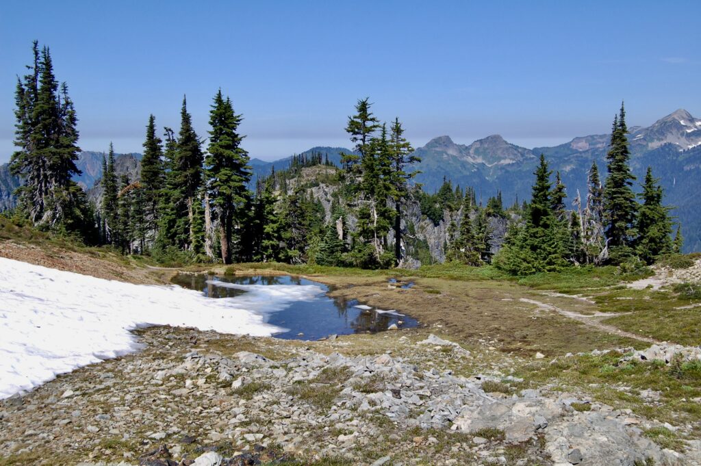
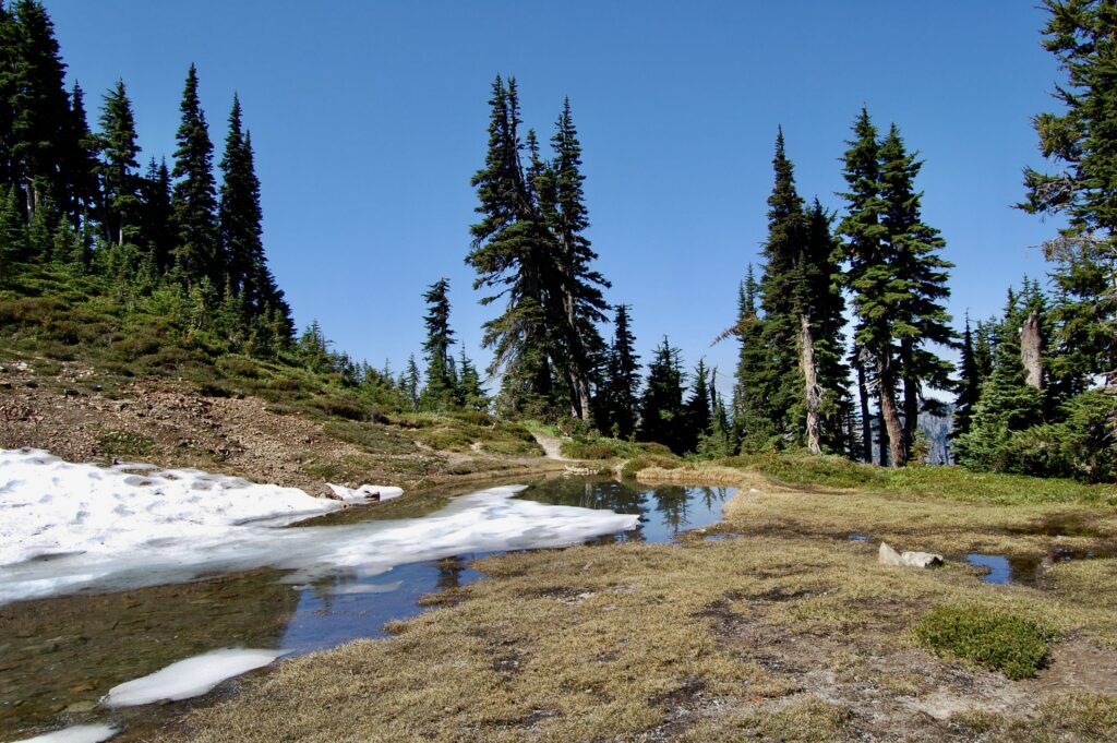
Small tarns fed by snowmelt dot the flats along the flanks of the range.
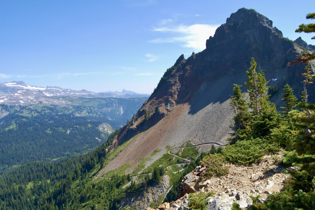
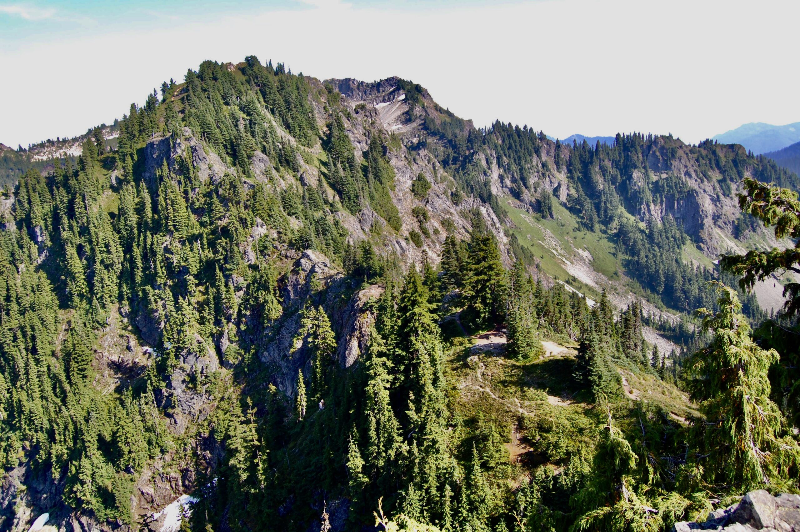
Denman Peak, west of Plummer, with trails zigzagging up the slopes below the cliffs. The pass and the summit scrambles await.
Standing above the pass looking down at paths and scrambles along the “back side” of Denman Peak.
The backcountry beckons, but I’m gonna keep climbing up.
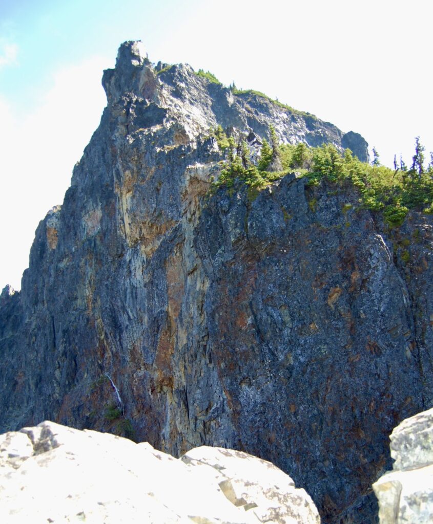
The Cliffs of Denman.
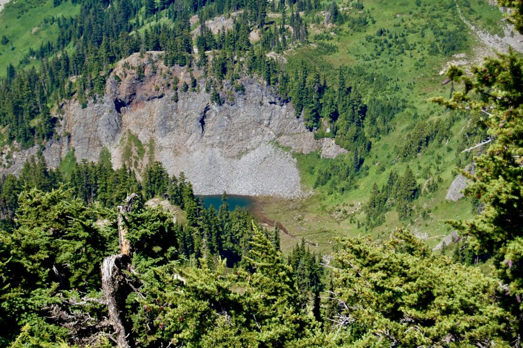
Peaking over from Plummer into Cliff Lake.
Views such as this one keeps me coming back into the Great Outdoors. It’s a big reason why I chose to live in a progressive city close to so many national parks and wilderness areas. Monday the 3rd of August 2009.
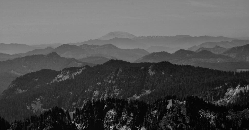
Looking due south towards the open crater of Mt. St. Helens, now only 8,364 feet tall in the wake of its famous and deadly eruption on Sunday 18 May 1980.
Never get tired of gazing upon The Mountain.
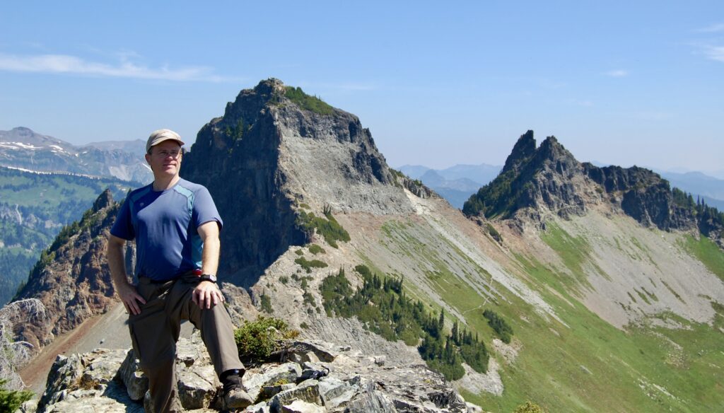
Yuppers, that’s me, LOL! Another hiker/scrambler upon the summit of Plummer Peak offered to take a few pictures of me, and I said, “Sure!” and, “Thank you.” He was a bit older than me, so I wondered what ever happened to him later on. Life is rich with so many chance encounters with people, including many wonderful ones, we never meet again. Or if we do, we don’t recognize or remember them. The remnants of Mt. St. Helens cuts into the haze on the far horizons behind me.
Oh my goodness, those lens flares and light effects make me look like some strange mix of heroic general and divine angel with a purple-pink belly button. Was most intentional and a little amusing in an embarrassing sort of way, so here it is for a chuckle! Meanwhile, another volcano, Mt. Adams, looms southwards in the distance.
Loving being here atop a mountain in the Cascadian sunshine. Those “rays of divinity” beaming down may be unintentional, and they were certainly good for my soul being outdoors here in Planet Earth beneath our Star Sol. Still gotta purple-pink belly button, LOL!
In my element, and grateful for the opportunity to be here. I could have stayed down on the family farm in my native Virginia, or stayed in Vermont, or Wyoming, or gone on to Alaska, or stayed in North Carolina or Georgia or Colorado, or a dozen other choices, and nothing wrong with any of them. Each have their own timelines of lives lived and living. Instead I chose to enter the outdoor adventure lifestyle and moved to the Pacific Northwest to make it so a certain way. No regrets, just wonders.
Hello, again! The photographer was enthusiastic with my Nikon D40, and I appreciated his vigor. We did exchange names, but I know longer recall what his was. Any notes I may have scribbled down were lost in the house fire the following year. And that’s Little Tahoma Peak behind my head. Once upon a long time ago it was part of a much more immense volcano over 16,000 feet high before eruptions, explosions, and erosion reduced The Mountain to one volcano and a rough, jagged sub-peak. The Law of Entropy rules here.
As I descend, other hikers clamber on up. We all wave cheerily to each other and bobble onwards in our merry ways.
Looking back up at the tippity top of Plummer Peak.
The Far Side of Plummer…
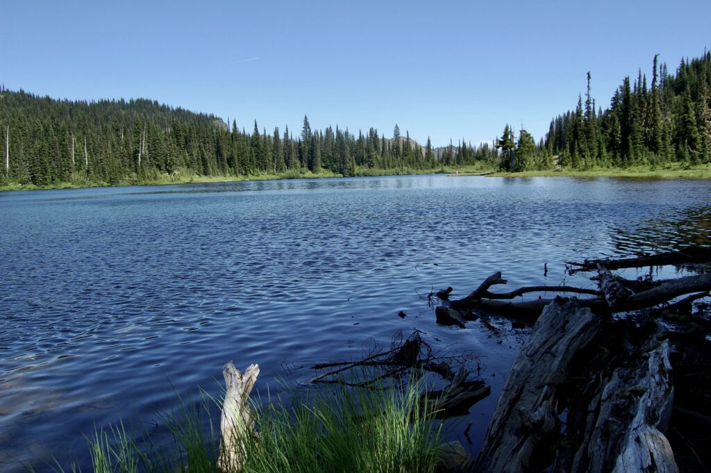
Back down at the car and the iconic Reflection Lakes below The Mountain.
In those woods beyond the lake, what lives there? And who goes there?
I move, therefore I live.
Pinnacle Peak juts up on the left as one looks south, to the right of those trees, with Plummer further to picture right. Pinnacle’s 6,562 feet or about 2,000 meters tall, and is, after Unicorn, the 2nd highest peak in the Tatoosh.
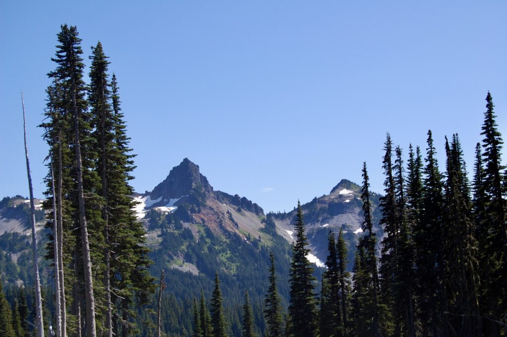
The Tatoosh Range stretches across the southern edges of Mount Rainier National Park. The tallest, Unicorn Peak, looks so small, tho, on the far left. Others are out of sight, including Eagle Peak that I hiked upon the first day as it’s too far past picture right. Oh, what a glorious day, tho! Monday the 3rd of August 2009.
Here I zoom in on Unicorn Peak a little bit, enjoying fond memories of summiting it with a Mountaineers group nearly a decade ago.
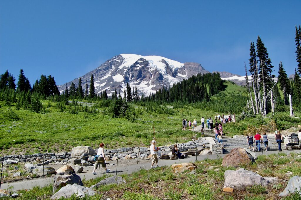
Turned around in the Paradise Parking Lot to marvel at the bulk of The Mountain. We’re actually on the flanks of this massive volcano.
Too massive to even peek at us little humans.
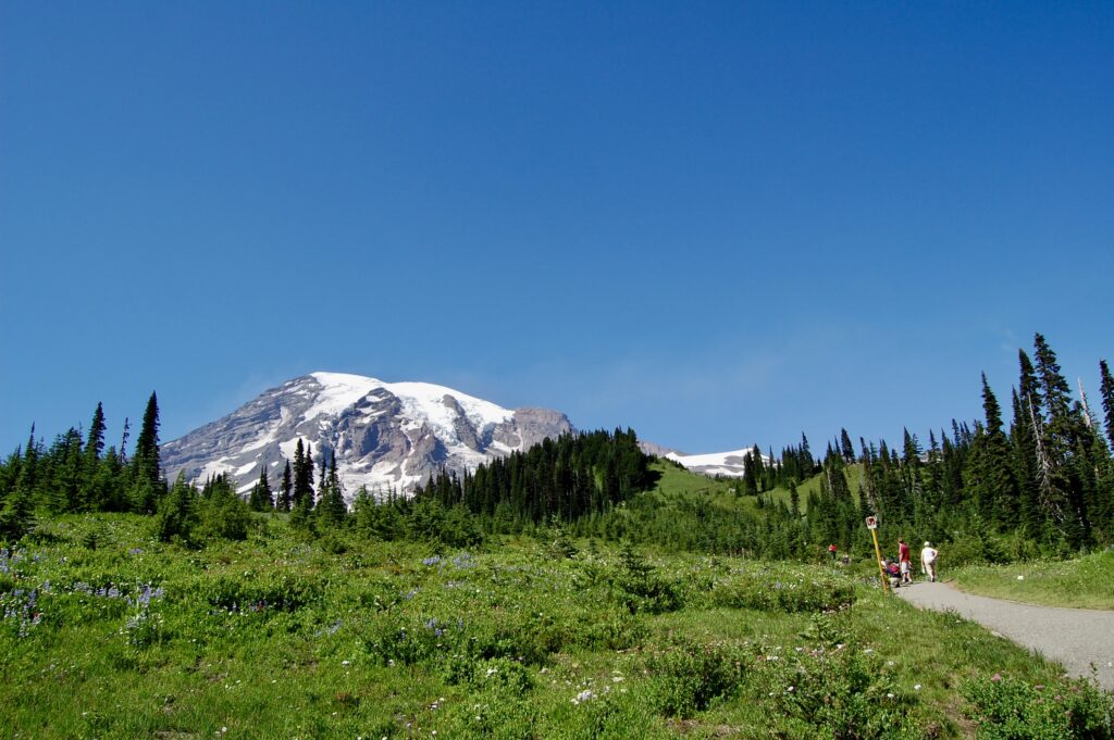
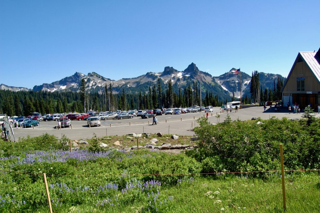
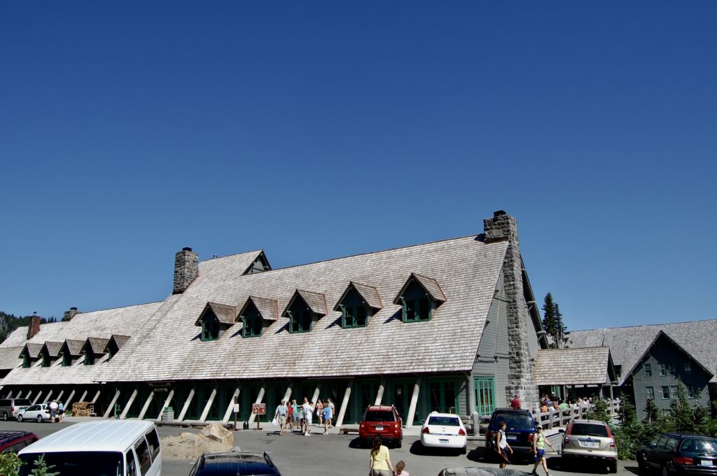
Paradise is a busy little mountain village year round.
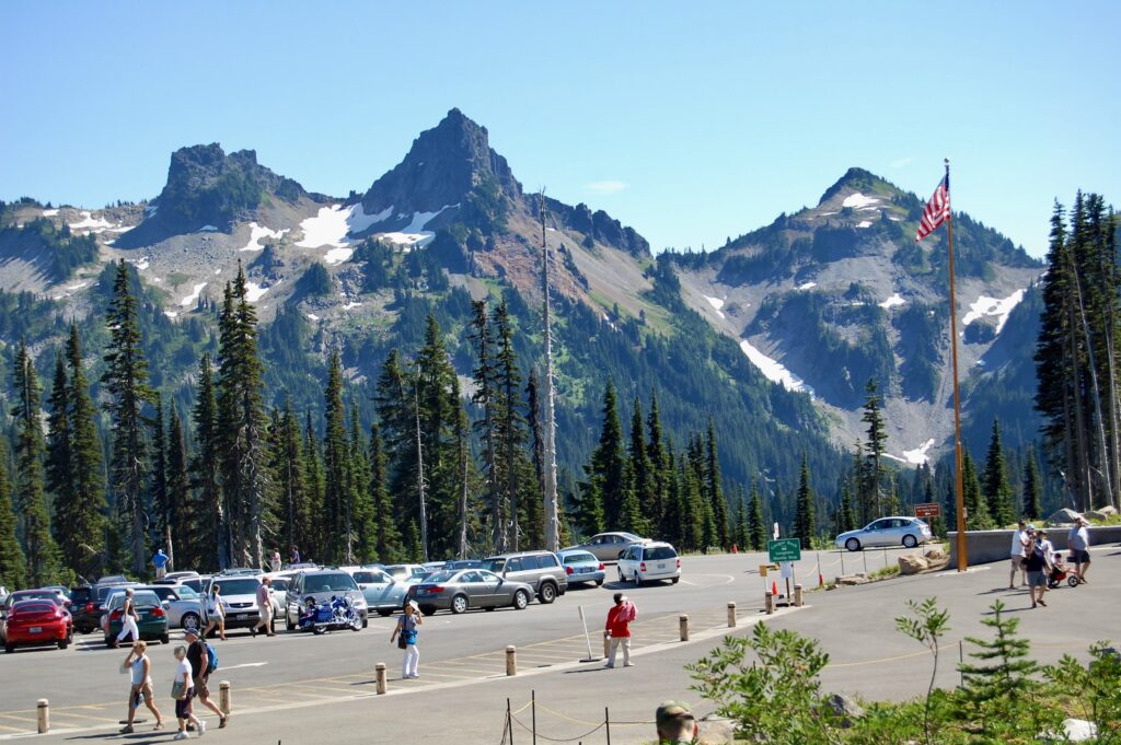
The Tatoosh strikes with awe in nearly every moment. Here, Left to Right, tower The Castle (6,440 feet or 1,963 meters), Pinnacle Peak, and Plummer.
![]()
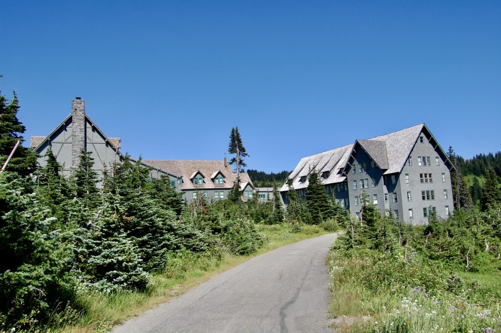
Walking towards the Paradise Inn complex.
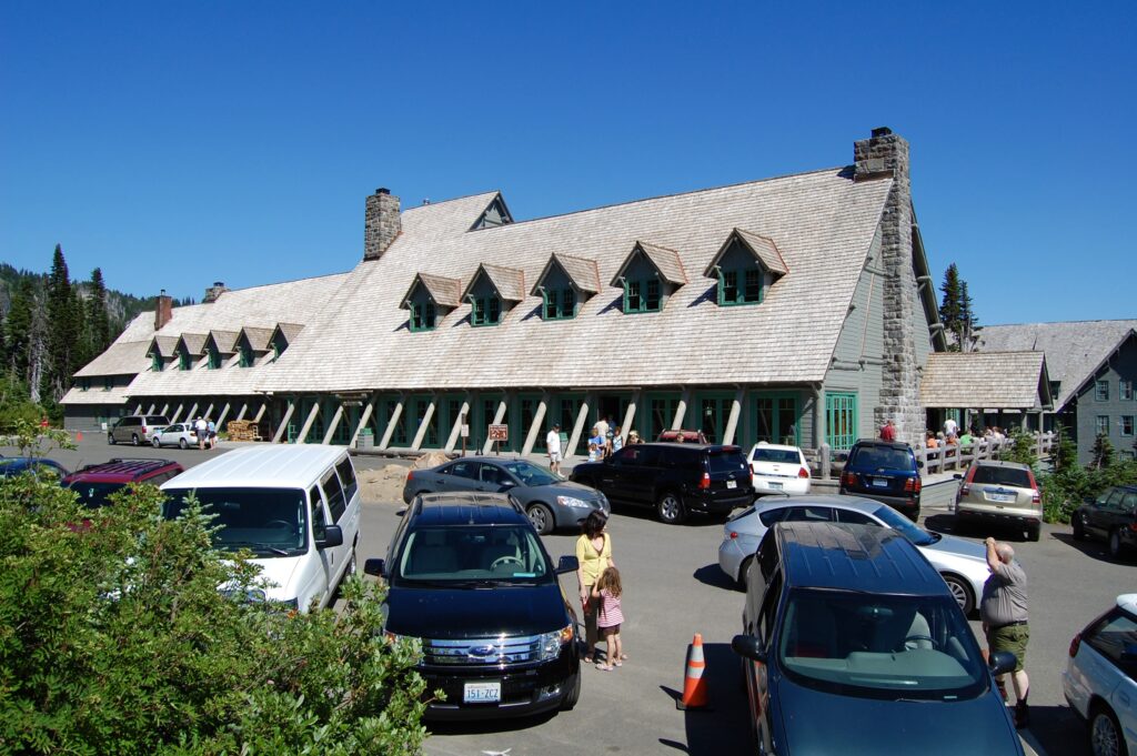
Fellow humans exploring and experiencing the world as they live their lives. I wonder whatever happened to these people over years and decades. Some may think it morbid, but I’m curious as I ponder and reflect upon every life as a flame of some sort, burning bright then fading away, with every life being lived a poem, a song of good and bad and inbetweens. I love being around people, and yet together we have wrecked the world. Even so we keep on living hoping and working to make our Planet Earth a better place even in the midst of tumultuous times.

Incredible Paradise Valley from the side of the road as I drive the curvy mountain roads towards the southeast corner of the park.
![]()
Gorgeous in Summer, the place becomes equally splendid and dangerously beautiful in Winter. This national park can be enjoyed year round.
The national park has numerous beautiful waterfalls big and small cascading down the flanks of Mt. Rainier. This spectacular drop is Christine Falls off the Longmire-Paradise Road, and is a series of beautiful plunge pool cascades on Van Trump Creek. The water level is low this time of year. It’s just after 8:20 on Tuesday morning on the 4th of August 2009, the last day of this particular road trip. Unable to recall where I camped, but I suspect I pulled over somewhere quiet and slept in the back of the minivan. I’m zigzagging back and forth between East and West as I explore little but dangerous nooks and crannies of this region of geological churn.
![]()
From somewhere along the Stevens Canyon Road @ 8:45 in the morning.
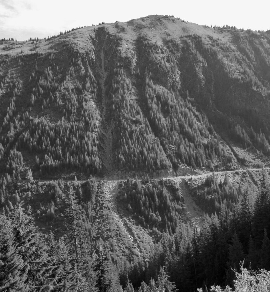
Mountain ridges gouged by avalanches, rock slides, and floods.
Stevens Creek tumbles down from the flanks of The Mountain to merge with other streams into a roaring canyon as it passes beneath the road. And this is low water, too! See, I look at this as the whitewater paddler I am, or used to be all the time. High water would be awesome! And deadly as all those logs and shattered, shredded branches would float up and form kamikaze strainers, log jams, and chew you alive. Too much wood in the river. Scary fun to look at and ponder different impossible routes, tho.
![]()
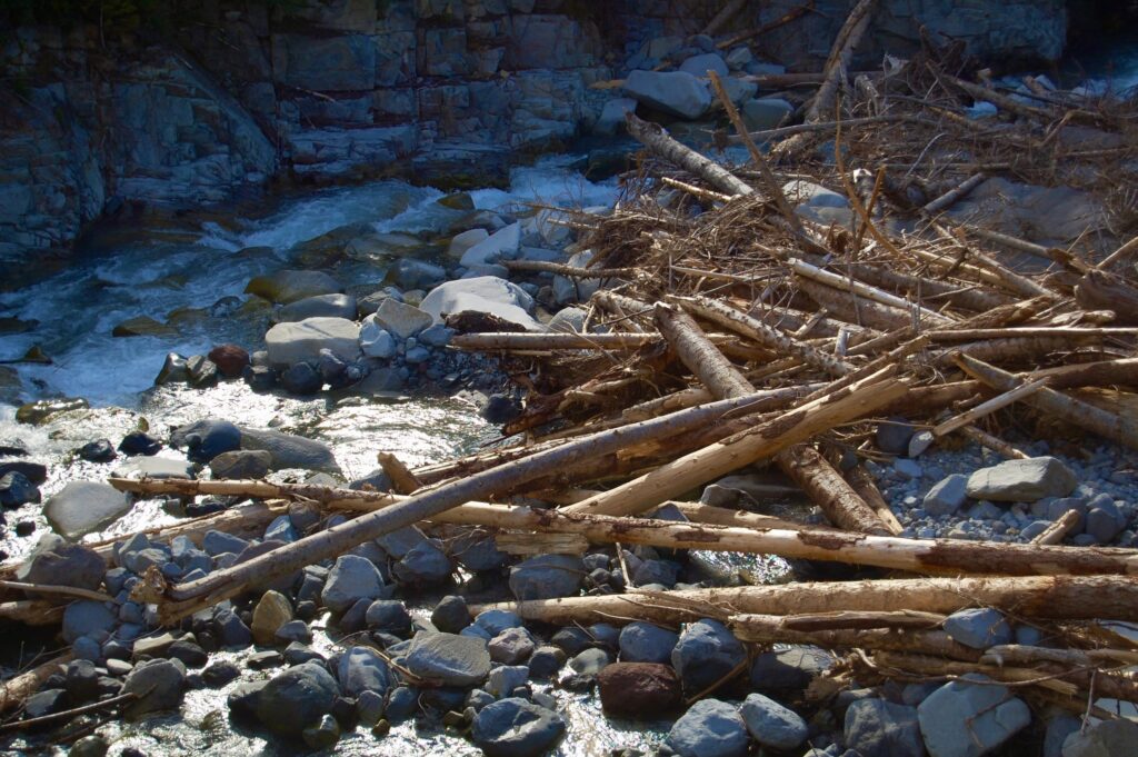
Beautiful death traps abound in Stevens Canyon.
One can see the wreckage left in the wake of winter and spring avalanches where massive amounts of snow, ice, and perhaps rocks bulldozed down the mountainsides and rolled across the flats shoving shattered timber into the river.
Gazing back into the Tatoosh at Unicorn Peak, and on the right, Pinnacle.
Oh, what a glorious summer day! And the temperatures still feel so much cooler up here in the mountains than down low in so many other parts of this great and troubled nation.
Fireweed, Chamerion augustifolium, is a herbaceous perennial often found growing in formerly burned-over areas. Had just traveled thru The “old” Burn area to the trailhead for the East Side Trail up along the Ohanapecosh River towards the Grove of the Patriarchs.
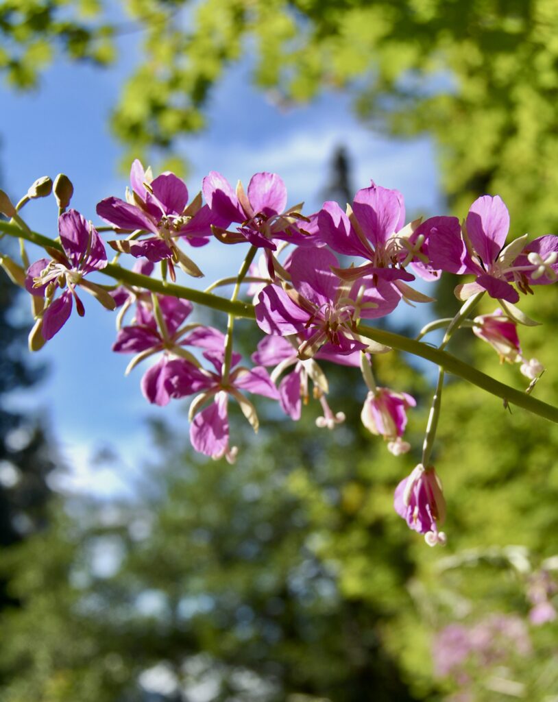
The purple-pink magenta colors of Fireweed flowers glow among the greens and browns of the forests.
![]()
The East Side Trail beckons me north. Maybe I’ll be luck enough to spy a cougar peeking at me from the hillside above, or a bear waddling around turning over old logs, or a family of Sasquatch soaking their big feet in the cold Ohanapecosh River. But, hey, it’s already mid-morning at 9:43.
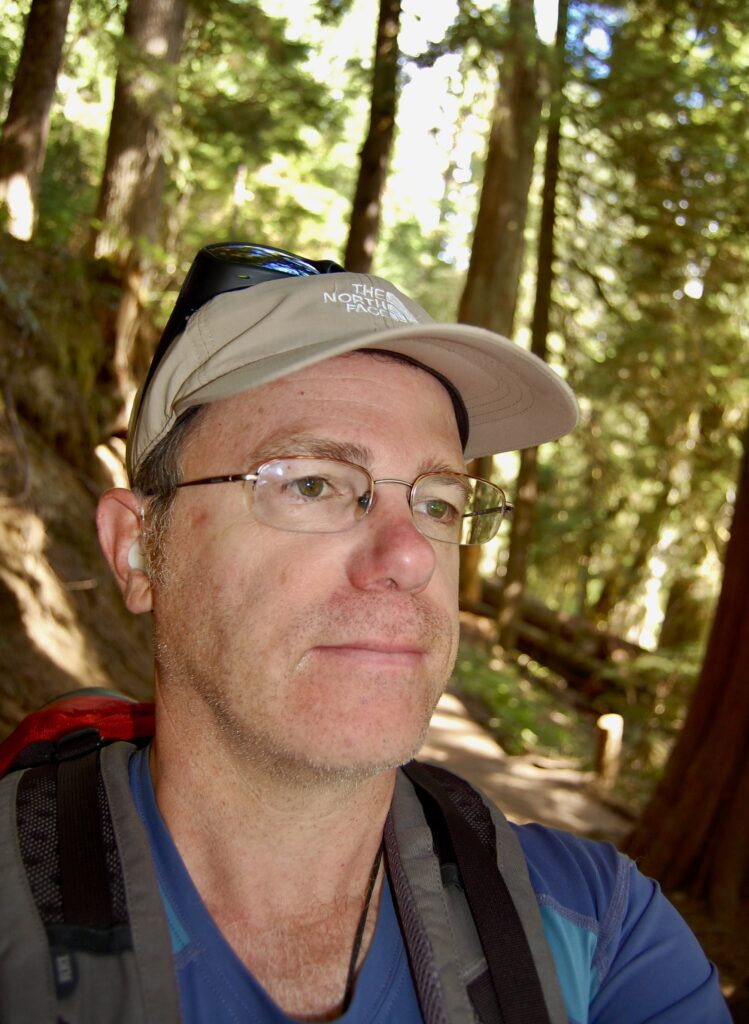
The author winding down his three day adventure.
Onwards!
Scamper up that log! Or, duck and waddle, LOL!
The Ohanapecosh runs quietly thru the forests here. Water levels tend to run low during August. The tranquility of the river gliding along invites one to slow down as serenity calms restless spirits and overactive minds. Took this foto from the center of the famous little bridge.
Life finds a way, they say. Well, “life finds a way” is the iconic quote from the character Dr. Ian Malcolm in Michael Crichton’s 1990 novel, Jurassic Park, and voiced by actor Jeff Goldblum in the 1993 movie.
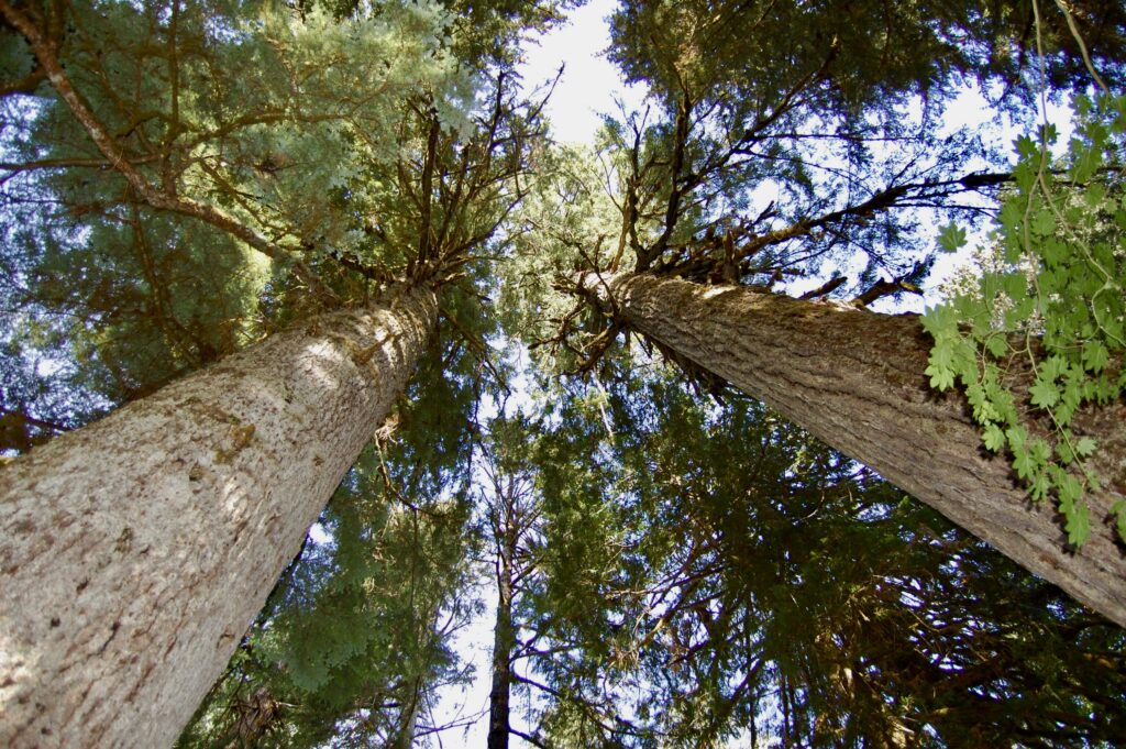
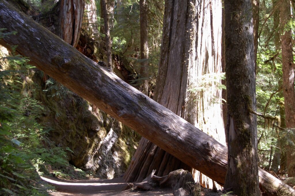
Old growth giants.
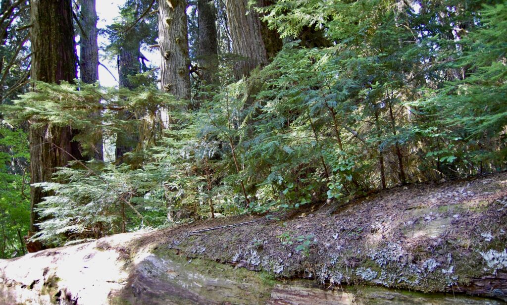
Fallen giants.
These massive living biological organisms rooted in space and moving thru time leave me in awe of their grandeur and majesty and the raw, primal, stubborn, expansive power of life itself. The Grove of the Patriarch is home to a mix of gigantic Douglas firs, Western red cedar, and Western hemlocks. Many are centuries old. Some are over a thousand years in age. They have all developed mind-boggling girths and some tower over 300 feet tall. Wow! And it’s not quite 10 in the morning here.
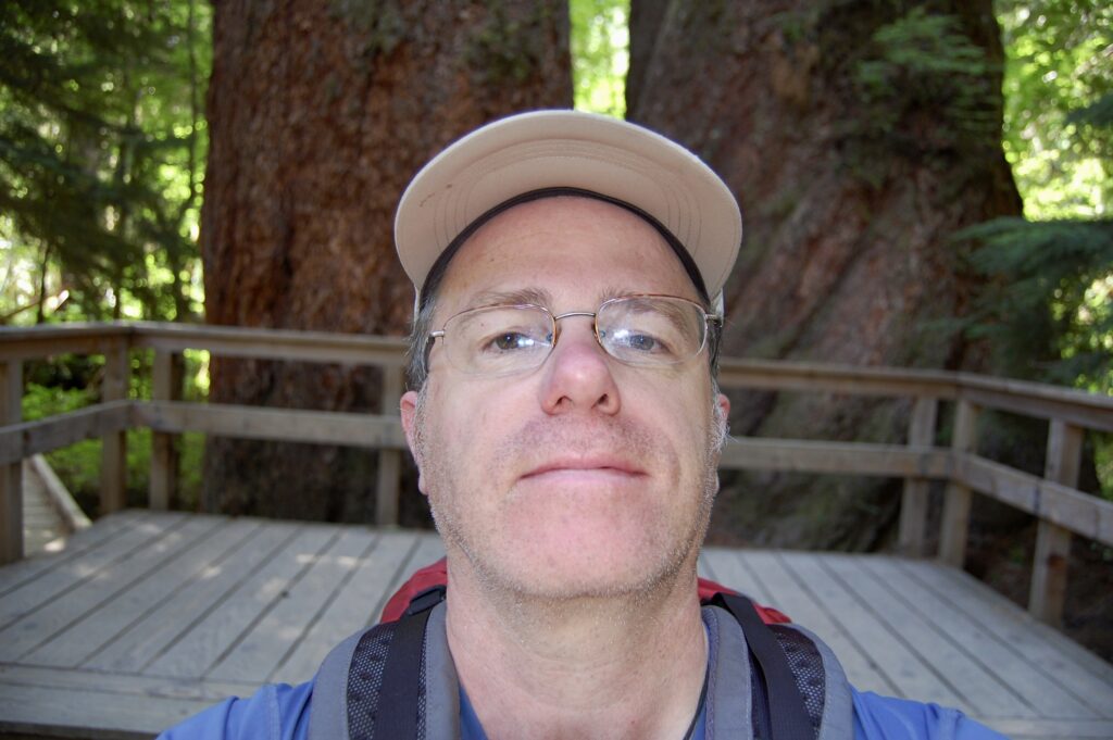
At the End. Beautiful and impressive closure to a wonderful, much needed solo getaway. Started off with a bang as planned, grunting up Eagle Peak on the first day and atop Plummer Peak on the second, and topped off with a mellow forest stroll beneath giant trees by a river. I’m surprised I didn’t take any fotos of the suspension bridge over the Ohanapecosh. It’s a backcountry engineering marvel. The Grove of the Patriarchs is on an island midstream, and the bridge is the safest way to cross over as fording is not recommended. As I write these words in June of 2024, I learned the bridge, washed out and destroyed by a great flood in November of 2021, remains out. There have been a number of such calamities in the national park there in recent years and across all Cascadia with increasing frequency with global climate disruption. The NPS claims new bridge replacement construction is to begin in 2027. There were and remain environmental concerns, skilled labor availability issues, and budgetary considerations to navigate. It’ll take time, and anything may occur before then. Meanwhile, back in 2009, I remember returning to our family’s white Dodge Caravan and driving back home to Seattle without incident. This journey was refreshing, much needed, without any injuries, and I felt good to be back home where I was loved.
William Dudley Bass
Wednesday 5 June 2024
Thursday 27 June 2024
Shoreline/Seattle, Washington
USA
Cascadia
Earth
Sol
Note on Fotografy: I shot these fotos with a Nikon D40 DSLR without a tripod. At the time the D40 was considered one of the best lightweight, moderately-priced, travel camera for the amateur hobbyist.
Notes:
“Eagle Peak,” Summit Post dot org: https://www.summitpost.org/eagle-peak/151871.
“Eagle Peak Saddle,” Washington Trails Association (WTA): https://www.wta.org/go-hiking/hikes/eagle-peak-saddle.
“Fireweed,” Flowers of Rainier: https://flowersofrainier.com/flower/fireweed/.
“Grove of the Patriarchs Trailhead,” Mount Rainier National Park: https://www.nps.gov/places/grove-of-the-patriarchs-trailhead.htm.
“Longmire Historic District Walking Tour,” Mount Rainier National Park: https://www.nps.gov/mora/planyourvisit/upload/Longmire-Historic-Walking-Tour-July-17-2.pdf.
“Nisqually Historic Suspension Bridge,” Mount Rainier National Park: https://www.nps.gov/places/nisqually-bridge.htm.
“North American Vertical Datum of 1988,” Wikipedia: https://en.wikipedia.org/wiki/North_American_Vertical_Datum_of_1988.
“Plummer Peak,” Washington Trails Association (WTA): https://www.wta.org/go-hiking/hikes/plummer-peak.
“Subalpine Wildflowers – Blue/Purple,” National Park Service: https://www.nps.gov/mora/learn/nature/subalpine-wildflowers-blue.htm#CP_JUMP_565628.
Copyright © 2024 by William Dudley Bass. All Rights Reserved by the Author & his Descendants until we Humans establish Wise Stewardship over and for our Earth and Solarian Commons. Thank you.