
Our first family dayhike at Ebey’s Landing on Whidbey Island this year, Sunday 21 February 2010
*Graphic heavy with 57 pictures*
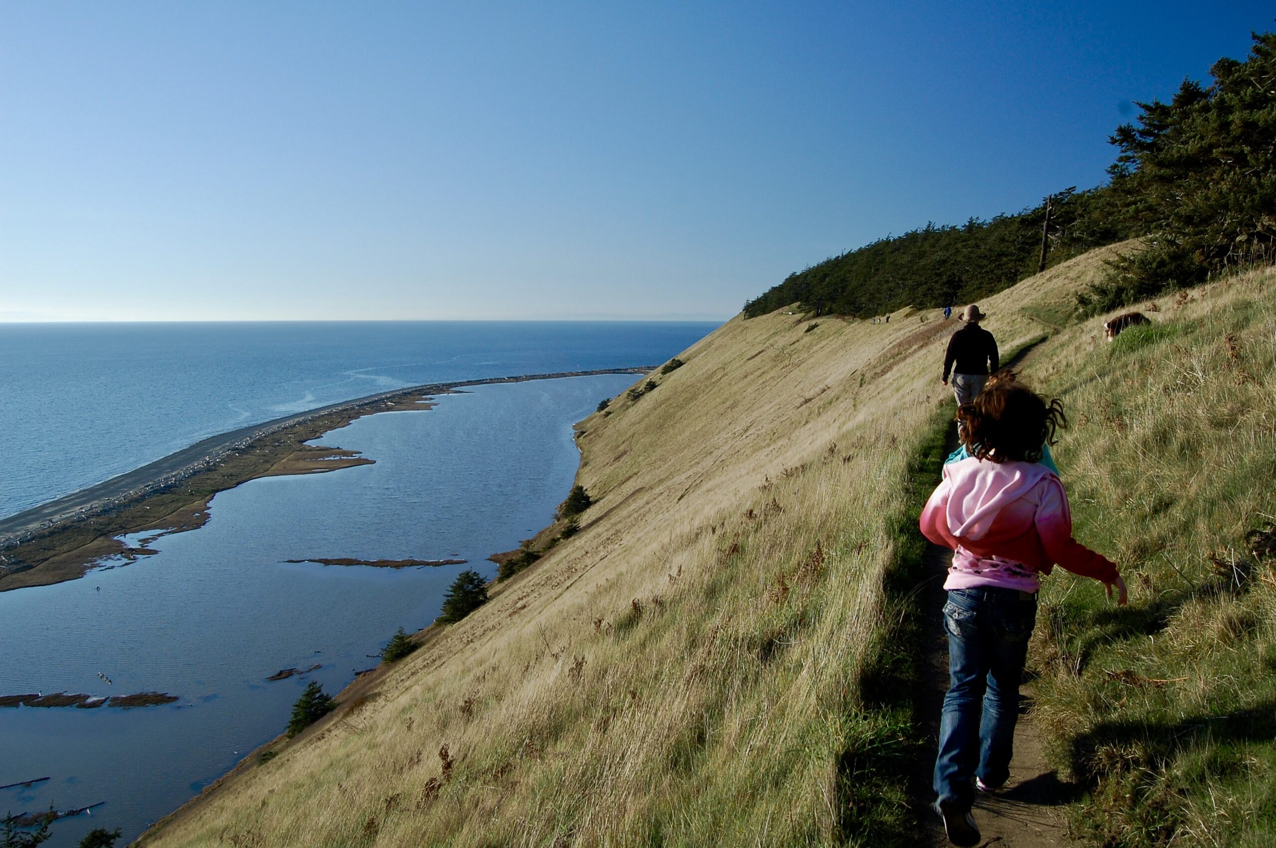
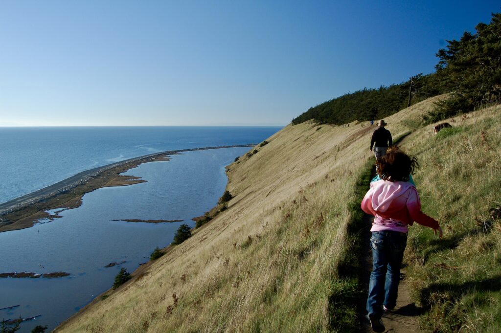
Off we go along the edge of the world! Kristina takes the lead with our dog Jo sniffing in the grass uphill to her right. Talia’s in the middle with her playmate Anaise trotting along behind. Foto by me, the author, with a Nikon D40 DSLR.
In the weeks before our house burned down, our family, blended into different combinations, made two trips up to Ebey’s Landing National Historical Reserve and State Park. It’s a unique integration of national park, state park, and local town and county parks. Whidbey Island is the largest island by far in the State of Washington and the 40th largest within the United States of America. It’s a long, slender, and somewhat crooked extension of a cluster of archipelagos linked together in the Salish Sea. On this wintry trip with hints of spring are my then-now-ex-wife Kristina and I along with Talia, my stepdaughter I’ve help raise since her birth, and Anaise, one of Talia’s early childhood friends. Plus JoJo Jo Dog! We packed up snacks, bottles of water, extra clothes, and a first aid kit, piled into our minivan at our home in Edmonds, and headed north to the islands. The weather turned out “Fabulous! It’s fabulous, William!” to quote Kristina. The morning cold was pushed out by bright, blue skies without any clouds to behold. Just lots of golden sunshine and distant fog with the low, brown, lowland haze of urban air pollution.
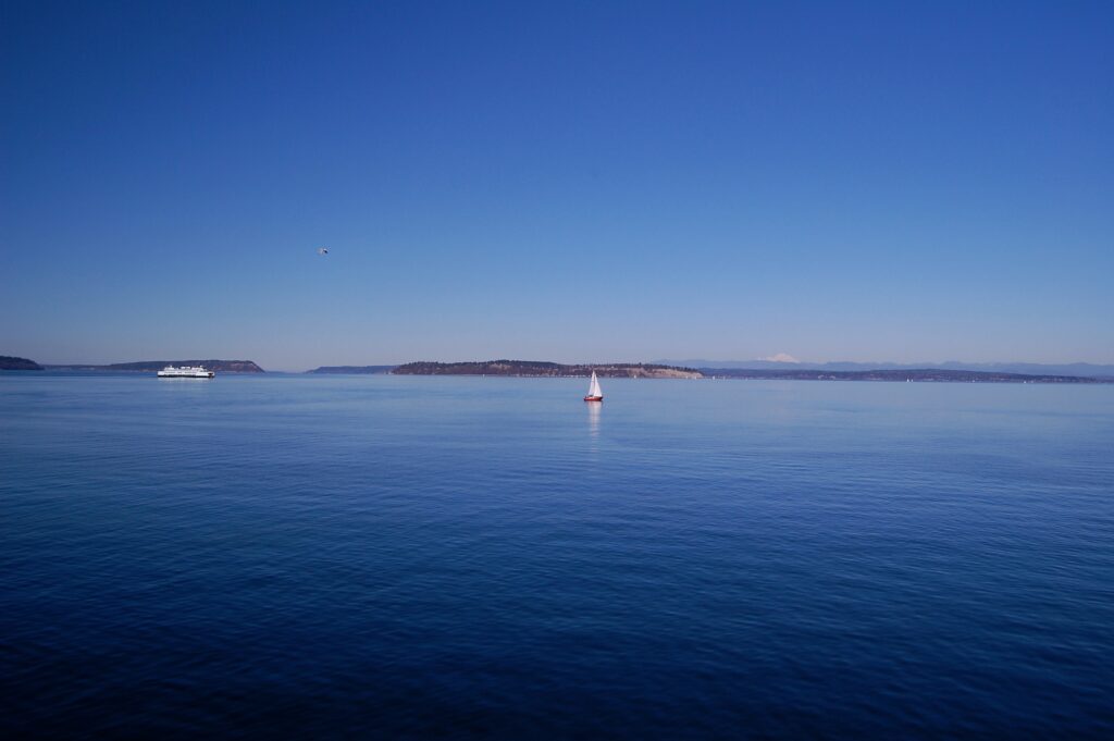
Views across the Salish Sea from the Mukilteo to Clinton ferry. On the far horizon squats the big, beautiful snowy volcano Kulshan, more commonly known as Mt. Baker.
Loved looked out across the water at snowy mountains, loved the sunshine and blue skies, and, yes, we love sailboats!
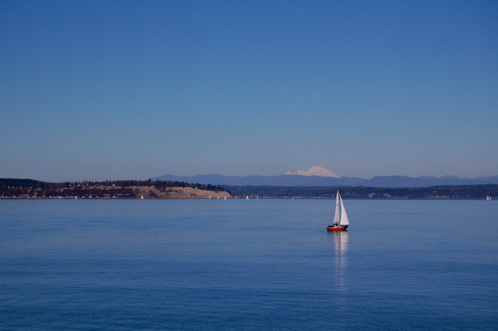
More blue waters and snowy mountains! Taken from the ferry ride from Mukilteo on the mainland to Clinton on Whidbey Island.
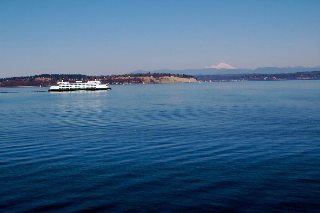
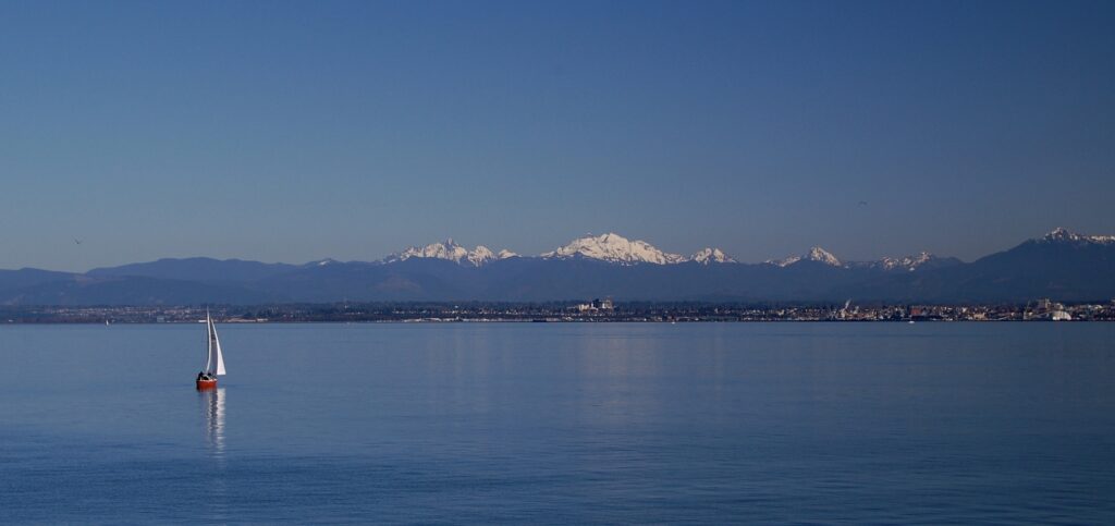
Another ferry crosses the Salish. These marine crossings were a big part of our lives during our many travels around the coastal regions of Western Washington and Southwestern British Columbia. The US-Canadian border zigzags across peninsulas and thru the islands and inland waterways of the beautiful Salish Sea.
After driving halfway up the island, we pass thru the edge of the town of Coupeville and arrive at the Ebey’s Prairie Overlook Parking Lot near the old Davis Blockhouse at Ebey’s Landing. The small fort behind us was one of several built by Euro-American settlers towards the end of the Puget Sound Indian Wars. Here we gaze out across Ebey’s Prairie.
Beyond the fields along the edge of Ebey’s Prairie lay The Kettles and the Kettles Reserve. Kettles are geological oddities left over from the retreat of the giant glacial ice caps. As the ice retreated, large chunks broke off, got left behind, and were covered in dirt and debris. As the ice chunks eventually melted, a crater-like hole or pit was left behind reminding folks of old, cast-iron cooking kettles.
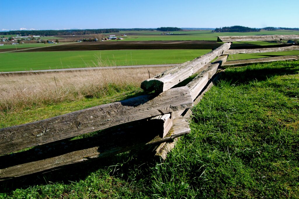
Split rail fences stretch out along the trails and fields.
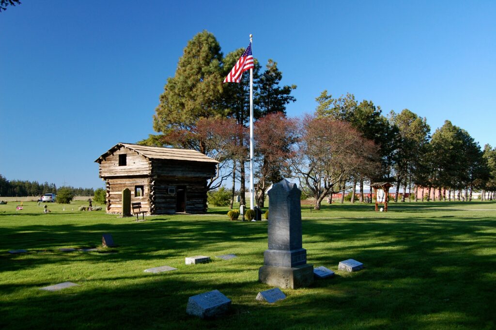
The Davis Blockhouse fort on the edge of Sunnyside Cemetery at Ebey’s Landing National Reserve.
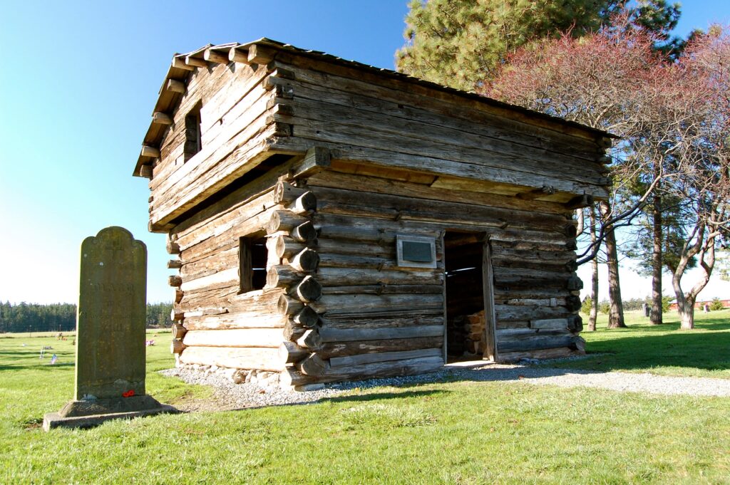
The Davis Blockhouse was constructed by European-Americans in 1855 for defense against the Haida and Tlingit tribes. Decades later, it was moved to Sunnyside Cemetery in 1915 where the Ladies of the Round Table led its restoration. The Puget Sound Indian Wars were desultory and complicated. Haida war parties would raid and fight up to a thousand miles in all directions, fighting with both the Tlingit tribes in Russian-occupied Alaska, British settlers in B.C., and invading down into the Salish as far south as into Puget Sound. The Haida often raided the smaller Coast Salish tribes for slaves, and were somewhat impregnable in their island fortresses up in Haida Gwaii, now the Queen Charlotte Islands of Canada. Sometimes the Tlingit would pursue the Haida by canoe all the way down into the Salish reasons to avenge their assaults. Once there was the 1856 three-way Battle of Port Gamble across the sea from Whidbey Island between the Americans, the Haida, and the Tlingit. There were concerns among the Russians and British of getting pulled into these conflicts as well.
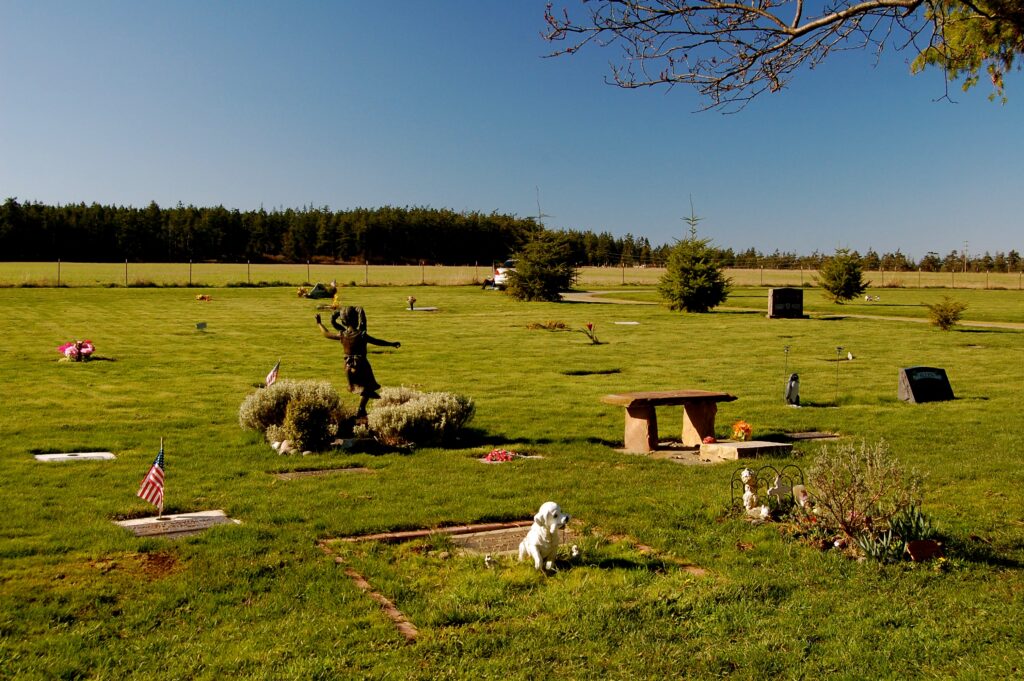
The strangeness of these graves on a bright, sunny day reminded me of a bizarre mix of daytime ghosts and Edward Scissorhands.
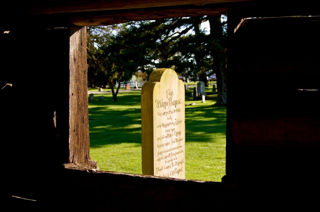
From inside the blockhouse looking out where the Dead rest along the edge of the world.
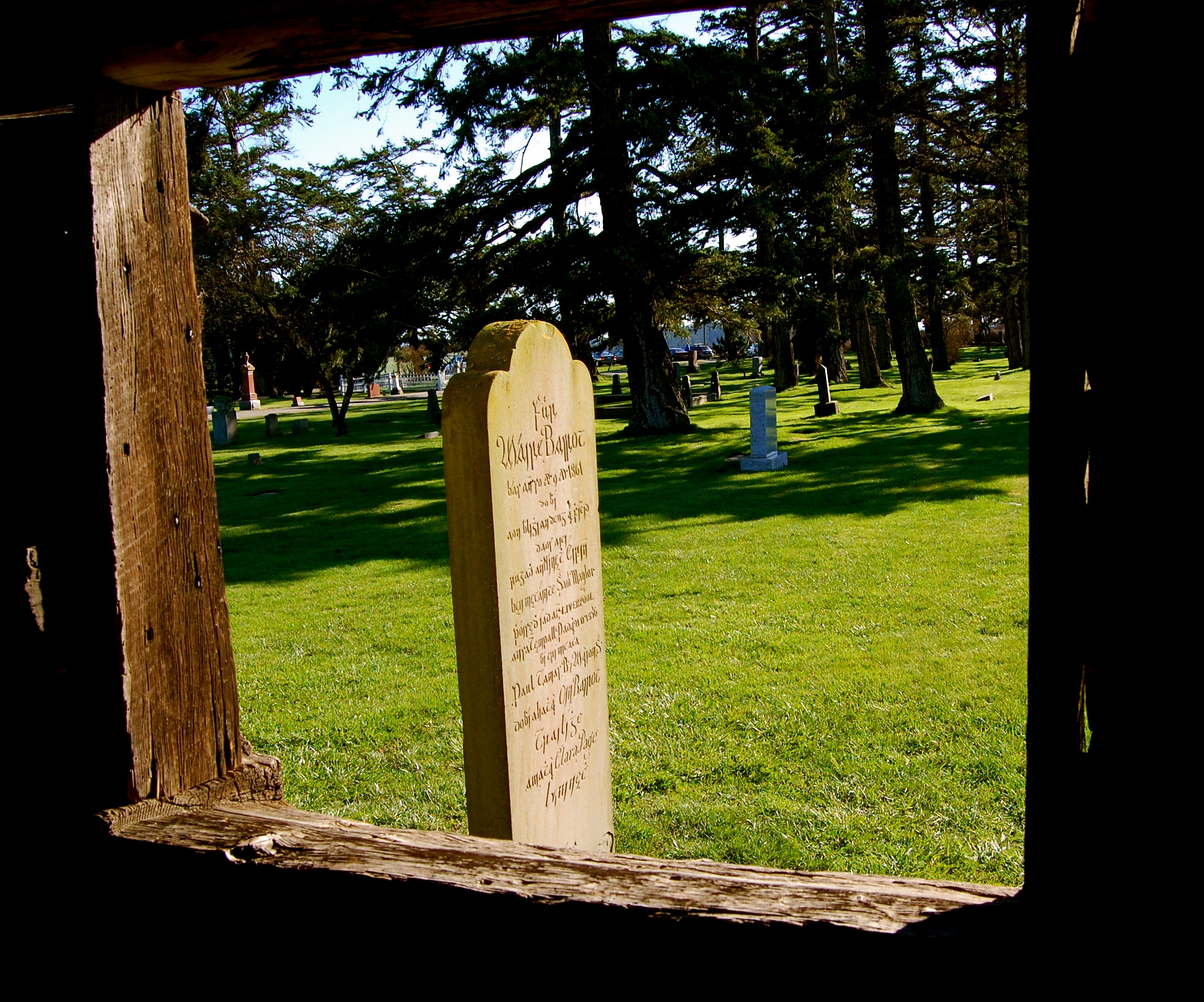
There are times when love is unstoppable even by death. This tombstone, its words chiseled in Gaelic, honors the life and memory of Maire “Mary” Barrett Maylor (1830-18610). She was originally from Nenagh in County Tipperary, Ireland, and Samuel, her husband from Ballintemple in County Cork, also in Ireland. They lived on Whidbey Island upon what’s now called Maylor Point on the edge of Oak Harbor. After Mary died in childbirth at about 31 years of age, he returned to Cork with his 3 sons, commissioned this tombstone, and eventually brought it across the USA during the Civil War to plant it at her grave. Samuel remarried in Ireland, moved back to Washington, had more children, and lived until age 74 in September 1896. It is the tragic story of his first wife Mary and his epic mission to honor her untimely death, however, that people most remember. See the links posted at the end of this article for more information on this 19th Century Irish family in America.
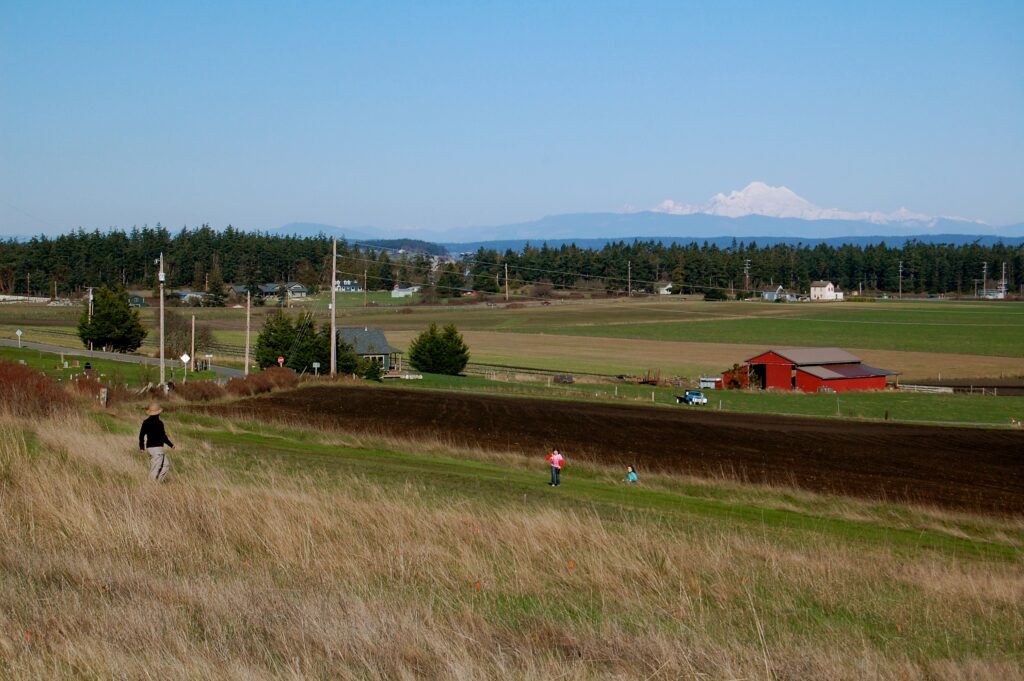
Kristina follows downhill as Talia & her buddy race ahead towards the sea as Mt. Baker/Kulshan looms in the distance.
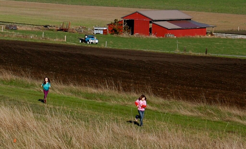
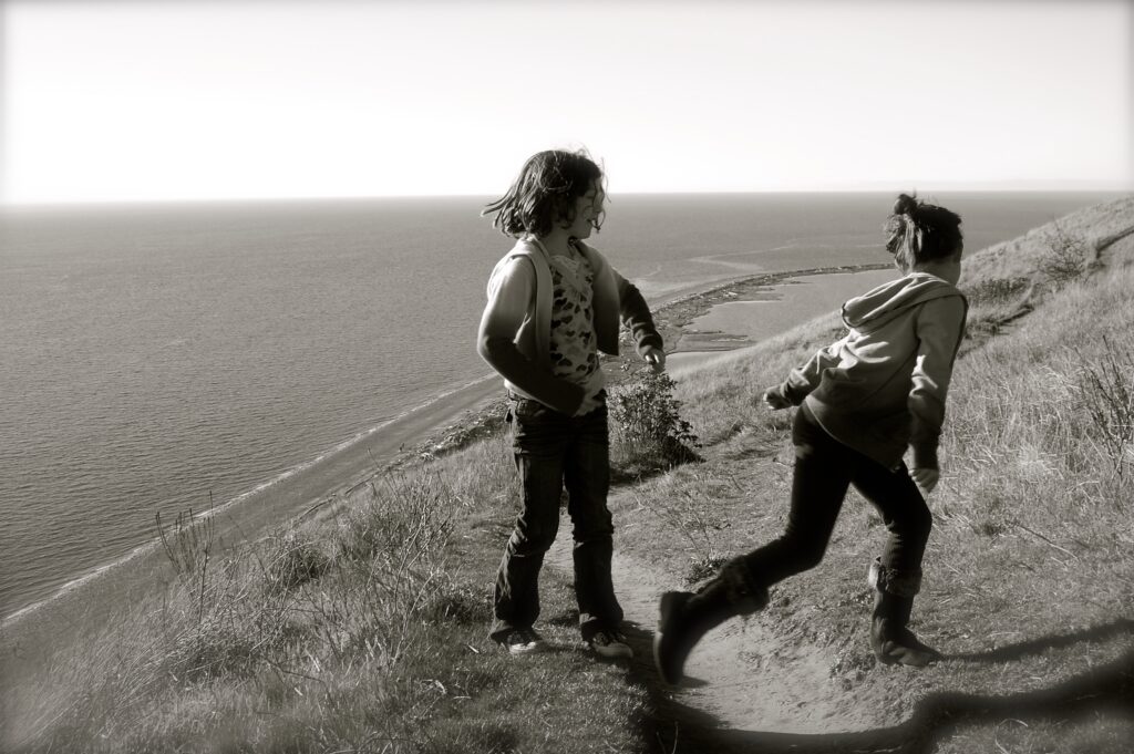
The two friends scamper about on this sunny Sunday in late February of 2010.
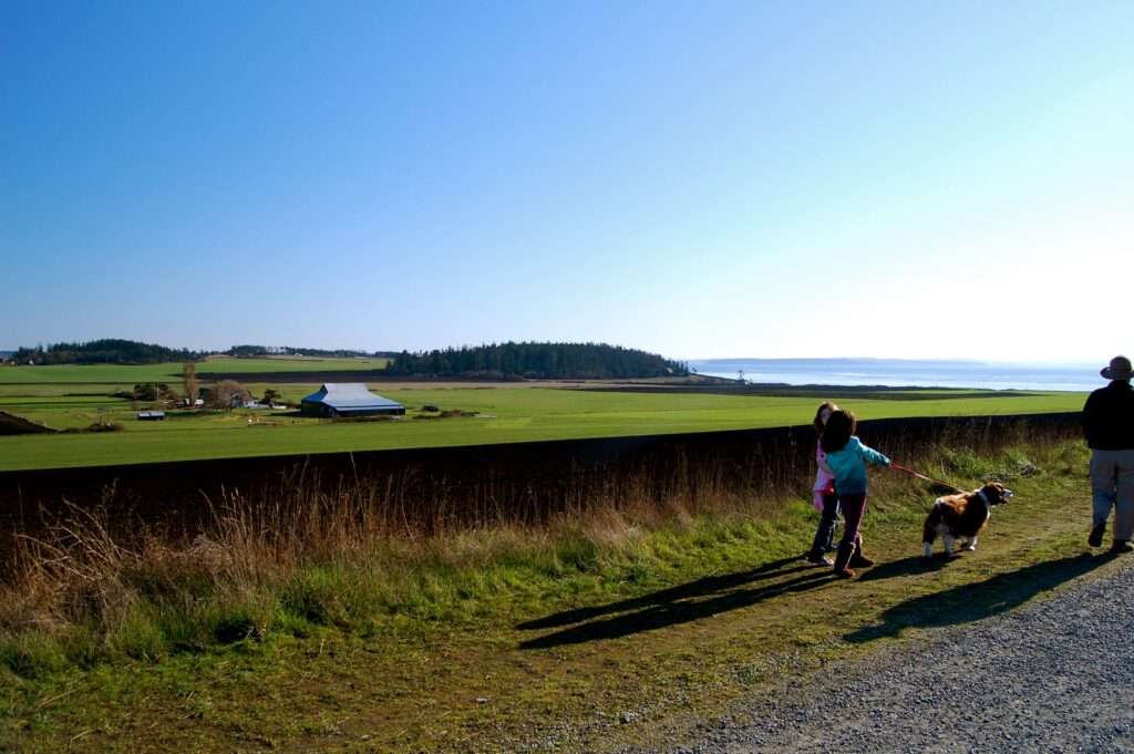
Trottin’ along & walkin’ the dog…and we see the sea.
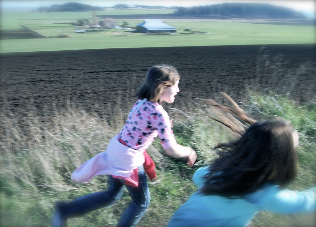
Run! Run! Run! The blur of fun!
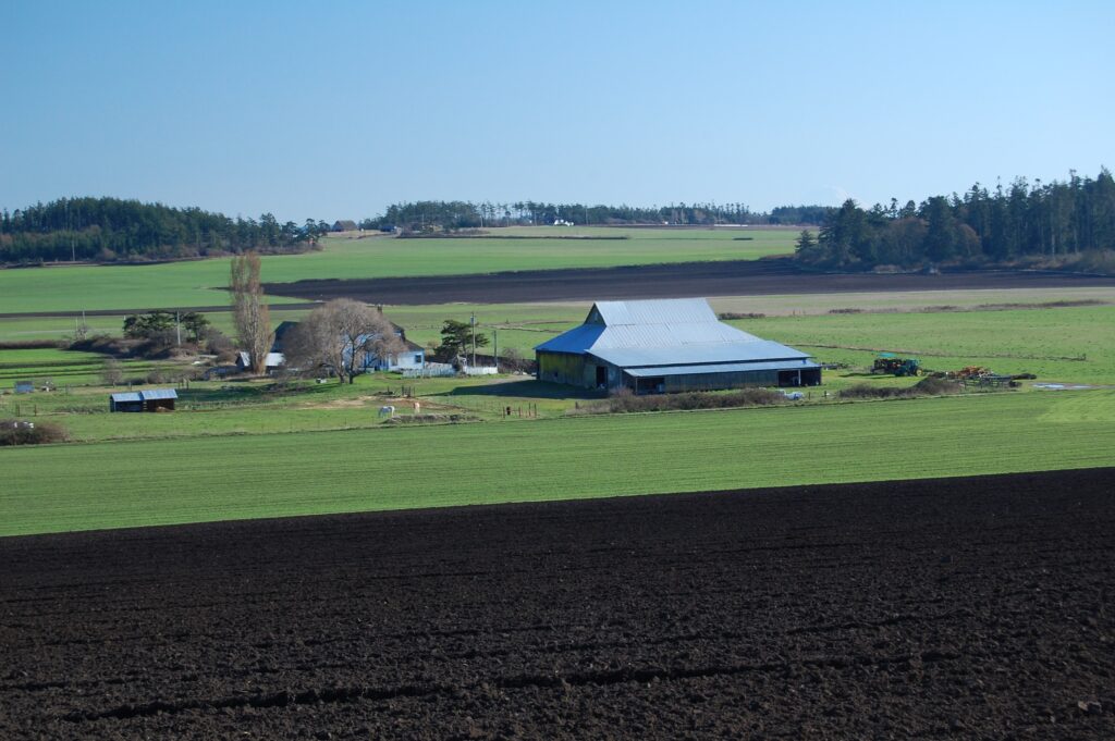
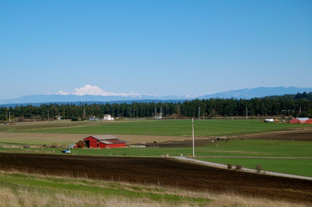
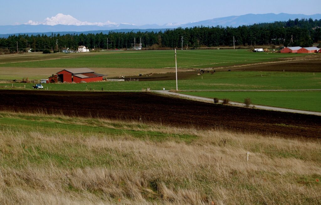
The farmer in me, raised in the red, sandy clay of rural Virginia farm country, is amazed at the richness of the soil here in Ebey’s Prairie in the center of Whidbey Island, Washington.
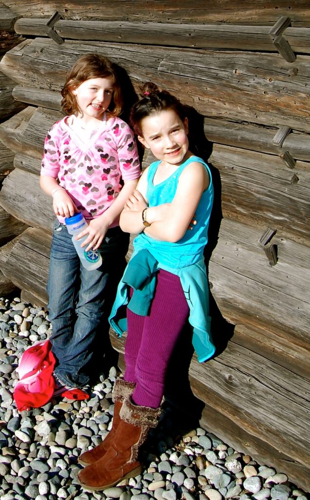
“A & T” back at the Davis Blockhouse. We had circled thru the fields back to the cemetery.
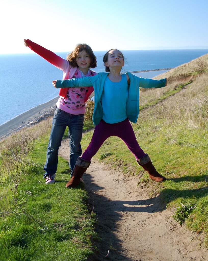
These two were the best of friends for less than a few years before we all lost touch between moves and life changes. Here Talia is in her 7th year and will soon turn 8 later in May.
![]()
We finally make it out to the bluffs that soar high above the sea. Well, there are indeed a few distant clouds after all. The view, however, is spectacular.
Kristina & Jo are far ahead at what seems to be the top of the world here at Ebey’s Landing National Park.
Laughs and giggles and gasps for breath. The western edge of the island juts out into the Salish Sea.
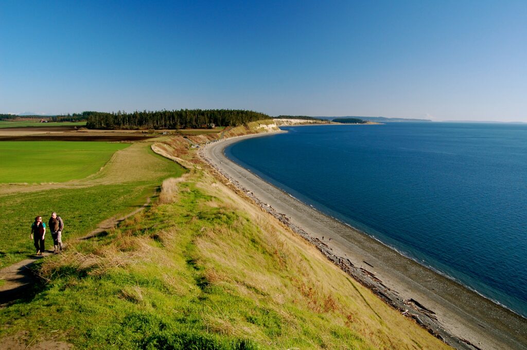
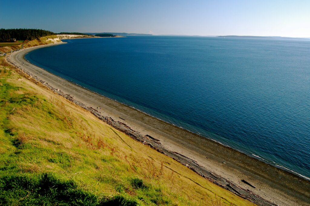
We stop and marvel at this glorious expanse of natural beauty. Ebey’s Landing sits where long, skinny Whidbey Island bends like a crooked leg with the knee of the crook jutting into the Straight of Juan de Fuca and where it merges into the upper Puget Sound. They’re all part of the greater inland sea of the Salish.
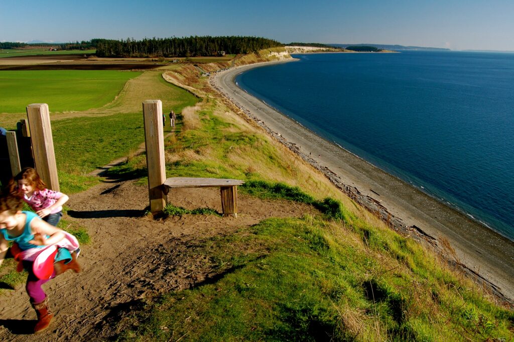
The two girls walk as one towards Kristina who can’t wait to show them something.
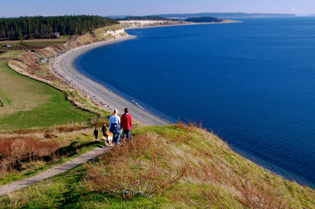
Ebey’s Landing is popular with locals and daytrippers from the big urban areas alike.
“TaTa” straddles the trail while I take a picture of Kristina taking a picture of Talia & her li’l buddy.
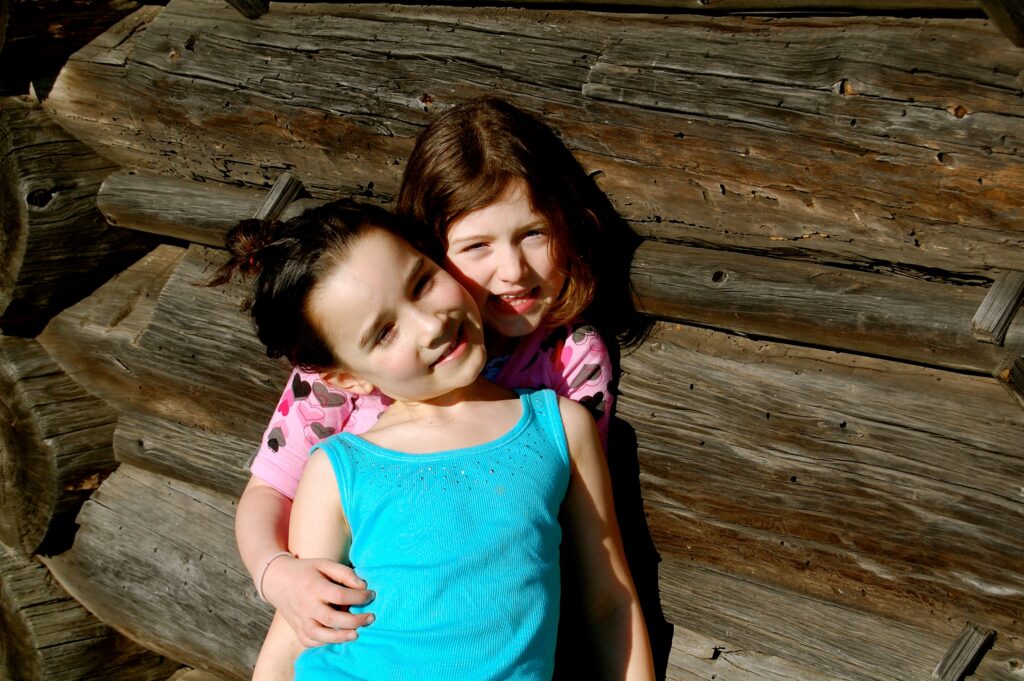
Best friends in the moment.
As the kids lose themselves in play, we see more of Perego’s Lagoon peeking out from behind the bluffs before the expanse of open water and sky.
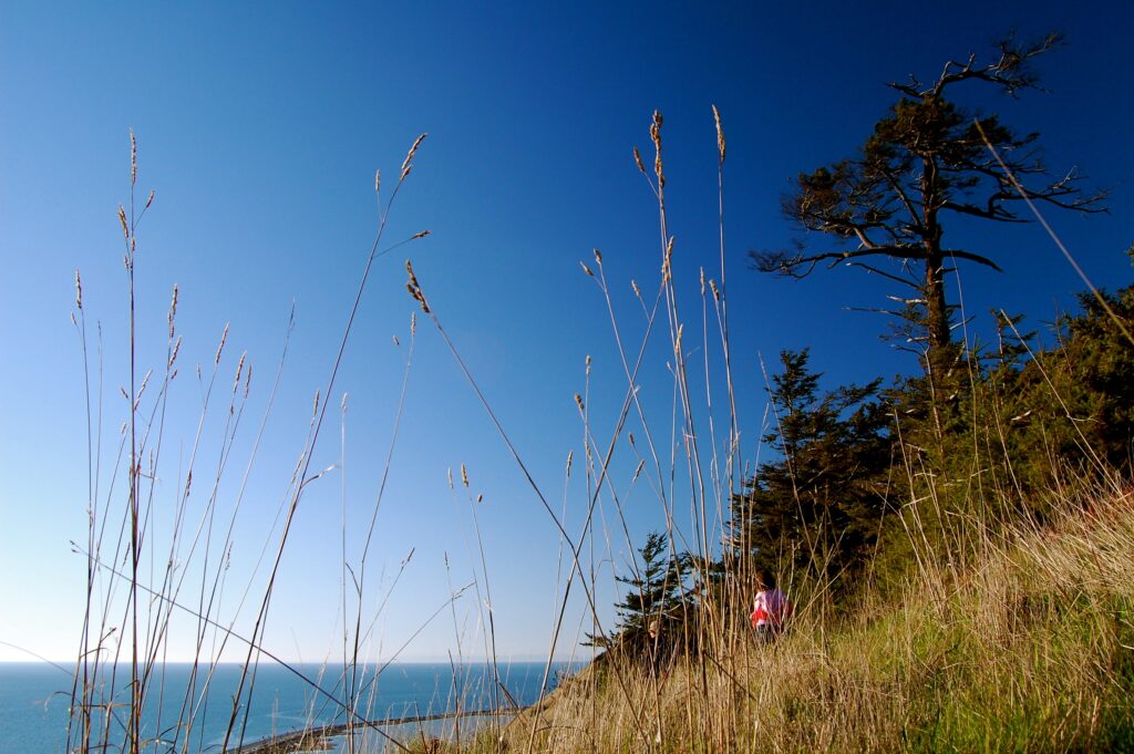
Gazing away…
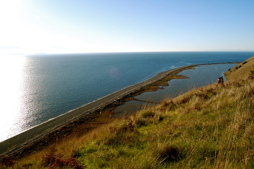
Perego’s Lagoon is a bit of an anomaly out here in the islands and seashores of the Salish Sea. The beach separating the lagoon from the sea is a barrier beach. Some term it a closed spit or a looped barrier beach, indeed, a closed loop. Gazing down upon this very scene from atop these high, grassy bluffs here at Ebey’s makes for one of the most unique beach hikes we’ve ever experienced out there in the Pacific Northwest.
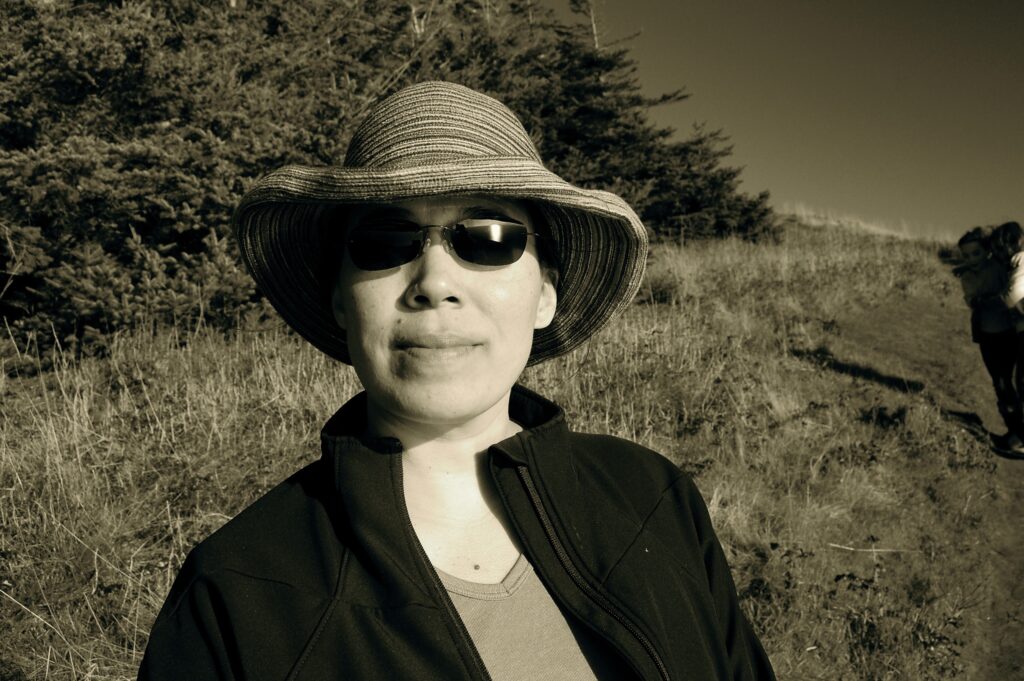
Kristina Katayama Bass poses along the edge of the high bluffs trail this Sunday the 21st of February 2010.
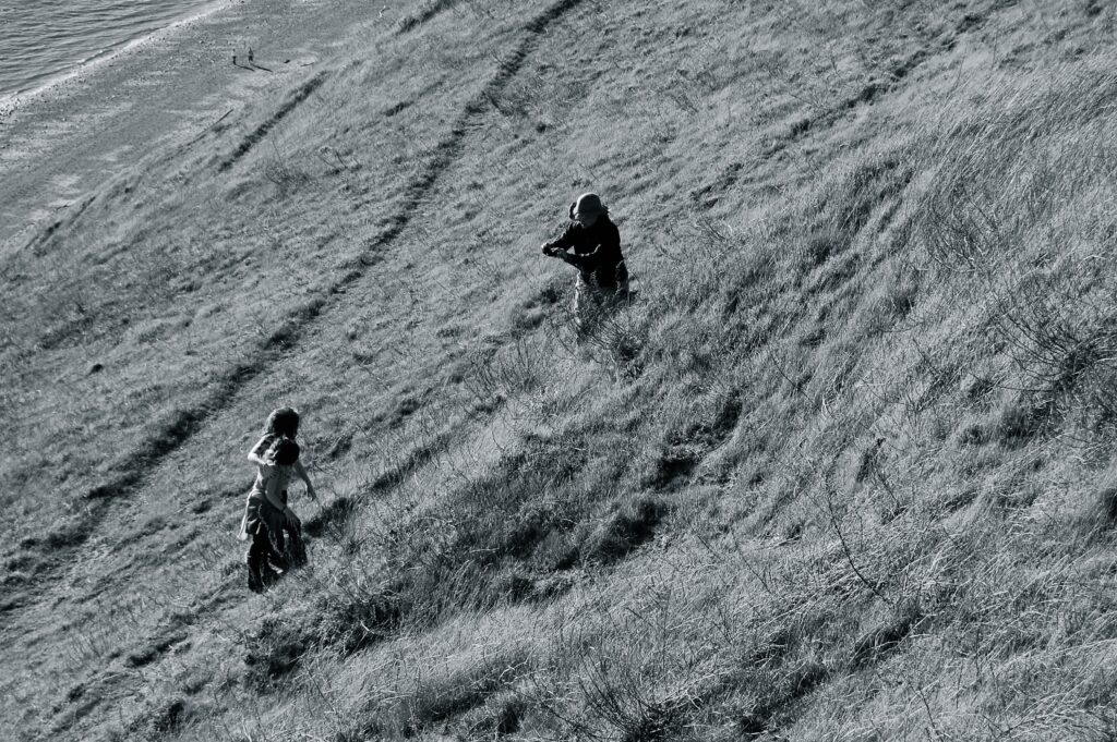
Oh, the wild, carefree energy of children, running, running, running along the Edge of the World.
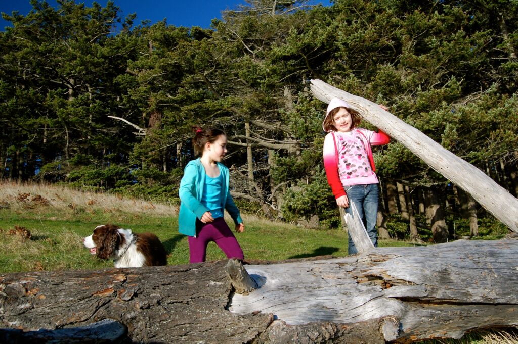
Jo JoJo Jolie & the 2 girls at the Big Dead Tree. Yes, it’s a log, and as it’s such an enormous beast of a trunk with branches still branching off, we call the “Big Dead Tree.” Was often a stopping point for many hikers to “take a load off” and eat, drink, and enjoy the view.
Li’l Buddies!
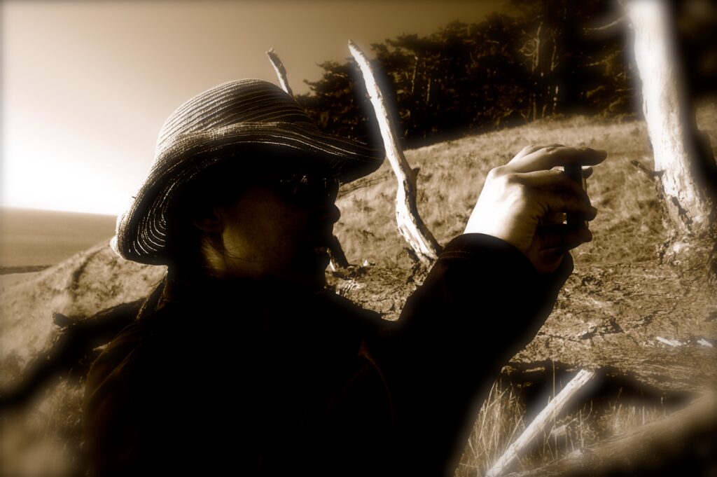
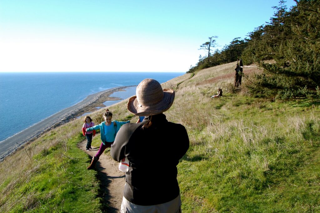
Kristina battles with the camera on her cellfone, with nature, and two squirmy, giggling kids who stick their tongues out and won’t stay still.
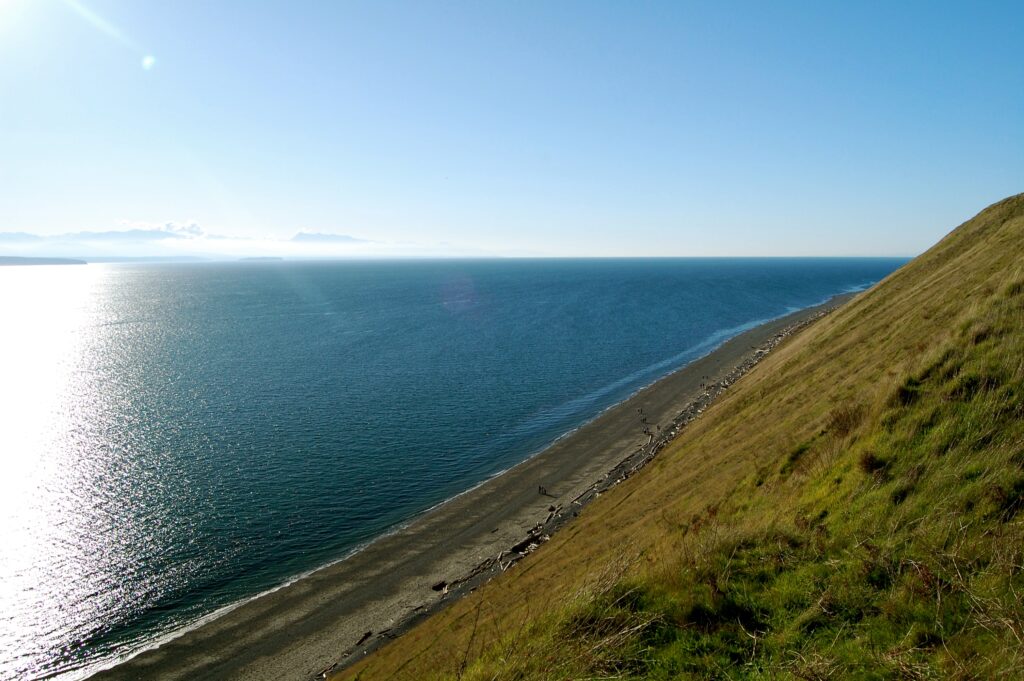
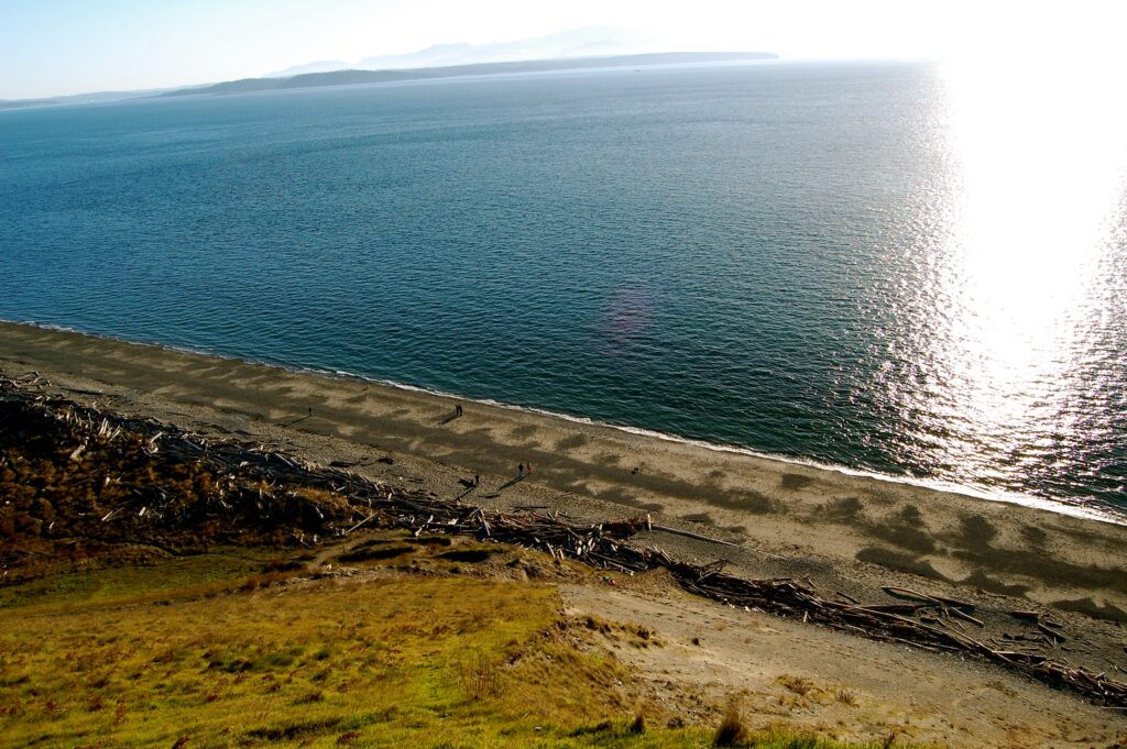
Gazing down these long, steep bluffs, many with sheer cliffy drop-offs below the hillside line of sight, and across Perego’s Lagoon to the beaches and on to the seas beyond. Further still sprawls the Olympic Peninsula and its offshoots. Beyond the Olympics? The Pacific.
![]()
The steepness below and around us leaves us in awe. The expanse of sky and water and soil is sublime on this clear February day outdoors in the Great Pacific Northwest.
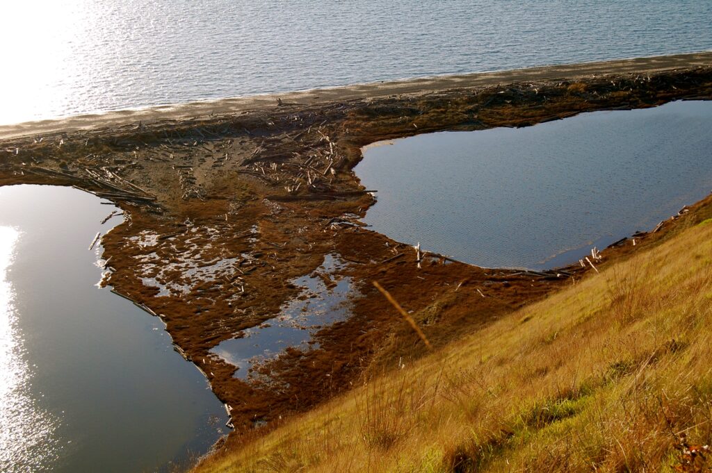
Marshy little isthmus divides the lagoon behind the enclosed loop of the barrier spit. High tides and heavy rains replenish the lagoon.
Relics of ferocious storms amid the dance of light, darkness, and shadows hark of storms yet to come.
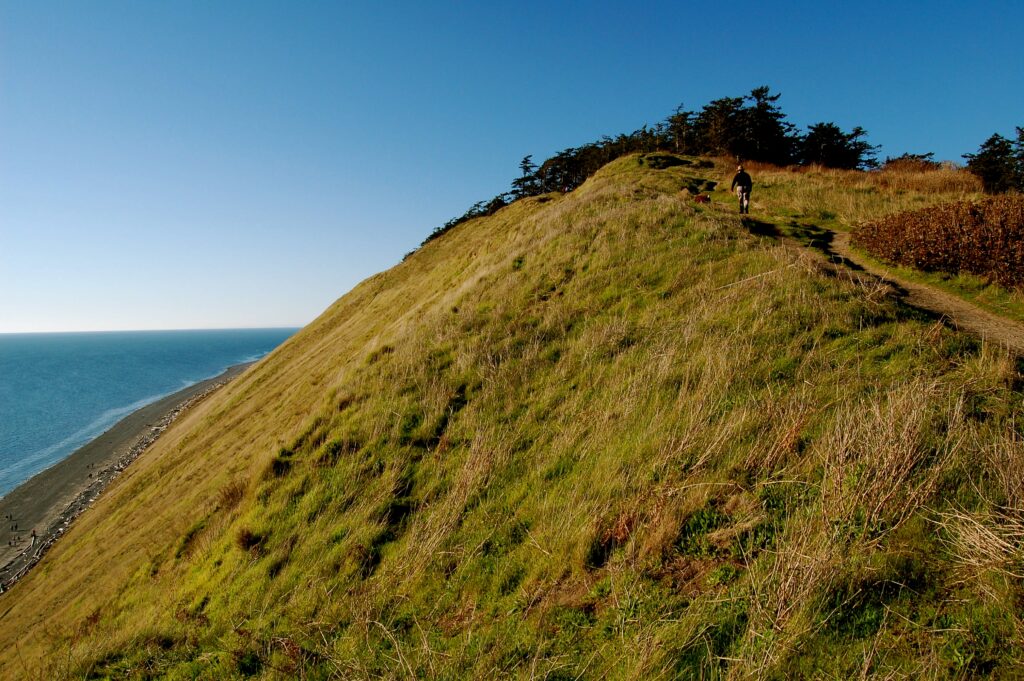
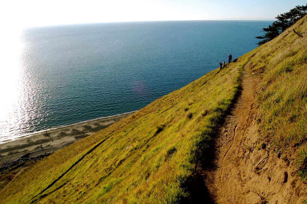
The steepness beckons.
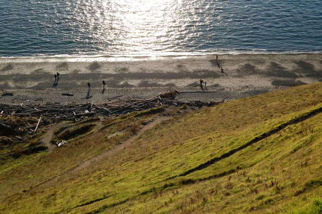
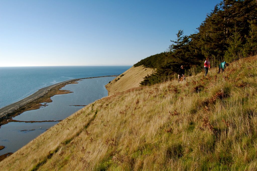
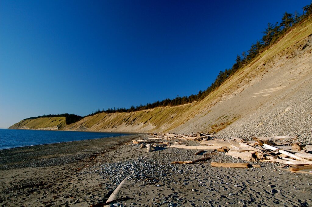
The high bluffs trail descends below us down to the beach.
We hike on to the end of the first switchback to zigzag down the hill.
The seashore beckons like any mountaintop.
The Big Wide Open…& way down on the beach is Jo doing her own doggie thang.
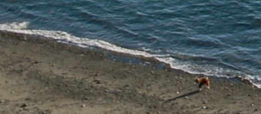
Cut & cropped the above to show fuzzy Jo Jo Jolie down on the beach.
Down on the beach above Perego’s Lagoon.
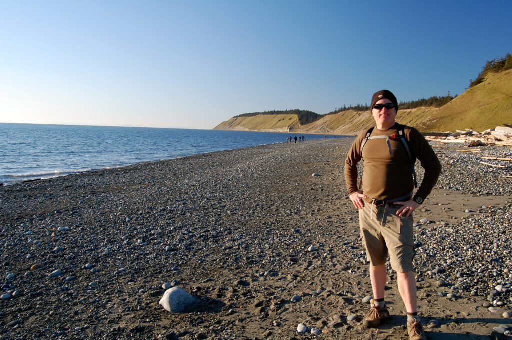
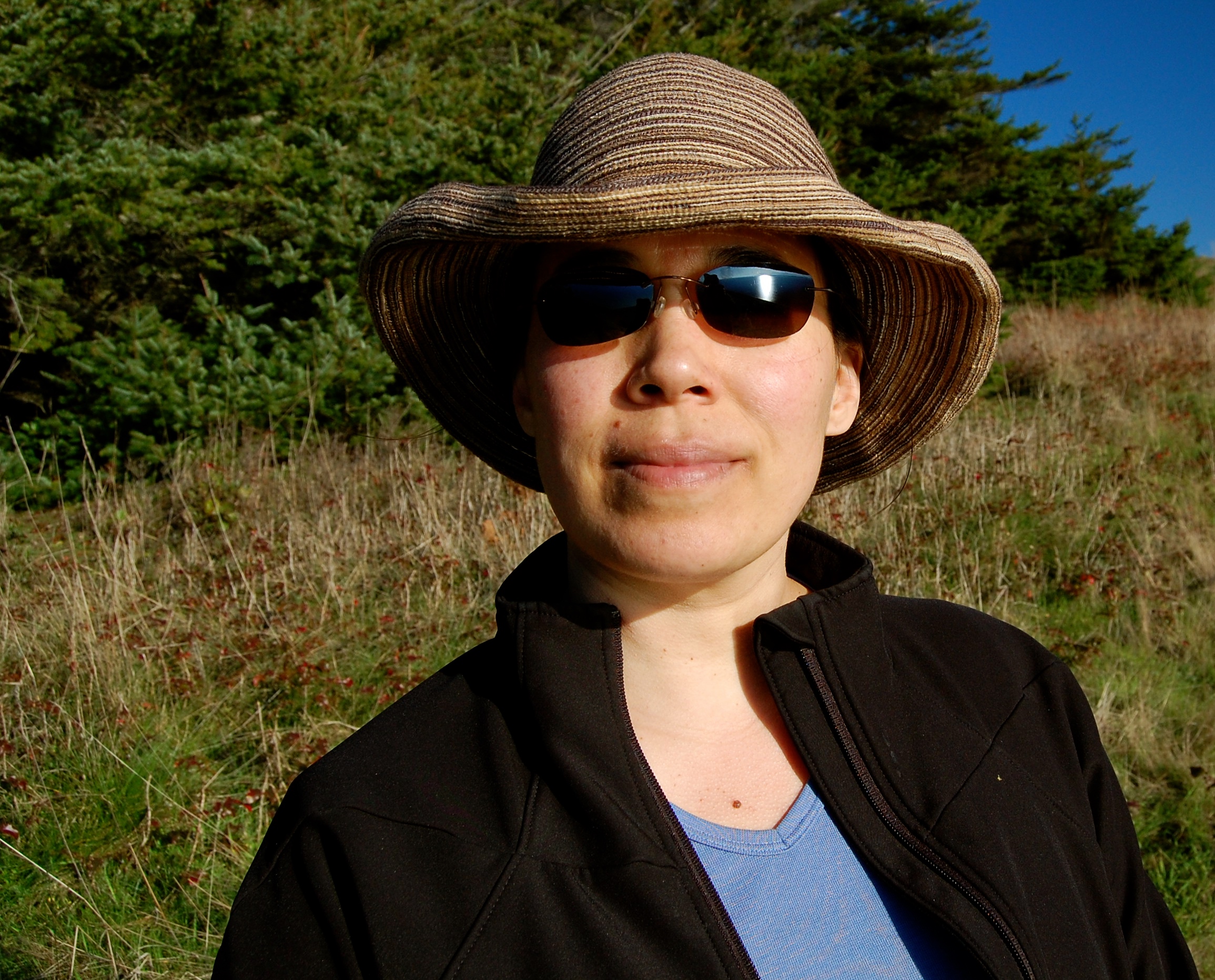
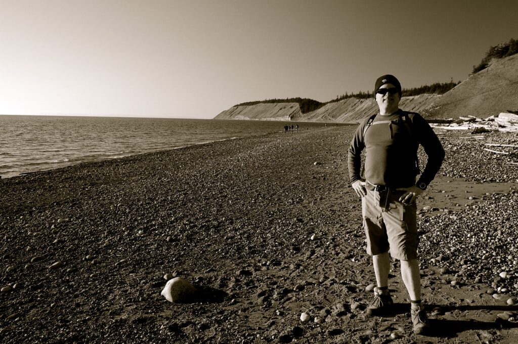
That’s me. Kristina took this picture.
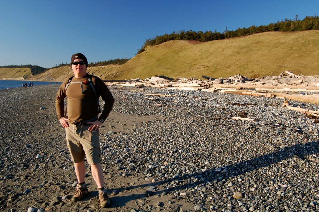
Hard to believe this gorgeous weather on this winter Sunday in February! Behind me one can see the long switchbacks of the trail worn into the steep hillsides.
Soon the four of us reach the trailhead, use the “restprivy,” LOL, pile back into our minivan, and head on back home. We love Ebey’s Landing!
William Dudley Bass
Saturday 19 April 2025
Shoreline/Seattle, Washington
USA
Cascadia
Earth
Sol
NOTES:
Guides to the greater Ebey’s Park Complex:
Ebey’s Landing National Historical Reserve Washington, National Park Service.
https://www.nps.gov/ebla/index.htm.
Ebey’s Landing National Historical Reserve, The Friends of Ebey’s 501(c)3.
https://www.ebeysreserve.com.
Ebey’s Landing, Washington State Park Foundation.
https://waparks.org/parks/ebeys-landing/.
More on Mary and Samuel Barrett and their Irish Gaelic tombstone:
“Mairie ‘Mary’ Barrett Maylor,” Find a Grave, https://www.findagrave.com/memorial/11548849/maire-maylor.
“Mary Barrett Historical Marker,” The Historical Marker Database, https://www.hmdb.org/m.asp?m=60979.
“Samuel Lindsay Maylor,” Find a Grave, https://www.findagrave.com/memorial/50981834/samuel_lindsay-maylor.
Wallace, Arminta. “The tragic tale behind an Irish-language headstone in Washington: Irish Connections: Behind Mary Barrett’s memorial is one man’s story of sorrow in the US,” The Irish Times: Abroad, Aug 2017. https://www.irishtimes.com/life-and-style/abroad/the-tragic-tale-behind-an-irish-language-headstone-in-washington-1.3188591.
Info on Perego’s Lagoon:
Shipman, Hugh. “Perego’s Lagoon,” Gravel Beach, Dec 2015,
https://gravelbeach.blogspot.com/2015/12peregos-lagoon.html.
Copyright © 2025 by William Dudley Bass. All Rights Reserved by the Author & his Descendants until we Humans establish Wise Stewardship over and for our Earth and Solarian Commons. Thank you.